Property Record
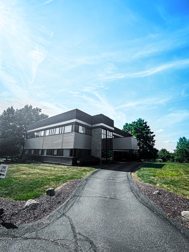
119 Vip Dr, Wexford, PA 15090


Current Lease Availabilities
Property Detail
119 Vip Dr
Pittsburgh, PA
PLAN #6 LOT 150XAVG348.62X150.06 (OR 1.198 A LD) V. I. P. DR PLAN #7 LOT 99.69XAVG424.03X423.30 (OR 2.009 A
1497-P-00007-0000-00
Allegheny
Medicalbuilding
Pennsylvania
B and X Area of moderate flood hazard, usually the area between the limits of the 100-year and 500-year floods.
7
2024
3.21 AC
2025
North Pittsburgh/Rte 19
411002
Pittsburgh
NEARBY LISTINGS FOR SALE OR LEASE
DEMOGRAPHICS near 119 Vip Dr
1 mile
3 mile
5 mile
2025 Total Population
2,582
26,533
71,533
2030 Population
2,521
26,045
70,522
Pop Growth 2025-2030
(2.36%)
(1.84%)
(1.41%)
Average Age
43
41
42
2025 Total Households
958
9,620
27,004
HH Growth 2025-2030
(2.40%)
(1.89%)
(1.40%)
Median Household Inc
$146,295
$164,752
$143,624
Avg Household Size
2.70
2.70
2.60
2025 Avg HH Vehicles
2.00
2.00
2.00
Median Home Value
$475,708
$477,811
$435,264
Median Year Built
1986
1990
1986
Nearby Places
Map Layers
Map Styles
 Street
 Aerial
Layers
 Traffic
 Biking
Places
Listings with unknown addresses are not visible on the map
- Restaurants
- Banks
- Shops
- Fitness
- Groceries
PUBLIC TRANSPORTATION
AIRPORT
Pittsburgh International
Drive
Walk
Distance
Pittsburgh International
31 min
15.7 mi
Nearby Properties
Address
Land Use
TOTAL SIZE
Lot Size
Zoning
Address
Land Use
TOTAL SIZE
Lot Size
Zoning
1.82 AC
Address
Land Use
TOTAL SIZE
Lot Size
Zoning
75.05 AC
Address
Land Use
TOTAL SIZE
Lot Size
Zoning
30.03 AC
Address
Land Use
TOTAL SIZE
Lot Size
Zoning
101.14 AC
Address
Land Use
TOTAL SIZE
Lot Size
Zoning
2.58 AC
Address
Land Use
TOTAL SIZE
Lot Size
Zoning
19.62 AC
Address
Land Use
TOTAL SIZE
Lot Size
Zoning
18.78 AC
Address
Land Use
TOTAL SIZE
Lot Size
Zoning
15.37 AC
Address
Land Use
TOTAL SIZE
Lot Size
Zoning
10.62 AC
Address
Land Use
TOTAL SIZE
Lot Size
Zoning
1,421 SF
24.62 AC
Address
Land Use
TOTAL SIZE
Lot Size
Zoning
16.90 AC
Address
Land Use
TOTAL SIZE
Lot Size
Zoning
7.80 AC
Address
Land Use
TOTAL SIZE
Lot Size
Zoning
21.97 AC
Address
Land Use
TOTAL SIZE
Lot Size
Zoning
12.73 AC
Address
Land Use
TOTAL SIZE
Lot Size
Zoning
14.80 AC
Address
Land Use
TOTAL SIZE
Lot Size
Zoning
Address
Land Use
TOTAL SIZE
Lot Size
Zoning
7.21 AC
Address
Land Use
TOTAL SIZE
Lot Size
Zoning
Address
Land Use
TOTAL SIZE
Lot Size
Zoning
10.62 AC
Address
Land Use
TOTAL SIZE
Lot Size
Zoning
9.20 AC
Address
Land Use
TOTAL SIZE
Lot Size
Zoning
39.82 AC
Address
Land Use
TOTAL SIZE
Lot Size
Zoning
Address
Land Use
TOTAL SIZE
Lot Size
Zoning
Address
Land Use
TOTAL SIZE
Lot Size
Zoning
9.04 AC
Address
Land Use
TOTAL SIZE
Lot Size
Zoning
7.58 AC
Address
Land Use
TOTAL SIZE
Lot Size
Zoning
1.59 AC
Address
Land Use
TOTAL SIZE
Lot Size
Zoning
20.84 AC
Address
Land Use
TOTAL SIZE
Lot Size
Zoning
2.35 AC
Address
Land Use
TOTAL SIZE
Lot Size
Zoning
814 SF
10.79 AC
Address
Land Use
TOTAL SIZE
Lot Size
Zoning
The World's #1 Commercial Real Estate Marketplace
Connect with us
© 2026 CoStar Group
The information above has been obtained from sources believed reliable. While we do not doubt its accuracy we have not verified it and make no guarantee, warranty or representation about it. It is your responsibility to independently confirm its accuracy and completeness. Any projections, opinions, assumptions, or estimates used are for example only and do not represent the current or future performance of the property. The value of this transaction to you depends on tax and other factors which should be evaluated by your tax, financial, and legal advisors. You and your advisors should conduct a careful, independent investigation of the property to determine to your satisfaction the suitability of the property for your needs.