Property Record
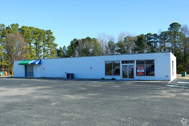
119 Wolf Trap Rd, Yorktown, VA 23692


Property Detail
119 Wolf Trap Rd
S07C-0596-0454
PLAT OF APPLES AUTO PARTS INC LOT 1A (RESUB OF LOT 1 E E AMORY)
Storebuilding
York
GENERAL BU
Virginia
B and X Area of moderate flood hazard, usually the area between the limits of the 100-year and 500-year floods.
1a
2025
0.32 AC
2026
Poquoson
050303
Hampton Roads
3,000 SF
Virginia Beach-Chesapeake-Norfolk, VA-NC
NEARBY LISTINGS FOR SALE OR LEASE
DEMOGRAPHICS near 119 Wolf Trap Rd
1 mile
3 mile
5 mile
2025 Total Population
5,832
29,080
105,876
2030 Population
5,819
28,968
105,129
Pop Growth 2025-2030
(0.22%)
(0.39%)
(0.71%)
Average Age
41
43
40
2025 Total Households
2,318
11,406
42,422
HH Growth 2025-2030
(0.30%)
(0.46%)
(0.76%)
Median Household Inc
$94,476
$104,762
$83,161
Avg Household Size
2.50
2.50
2.40
2025 Avg HH Vehicles
2.00
2.00
2.00
Median Home Value
$376,632
$395,915
$362,402
Median Year Built
1990
1985
1987
Nearby Places
Map Layers
Map Styles
 Street
 Aerial
Layers
 Traffic
 Biking
Places
Listings with unknown addresses are not visible on the map
- Restaurants
- Banks
- Shops
- Fitness
- Groceries
PUBLIC TRANSPORTATION
AIRPORT
Newport News/Williamsburg International
Drive
Walk
Distance
Newport News/Williamsburg International
10 min
5.1 mi
Norfolk International
Drive
Walk
Distance
Norfolk International
44 min
29.1 mi
Freight Ports
Virginia Port Authority - Newport News
Drive
Walk
Distance
Virginia Port Authority - Newport News
25 min
17.0 mi
SALE & LEASE HISTORY
LISTING DATE
SALE/LEASE

Nov 10, 2023
For Lease
Nearby Properties
Address
Land Use
TOTAL SIZE
Lot Size
Zoning
Address
Land Use
TOTAL SIZE
Lot Size
Zoning
139,155 SF
15.01 AC
O2
Address
Land Use
TOTAL SIZE
Lot Size
Zoning
39,492 SF
798.51 AC
RESOURCE C
Address
Land Use
TOTAL SIZE
Lot Size
Zoning
297,617 SF
50.90 AC
RC,GB
Address
Land Use
TOTAL SIZE
Lot Size
Zoning
252 SF
17.21 AC
MULTI-FAMI
Address
Land Use
TOTAL SIZE
Lot Size
Zoning
197,355 SF
10.89 AC
R8
Address
Land Use
TOTAL SIZE
Lot Size
Zoning
5.04 AC
R9
Address
Land Use
TOTAL SIZE
Lot Size
Zoning
97,180 SF
53.17 AC
C1
Address
Land Use
TOTAL SIZE
Lot Size
Zoning
20,216 SF
141.21 AC
GENERAL IN
Address
Land Use
TOTAL SIZE
Lot Size
Zoning
290,802 SF
29.47 AC
RMF,GB
Address
Land Use
TOTAL SIZE
Lot Size
Zoning
156 SF
19.99 AC
MULTI-FAMI
Address
Land Use
TOTAL SIZE
Lot Size
Zoning
10,000 SF
9.10 AC
PLANNED DE
Address
Land Use
TOTAL SIZE
Lot Size
Zoning
56,654 SF
12.03 AC
LIMITED IN
Address
Land Use
TOTAL SIZE
Lot Size
Zoning
50,744 SF
53.12 AC
LIMITED IN
Address
Land Use
TOTAL SIZE
Lot Size
Zoning
39,411 SF
8.23 AC
GENERAL BU
Address
Land Use
TOTAL SIZE
Lot Size
Zoning
80,784 SF
0.80 AC
O2
Address
Land Use
TOTAL SIZE
Lot Size
Zoning
87,160 SF
19.68 AC
RESOURCE C
Address
Land Use
TOTAL SIZE
Lot Size
Zoning
7,275 SF
18.02 AC
IL,GB
Address
Land Use
TOTAL SIZE
Lot Size
Zoning
73.35 AC
R9
Address
Land Use
TOTAL SIZE
Lot Size
Zoning
102,942 SF
7.34 AC
R8
Address
Land Use
TOTAL SIZE
Lot Size
Zoning
85,727 SF
11.76 AC
GB,R20
Address
Land Use
TOTAL SIZE
Lot Size
Zoning
930.01 AC
RESOURCE C
Address
Land Use
TOTAL SIZE
Lot Size
Zoning
19,763 SF
2.98 AC
GENERAL BU
Address
Land Use
TOTAL SIZE
Lot Size
Zoning
68,151 SF
15.72 AC
RESOURCE C
Address
Land Use
TOTAL SIZE
Lot Size
Zoning
44,605 SF
12 AC
R8
Address
Land Use
TOTAL SIZE
Lot Size
Zoning
646.02 AC
RESOURCE C
Address
Land Use
TOTAL SIZE
Lot Size
Zoning
63,368 SF
17.22 AC
RESOURCE C
Address
Land Use
TOTAL SIZE
Lot Size
Zoning
69,573 SF
12.44 AC
GB,R20
Address
Land Use
TOTAL SIZE
Lot Size
Zoning
74,345 SF
8.53 AC
GENERAL BU
Address
Land Use
TOTAL SIZE
Lot Size
Zoning
55,985 SF
15.50 AC
RC,R20
Address
Land Use
TOTAL SIZE
Lot Size
Zoning
40.06 AC
R9
The World's #1 Commercial Real Estate Marketplace
Connect with us
© 2026 CoStar Group
The information above has been obtained from sources believed reliable. While we do not doubt its accuracy we have not verified it and make no guarantee, warranty or representation about it. It is your responsibility to independently confirm its accuracy and completeness. Any projections, opinions, assumptions, or estimates used are for example only and do not represent the current or future performance of the property. The value of this transaction to you depends on tax and other factors which should be evaluated by your tax, financial, and legal advisors. You and your advisors should conduct a careful, independent investigation of the property to determine to your satisfaction the suitability of the property for your needs.