Property Record
11904 Nokesville Rd, Bristow, VA 20136

NEARBY LISTINGS FOR SALE OR LEASE
Property Detail
11904 Nokesville Rd
7594-39-3155
BK/PG 1854/1017NO BUYER ADDRESS
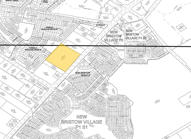
Vacantlandnec
Prince William
X
Virginia
51061C0375D
11.70 AC
2024
Route 29/I-66 Corridor
2025
Washington, DC
901417
Washington-Arlington-Alexandria, DC-VA-MD-WV
DEMOGRAPHICS near 11904 Nokesville Rd
1 Mile
3 Mile
5 Mile
2024 Total Population
5,803
33,932
120,729
2029 Population
5,896
34,728
122,820
Pop Growth 2024-2029
+ 1.60%
+ 2.35%
+ 1.73%
Average Age
36
36
36
2024 Total Households
1,662
10,284
38,129
HH Growth 2024-2029
+ 1.68%
+ 2.43%
+ 1.75%
Median Household Inc
$164,452
$153,350
$118,460
Avg Household Size
3.40
3.20
3.10
2024 Avg HH Vehicles
2.00
2.00
2.00
Median Home Value
$651,975
$549,436
$464,771
Median Year Built
2002
2004
1995
Nearby Places
Map Layers
Map Styles
 Street
 Aerial
- Restaurants
- Banks
- Shops
- Fitness
- Groceries
PUBLIC TRANSPORTATION
COMMUTER RAIL
DRIVE
WALK
Distance
9 min
3.5 mi
Broad Run/Airport (Manassas Line - Virginia Railway Express)
DRIVE
WALK
Distance
Broad Run/Airport (Manassas Line - Virginia Railway Express)
9 min
3.5 mi
AIRPORT
Washington Dulles International
DRIVE
WALK
Distance
Washington Dulles International
43 min
24.7 mi
Ronald Reagan Washington Ntl
DRIVE
WALK
Distance
Ronald Reagan Washington Ntl
59 min
39.3 mi
Nearby Properties
Address
Land Use
TOTAL SIZE
Lot Size
Zoning
Address
Land Use
TOTAL SIZE
Lot Size
Zoning
795,191 SF
82.58 AC
M1
Address
Land Use
TOTAL SIZE
Lot Size
Zoning
347,876 SF
23.23 AC
PBD
Address
Land Use
TOTAL SIZE
Lot Size
Zoning
394,593 SF
27.60 AC
MT
Address
Land Use
TOTAL SIZE
Lot Size
Zoning
233,757 SF
15.54 AC
PBD
Address
Land Use
TOTAL SIZE
Lot Size
Zoning
223,757 SF
15.92 AC
PBD
Address
Land Use
TOTAL SIZE
Lot Size
Zoning
216,067 SF
15.85 AC
PBD
Address
Land Use
TOTAL SIZE
Lot Size
Zoning
213,320 SF
31.06 AC
PBD
Address
Land Use
TOTAL SIZE
Lot Size
Zoning
305,510 SF
22.72 AC
M2
Address
Land Use
TOTAL SIZE
Lot Size
Zoning
269,091 SF
32.31 AC
M2
Address
Land Use
TOTAL SIZE
Lot Size
Zoning
224,652 SF
12.05 AC
PBD
Address
Land Use
TOTAL SIZE
Lot Size
Zoning
241,249 SF
12.58 AC
PBD
Address
Land Use
TOTAL SIZE
Lot Size
Zoning
281,000 SF
10.08 AC
PBD
Address
Land Use
TOTAL SIZE
Lot Size
Zoning
259,200 SF
14.22 AC
PBD
Address
Land Use
TOTAL SIZE
Lot Size
Zoning
230,706 SF
13.94 AC
PMD
Address
Land Use
TOTAL SIZE
Lot Size
Zoning
656,797 SF
Address
Land Use
TOTAL SIZE
Lot Size
Zoning
824,085 SF
120.07 AC
MIXED
Address
Land Use
TOTAL SIZE
Lot Size
Zoning
247,608 SF
19.50 AC
PBD
Address
Land Use
TOTAL SIZE
Lot Size
Zoning
127,000 SF
12.40 AC
M2
Address
Land Use
TOTAL SIZE
Lot Size
Zoning
440,331 SF
61.47 AC
M1
Address
Land Use
TOTAL SIZE
Lot Size
Zoning
409,252 SF
18.75 AC
M2
Address
Land Use
TOTAL SIZE
Lot Size
Zoning
136,228 SF
9.19 AC
M2
Address
Land Use
TOTAL SIZE
Lot Size
Zoning
270,540 SF
13.65 AC
PBD
Address
Land Use
TOTAL SIZE
Lot Size
Zoning
352,030 SF
21.14 AC
PBD
Address
Land Use
TOTAL SIZE
Lot Size
Zoning
446,663 SF
92.79 AC
A1
Address
Land Use
TOTAL SIZE
Lot Size
Zoning
395,617 SF
19.08 AC
PMD
Address
Land Use
TOTAL SIZE
Lot Size
Zoning
187,752 SF
20.77 AC
HEAVY INDU
Address
Land Use
TOTAL SIZE
Lot Size
Zoning
2,357 SF
216.41 AC
AIRPORT
Address
Land Use
TOTAL SIZE
Lot Size
Zoning
30.22 AC
M2
Address
Land Use
TOTAL SIZE
Lot Size
Zoning
380,264 SF
15.25 AC
PMD
Address
Land Use
TOTAL SIZE
Lot Size
Zoning
335,553 SF
45.93 AC
M2
The World's #1 Commercial Real Estate Marketplace
Connect with us
© 2025 CoStar Group
The information above has been obtained from sources believed reliable. While we do not doubt its accuracy we have not verified it and make no guarantee, warranty or representation about it. It is your responsibility to independently confirm its accuracy and completeness. Any projections, opinions, assumptions, or estimates used are for example only and do not represent the current or future performance of the property. The value of this transaction to you depends on tax and other factors which should be evaluated by your tax, financial, and legal advisors. You and your advisors should conduct a careful, independent investigation of the property to determine to your satisfaction the suitability of the property for your needs.