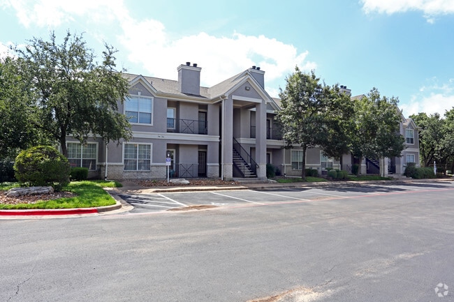
Property Record
11908 Anderson Mill Rd, Austin, TX 78726

Property Detail
11908 Anderson Mill Rd
Austin-Round Rock-San Marcos, TX
LOT 8-A NAUMANNS SUBD RESUB OF A PORTION OF LOT 8 (8.234AC TRAVIS CO)
523566
TRAVIS
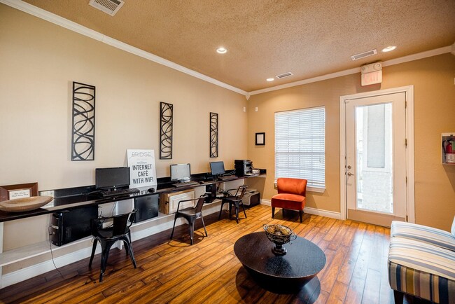
Multifamilydwelling
Texas
B and X Area of moderate flood hazard, usually the area between the limits of the 100-year and 500-year floods.
8-a,8
0
13.67 AC
2025
Cedar Park
035800
Austin
182,320 SF
NEARBY LISTINGS FOR SALE OR LEASE
-
-
View all Austin listings for sale on LoopNet.com
DEMOGRAPHICS near 11908 Anderson Mill Rd
1 mile
3 mile
5 mile
2025 Total Population
10,396
87,821
193,393
2030 Population
11,478
96,340
213,248
Pop Growth 2025-2030
+ 10.41%
+ 9.70%
+ 10.27%
Average Age
40
38
38
2025 Total Households
3,939
35,357
78,073
HH Growth 2025-2030
+ 11.02%
+ 10.67%
+ 11.04%
Median Household Inc
$134,504
$116,964
$112,910
Avg Household Size
2.60
2.50
2.40
2025 Avg HH Vehicles
2.00
2.00
2.00
Median Home Value
$475,340
$581,106
$590,309
Median Year Built
1992
2000
2000
Nearby Places
Map Layers
Map Styles
 Street
 Aerial
Layers
 Traffic
 Biking
Places
Listings with unknown addresses are not visible on the map
- Restaurants
- Banks
- Shops
- Fitness
- Groceries
PUBLIC TRANSPORTATION
AIRPORT
Austin-Bergstrom International
Drive
Walk
Distance
Austin-Bergstrom International
43 min
29.1 mi
Freight Ports
Calhoun Port
Drive
Walk
Distance
Calhoun Port
209 min
172.6 mi
Nearby Properties
Address
Land Use
TOTAL SIZE
Lot Size
Zoning
Address
Land Use
TOTAL SIZE
Lot Size
Zoning
535,000 SF
24.46 AC
Address
Land Use
TOTAL SIZE
Lot Size
Zoning
676,868 SF
13.54 AC
3-PD
Address
Land Use
TOTAL SIZE
Lot Size
Zoning
557,037 SF
29.48 AC
Address
Land Use
TOTAL SIZE
Lot Size
Zoning
256,338 SF
26.47 AC
Address
Land Use
TOTAL SIZE
Lot Size
Zoning
376,081 SF
8.62 AC
Address
Land Use
TOTAL SIZE
Lot Size
Zoning
363,544 SF
8.54 AC
Address
Land Use
TOTAL SIZE
Lot Size
Zoning
423,057 SF
21.90 AC
4-GRMUCO
Address
Land Use
TOTAL SIZE
Lot Size
Zoning
369,192 SF
78.87 AC
Address
Land Use
TOTAL SIZE
Lot Size
Zoning
385,918 SF
23.61 AC
Address
Land Use
TOTAL SIZE
Lot Size
Zoning
411,288 SF
27.68 AC
Address
Land Use
TOTAL SIZE
Lot Size
Zoning
576,996 SF
38.77 AC
Address
Land Use
TOTAL SIZE
Lot Size
Zoning
370,331 SF
14.10 AC
Address
Land Use
TOTAL SIZE
Lot Size
Zoning
610,326 SF
43.30 AC
Address
Land Use
TOTAL SIZE
Lot Size
Zoning
557,037 SF
32.48 AC
Address
Land Use
TOTAL SIZE
Lot Size
Zoning
687,401 SF
20.47 AC
Address
Land Use
TOTAL SIZE
Lot Size
Zoning
468,870 SF
22 AC
4-GRMUCO
Address
Land Use
TOTAL SIZE
Lot Size
Zoning
644,443 SF
7.02 AC
Address
Land Use
TOTAL SIZE
Lot Size
Zoning
388,673 SF
30.98 AC
Address
Land Use
TOTAL SIZE
Lot Size
Zoning
306,900 SF
34.50 AC
Address
Land Use
TOTAL SIZE
Lot Size
Zoning
320,454 SF
19.56 AC
Address
Land Use
TOTAL SIZE
Lot Size
Zoning
197,066 SF
16.10 AC
Address
Land Use
TOTAL SIZE
Lot Size
Zoning
301,811 SF
18.22 AC
Address
Land Use
TOTAL SIZE
Lot Size
Zoning
338,434 SF
40.57 AC
3-PD
Address
Land Use
TOTAL SIZE
Lot Size
Zoning
365,955 SF
22.84 AC
Address
Land Use
TOTAL SIZE
Lot Size
Zoning
272,168 SF
5.12 AC
Address
Land Use
TOTAL SIZE
Lot Size
Zoning
239,754 SF
19.14 AC
3-PUD
Address
Land Use
TOTAL SIZE
Lot Size
Zoning
172,975 SF
33.88 AC
Address
Land Use
TOTAL SIZE
Lot Size
Zoning
395,632 SF
20.25 AC
Address
Land Use
TOTAL SIZE
Lot Size
Zoning
292,606 SF
12.98 AC
Address
Land Use
TOTAL SIZE
Lot Size
Zoning
306,445 SF
23.59 AC
The World's #1 Commercial Real Estate Marketplace
Connect with us
© 2026 CoStar Group
The information above has been obtained from sources believed reliable. While we do not doubt its accuracy we have not verified it and make no guarantee, warranty or representation about it. It is your responsibility to independently confirm its accuracy and completeness. Any projections, opinions, assumptions, or estimates used are for example only and do not represent the current or future performance of the property. The value of this transaction to you depends on tax and other factors which should be evaluated by your tax, financial, and legal advisors. You and your advisors should conduct a careful, independent investigation of the property to determine to your satisfaction the suitability of the property for your needs.