Property Record
1191 Grove Level Rd, Maysville, GA 30558


NEARBY LISTINGS FOR SALE OR LEASE
Property Detail
1191 Grove Level Rd
B42-067
00400-Dragway To Maysville Area 7500
Privatepreserveopenspacevacantlandforestlandconservation
PB A-156
X
Banks
13157C0045C
Georgia
2025
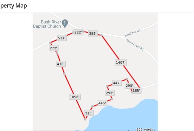
40.22 AC
2025
Athens/Gainesville
970300
Other Market Areas
DEMOGRAPHICS near 1191 Grove Level Rd
1 Mile
3 Mile
5 Mile
2024 Total Population
184
3,209
10,885
2029 Population
212
3,767
13,215
Pop Growth 2024-2029
+ 15.22%
+ 17.39%
+ 21.41%
Average Age
39
39
40
2024 Total Households
67
1,162
3,912
HH Growth 2024-2029
+ 14.93%
+ 16.95%
+ 20.55%
Median Household Inc
$50,833
$55,669
$60,202
Avg Household Size
2.80
2.80
2.70
2024 Avg HH Vehicles
2.00
2.00
2.00
Median Home Value
$203,125
$216,271
$206,522
Median Year Built
1988
1990
1992
Nearby Places
Map Layers
Map Styles
 Street
 Aerial
- Restaurants
- Banks
- Shops
- Fitness
- Groceries
SALE & LEASE HISTORY
LISTING DATE
SALE/LEASE

Jan 13, 2022
For Sale
Jan 12, 2022
For Sale
Jan 12, 2022
For Lease
Jan 07, 2022
For Sale
Jan 06, 2022
For Sale
Aug 28, 2023
For Sale
Nearby Properties
Address
Land Use
TOTAL SIZE
Lot Size
Zoning
Address
Land Use
TOTAL SIZE
Lot Size
Zoning
47,853 SF
15.93 AC
R2
Address
Land Use
TOTAL SIZE
Lot Size
Zoning
192,721 SF
22.14 AC
M1
Address
Land Use
TOTAL SIZE
Lot Size
Zoning
19,073 SF
78.87 AC
Address
Land Use
TOTAL SIZE
Lot Size
Zoning
52,325 SF
36.96 AC
HRC
Address
Land Use
TOTAL SIZE
Lot Size
Zoning
95,358 SF
23 AC
ARR
Address
Land Use
TOTAL SIZE
Lot Size
Zoning
206,500 SF
14.13 AC
001
Address
Land Use
TOTAL SIZE
Lot Size
Zoning
15,900 SF
21.13 AC
Address
Land Use
TOTAL SIZE
Lot Size
Zoning
170,100 SF
11.51 AC
001
Address
Land Use
TOTAL SIZE
Lot Size
Zoning
91,226 SF
40 AC
M1
Address
Land Use
TOTAL SIZE
Lot Size
Zoning
17,197 SF
318.04 AC
C2
Address
Land Use
TOTAL SIZE
Lot Size
Zoning
150,400 SF
13.91 AC
004
Address
Land Use
TOTAL SIZE
Lot Size
Zoning
18,170 SF
48.01 AC
ARR
Address
Land Use
TOTAL SIZE
Lot Size
Zoning
95,761 SF
30.97 AC
M1
Address
Land Use
TOTAL SIZE
Lot Size
Zoning
12,065 SF
2.09 AC
C2
Address
Land Use
TOTAL SIZE
Lot Size
Zoning
104,932 SF
23.60 AC
C2
Address
Land Use
TOTAL SIZE
Lot Size
Zoning
51,478 SF
1.52 AC
C2
Address
Land Use
TOTAL SIZE
Lot Size
Zoning
12,238 SF
1.73 AC
C2
Address
Land Use
TOTAL SIZE
Lot Size
Zoning
93.38 AC
GI
Address
Land Use
TOTAL SIZE
Lot Size
Zoning
80,000 SF
21.47 AC
C2
Address
Land Use
TOTAL SIZE
Lot Size
Zoning
95,761 SF
30.97 AC
M1
Address
Land Use
TOTAL SIZE
Lot Size
Zoning
12,872 SF
1.61 AC
C2
Address
Land Use
TOTAL SIZE
Lot Size
Zoning
484.55 AC
Address
Land Use
TOTAL SIZE
Lot Size
Zoning
3,600 SF
68.12 AC
C2
Address
Land Use
TOTAL SIZE
Lot Size
Zoning
15,971 SF
7.79 AC
C2
Address
Land Use
TOTAL SIZE
Lot Size
Zoning
44.49 AC
C2
Address
Land Use
TOTAL SIZE
Lot Size
Zoning
29,607 SF
1.03 AC
C2
Address
Land Use
TOTAL SIZE
Lot Size
Zoning
10,123 SF
8.88 AC
C2
Address
Land Use
TOTAL SIZE
Lot Size
Zoning
87.78 AC
GI
Address
Land Use
TOTAL SIZE
Lot Size
Zoning
9.87 AC
C2
Address
Land Use
TOTAL SIZE
Lot Size
Zoning
41.91 AC
C2
The World's #1 Commercial Real Estate Marketplace
Connect with us
© 2026 CoStar Group
The information above has been obtained from sources believed reliable. While we do not doubt its accuracy we have not verified it and make no guarantee, warranty or representation about it. It is your responsibility to independently confirm its accuracy and completeness. Any projections, opinions, assumptions, or estimates used are for example only and do not represent the current or future performance of the property. The value of this transaction to you depends on tax and other factors which should be evaluated by your tax, financial, and legal advisors. You and your advisors should conduct a careful, independent investigation of the property to determine to your satisfaction the suitability of the property for your needs.