Property Record
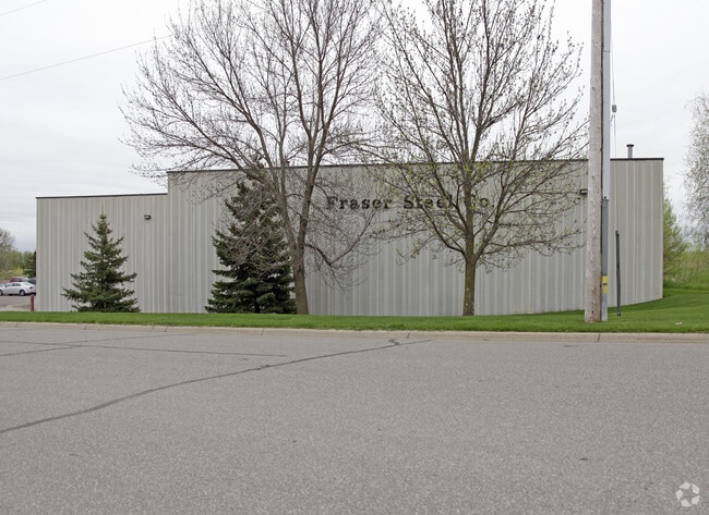
11915 53Rd St Ne, Albertville, MN 55301


NEARBY LISTINGS FOR SALE OR LEASE
Property Detail
11915 53Rd St Ne
Minneapolis/St Paul
Barthels Industrial Pk 2Nd Ad
Minneapolis-St. Paul-Bloomington, MN-WI
SECT-06 TWP-120 RANGE-023 BARTHELS INDUSTRIAL PK 2ND ADDN LOT-001 BLOCK-001 OT-001 BLOCK-001
101-135-001010
Wright
Realpropertynec
Minnesota
2024
1
2025
4.63 AC
100807
Wright County
72,520 SF
DEMOGRAPHICS near 11915 53Rd St Ne
1 Mile
3 Mile
5 Mile
2024 Total Population
4,101
31,939
57,145
2029 Population
4,589
35,743
63,201
Pop Growth 2024-2029
+ 11.90%
+ 11.91%
+ 10.60%
Average Age
35
35
36
2024 Total Households
1,369
10,449
18,986
HH Growth 2024-2029
+ 11.98%
+ 11.99%
+ 10.73%
Median Household Inc
$107,265
$119,651
$119,952
Avg Household Size
2.90
3.00
3.00
2024 Avg HH Vehicles
2.00
2.00
2.00
Median Home Value
$302,713
$316,883
$334,406
Median Year Built
2000
2002
2002
Nearby Places
Map Layers
Map Styles
 Street
 Aerial
- Restaurants
- Banks
- Shops
- Fitness
- Groceries
Nearby Properties
Address
Land Use
TOTAL SIZE
Lot Size
Zoning
Address
Land Use
TOTAL SIZE
Lot Size
Zoning
25,380 SF
130.75 AC
Address
Land Use
TOTAL SIZE
Lot Size
Zoning
44.82 AC
Address
Land Use
TOTAL SIZE
Lot Size
Zoning
40,984 SF
19.16 AC
Address
Land Use
TOTAL SIZE
Lot Size
Zoning
40,984 SF
34.62 AC
Address
Land Use
TOTAL SIZE
Lot Size
Zoning
110,784 SF
15.36 AC
Address
Land Use
TOTAL SIZE
Lot Size
Zoning
4,240 SF
2.45 AC
Address
Land Use
TOTAL SIZE
Lot Size
Zoning
58.85 AC
Address
Land Use
TOTAL SIZE
Lot Size
Zoning
106,614 SF
19.89 AC
Address
Land Use
TOTAL SIZE
Lot Size
Zoning
Address
Land Use
TOTAL SIZE
Lot Size
Zoning
Address
Land Use
TOTAL SIZE
Lot Size
Zoning
Address
Land Use
TOTAL SIZE
Lot Size
Zoning
178,398 SF
24 AC
Address
Land Use
TOTAL SIZE
Lot Size
Zoning
31,553 SF
41.63 AC
Address
Land Use
TOTAL SIZE
Lot Size
Zoning
Address
Land Use
TOTAL SIZE
Lot Size
Zoning
Address
Land Use
TOTAL SIZE
Lot Size
Zoning
7,932 SF
13.29 AC
Address
Land Use
TOTAL SIZE
Lot Size
Zoning
21,935 SF
4.15 AC
Address
Land Use
TOTAL SIZE
Lot Size
Zoning
46,521 SF
45.81 AC
Address
Land Use
TOTAL SIZE
Lot Size
Zoning
Address
Land Use
TOTAL SIZE
Lot Size
Zoning
Address
Land Use
TOTAL SIZE
Lot Size
Zoning
26,187 SF
2.05 AC
Address
Land Use
TOTAL SIZE
Lot Size
Zoning
78,300 SF
3.81 AC
Address
Land Use
TOTAL SIZE
Lot Size
Zoning
22,258 SF
2.35 AC
Address
Land Use
TOTAL SIZE
Lot Size
Zoning
29,184 SF
5 AC
Address
Land Use
TOTAL SIZE
Lot Size
Zoning
16.21 AC
Address
Land Use
TOTAL SIZE
Lot Size
Zoning
Address
Land Use
TOTAL SIZE
Lot Size
Zoning
15,560 SF
59.44 AC
Address
Land Use
TOTAL SIZE
Lot Size
Zoning
105,140 SF
12.88 AC
Address
Land Use
TOTAL SIZE
Lot Size
Zoning
12,250 SF
20.65 AC
The World's #1 Commercial Real Estate Marketplace
Connect with us
© 2026 CoStar Group
The information above has been obtained from sources believed reliable. While we do not doubt its accuracy we have not verified it and make no guarantee, warranty or representation about it. It is your responsibility to independently confirm its accuracy and completeness. Any projections, opinions, assumptions, or estimates used are for example only and do not represent the current or future performance of the property. The value of this transaction to you depends on tax and other factors which should be evaluated by your tax, financial, and legal advisors. You and your advisors should conduct a careful, independent investigation of the property to determine to your satisfaction the suitability of the property for your needs.