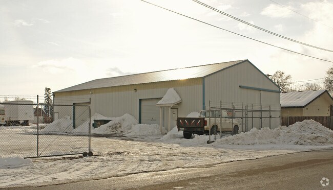
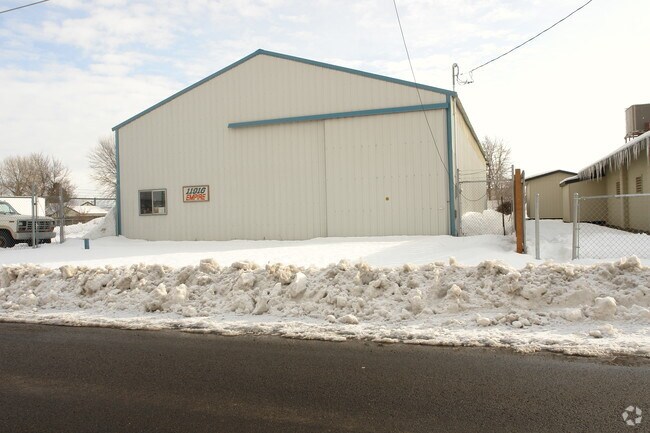
Property Record
11916 E Empire Ave, Spokane Valley, WA 99206

Property Detail
11916 E Empire Ave
45044.2001
SHP 2015-0006 LT 1 (AFN# 6490805)
Wholesaleoutletdiscountstore
Spokane
MUC
Washington
B and X Area of moderate flood hazard, usually the area between the limits of the 100-year and 500-year floods.
1
2025
0.63 AC
2025
Valley
012600
Spokane
2,800 SF
Spokane-Spokane Valley, WA
NEARBY LISTINGS FOR SALE OR LEASE
DEMOGRAPHICS near 11916 E Empire Ave
1 mile
3 mile
5 mile
2025 Total Population
7,639
56,178
122,686
2030 Population
7,913
57,322
125,488
Pop Growth 2025-2030
+ 3.59%
+ 2.04%
+ 2.28%
Average Age
36
40
40
2025 Total Households
3,202
23,311
49,233
HH Growth 2025-2030
+ 3.72%
+ 2.00%
+ 2.24%
Median Household Inc
$57,650
$69,918
$74,909
Avg Household Size
2.30
2.30
2.40
2025 Avg HH Vehicles
2.00
2.00
2.00
Median Home Value
$314,431
$378,895
$406,246
Median Year Built
1990
1979
1982
Nearby Places
Map Layers
Map Styles
 Street
 Aerial
Layers
 Traffic
 Biking
Places
Listings with unknown addresses are not visible on the map
- Restaurants
- Banks
- Shops
- Fitness
- Groceries
PUBLIC TRANSPORTATION
COMMUTER RAIL
Drive
Walk
Distance
16 min
9.5 mi
AIRPORT
Spokane International
Drive
Walk
Distance
Spokane International
23 min
15.3 mi
Nearby Properties
Address
Land Use
TOTAL SIZE
Lot Size
Zoning
Address
Land Use
TOTAL SIZE
Lot Size
Zoning
2,818,475 SF
466.05 AC
I-2
Address
Land Use
TOTAL SIZE
Lot Size
Zoning
3,688,247 SF
244.85 AC
I-2
Address
Land Use
TOTAL SIZE
Lot Size
Zoning
355,192 SF
35.83 AC
I-2
Address
Land Use
TOTAL SIZE
Lot Size
Zoning
169,003 SF
5.18 AC
MUC
Address
Land Use
TOTAL SIZE
Lot Size
Zoning
270,453 SF
28.62 AC
Address
Land Use
TOTAL SIZE
Lot Size
Zoning
259,169 SF
13.42 AC
MF-2
Address
Land Use
TOTAL SIZE
Lot Size
Zoning
318,756 SF
13.64 AC
MF-2
Address
Land Use
TOTAL SIZE
Lot Size
Zoning
378,750 SF
17.38 AC
R-2
Address
Land Use
TOTAL SIZE
Lot Size
Zoning
204,730 SF
8.60 AC
MUC
Address
Land Use
TOTAL SIZE
Lot Size
Zoning
161,130 SF
6.45 AC
GO
Address
Land Use
TOTAL SIZE
Lot Size
Zoning
240,663 SF
8.90 AC
MF-2
Address
Land Use
TOTAL SIZE
Lot Size
Zoning
84,600 SF
17.95 AC
MF-1
Address
Land Use
TOTAL SIZE
Lot Size
Zoning
136,518 SF
7.96 AC
O
Address
Land Use
TOTAL SIZE
Lot Size
Zoning
175,936 SF
12.16 AC
MF-2
Address
Land Use
TOTAL SIZE
Lot Size
Zoning
138,379 SF
17.39 AC
RC
Address
Land Use
TOTAL SIZE
Lot Size
Zoning
87,848 SF
7.36 AC
MF-2
Address
Land Use
TOTAL SIZE
Lot Size
Zoning
231,172 SF
19.20 AC
RC
Address
Land Use
TOTAL SIZE
Lot Size
Zoning
87,989 SF
5.38 AC
MF-2
Address
Land Use
TOTAL SIZE
Lot Size
Zoning
151,690 SF
7.89 AC
MF-2
Address
Land Use
TOTAL SIZE
Lot Size
Zoning
126,989 SF
7.55 AC
I-2
Address
Land Use
TOTAL SIZE
Lot Size
Zoning
61,059 SF
54.20 AC
P/OS
Address
Land Use
TOTAL SIZE
Lot Size
Zoning
143,772 SF
10.67 AC
MF-2
Address
Land Use
TOTAL SIZE
Lot Size
Zoning
157,232 SF
3.28 AC
MF-2
Address
Land Use
TOTAL SIZE
Lot Size
Zoning
120,296 SF
9.26 AC
MF-2
Address
Land Use
TOTAL SIZE
Lot Size
Zoning
115,536 SF
6.17 AC
MUC
Address
Land Use
TOTAL SIZE
Lot Size
Zoning
139,164 SF
5.62 AC
MUC
Address
Land Use
TOTAL SIZE
Lot Size
Zoning
47,612 SF
3.38 AC
CMU
Address
Land Use
TOTAL SIZE
Lot Size
Zoning
89,120 SF
5.83 AC
MDR
Address
Land Use
TOTAL SIZE
Lot Size
Zoning
120,798 SF
8.66 AC
I-2
Address
Land Use
TOTAL SIZE
Lot Size
Zoning
105,659 SF
4.40 AC
MF-1
The World's #1 Commercial Real Estate Marketplace
Connect with us
© 2026 CoStar Group
The information above has been obtained from sources believed reliable. While we do not doubt its accuracy we have not verified it and make no guarantee, warranty or representation about it. It is your responsibility to independently confirm its accuracy and completeness. Any projections, opinions, assumptions, or estimates used are for example only and do not represent the current or future performance of the property. The value of this transaction to you depends on tax and other factors which should be evaluated by your tax, financial, and legal advisors. You and your advisors should conduct a careful, independent investigation of the property to determine to your satisfaction the suitability of the property for your needs.