Property Record
1192 N Rupple Rd, Fayetteville, AR 72704

NEARBY LISTINGS FOR SALE OR LEASE
-
-
View all Fayetteville listings for sale on LoopNet.com
Property Detail
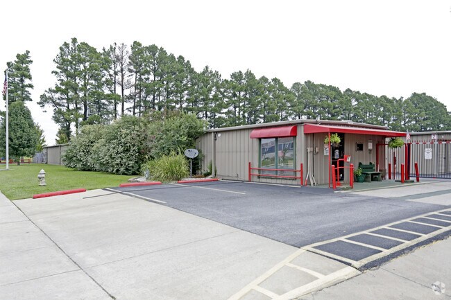
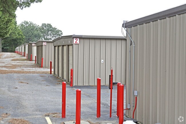
1192 N Rupple Rd
765-16231-000
Fayetteville Outlots
Publicstorage
PT E/2 NE 4.80 AC FURTHER DESCRIBED FROM 2021-28400 AS: PART OF THE SOUTHEAST QUARTER OF THE NORTHEAST QUARTER OF SECTION TWE
X
Washington
05143C0204G
Arkansas
2025
4.80 AC
2025
Greater Fayetteville
010516
Fayetteville/Springdale/Rogers
21,600 SF
Fayetteville-Springdale-Rogers, AR-MO
DEMOGRAPHICS near 1192 N Rupple Rd
1 Mile
3 Mile
5 Mile
2024 Total Population
12,272
58,486
99,080
2029 Population
13,476
63,900
108,442
Pop Growth 2024-2029
+ 9.81%
+ 9.26%
+ 9.45%
Average Age
32
31
34
2024 Total Households
5,382
23,184
40,698
HH Growth 2024-2029
+ 10.05%
+ 10.27%
+ 10.10%
Median Household Inc
$74,678
$57,841
$60,560
Avg Household Size
2.20
2.20
2.20
2024 Avg HH Vehicles
2.00
2.00
2.00
Median Home Value
$250,099
$246,465
$262,537
Median Year Built
2002
1999
1996
Nearby Places
Map Layers
Map Styles
 Street
 Aerial
- Restaurants
- Banks
- Shops
- Fitness
- Groceries
PUBLIC TRANSPORTATION
AIRPORT
Northwest Arkansas Ntl
DRIVE
WALK
Distance
Northwest Arkansas Ntl
39 min
21.0 mi
Freight Ports
Tulsa Port of Inola
DRIVE
WALK
Distance
Tulsa Port of Inola
104 min
87.2 mi
Nearby Properties
Address
Land Use
TOTAL SIZE
Lot Size
Zoning
Address
Land Use
TOTAL SIZE
Lot Size
Zoning
92,872 SF
15.37 AC
Address
Land Use
TOTAL SIZE
Lot Size
Zoning
27,060 SF
26.31 AC
Address
Land Use
TOTAL SIZE
Lot Size
Zoning
316,846 SF
2.31 AC
I1
Address
Land Use
TOTAL SIZE
Lot Size
Zoning
63,080 SF
3.42 AC
Address
Land Use
TOTAL SIZE
Lot Size
Zoning
42,327 SF
13.28 AC
I1
Address
Land Use
TOTAL SIZE
Lot Size
Zoning
45,300 SF
16.38 AC
Address
Land Use
TOTAL SIZE
Lot Size
Zoning
226,792 SF
26.66 AC
Address
Land Use
TOTAL SIZE
Lot Size
Zoning
145,586 SF
2.18 AC
R3
Address
Land Use
TOTAL SIZE
Lot Size
Zoning
19,544 SF
18.79 AC
Address
Land Use
TOTAL SIZE
Lot Size
Zoning
193,590 SF
8.67 AC
I1
Address
Land Use
TOTAL SIZE
Lot Size
Zoning
16,409 SF
17.40 AC
C1
Address
Land Use
TOTAL SIZE
Lot Size
Zoning
371,436 SF
29.18 AC
I2
Address
Land Use
TOTAL SIZE
Lot Size
Zoning
176,747 SF
4.98 AC
Address
Land Use
TOTAL SIZE
Lot Size
Zoning
36,104 SF
8.36 AC
I1
Address
Land Use
TOTAL SIZE
Lot Size
Zoning
62,644 SF
0.49 AC
R3
Address
Land Use
TOTAL SIZE
Lot Size
Zoning
40,964 SF
10.59 AC
F
Address
Land Use
TOTAL SIZE
Lot Size
Zoning
121,758 SF
20.54 AC
Address
Land Use
TOTAL SIZE
Lot Size
Zoning
48,120 SF
0.53 AC
R3
Address
Land Use
TOTAL SIZE
Lot Size
Zoning
91,380 SF
9.53 AC
Address
Land Use
TOTAL SIZE
Lot Size
Zoning
13,012 SF
10.36 AC
I2
Address
Land Use
TOTAL SIZE
Lot Size
Zoning
122,309 SF
9.64 AC
Address
Land Use
TOTAL SIZE
Lot Size
Zoning
73,886 SF
6.59 AC
C2
Address
Land Use
TOTAL SIZE
Lot Size
Zoning
86,794 SF
0.33 AC
Address
Land Use
TOTAL SIZE
Lot Size
Zoning
78,284 SF
0.43 AC
Address
Land Use
TOTAL SIZE
Lot Size
Zoning
171,828 SF
9.95 AC
R2
Address
Land Use
TOTAL SIZE
Lot Size
Zoning
254,783 SF
26.49 AC
C2
Address
Land Use
TOTAL SIZE
Lot Size
Zoning
22,208 SF
5.22 AC
Address
Land Use
TOTAL SIZE
Lot Size
Zoning
259,706 SF
5.31 AC
C2
Address
Land Use
TOTAL SIZE
Lot Size
Zoning
86,260 SF
4.15 AC
Address
Land Use
TOTAL SIZE
Lot Size
Zoning
39,936 SF
1.68 AC
The World's #1 Commercial Real Estate Marketplace
Connect with us
© 2025 CoStar Group
The information above has been obtained from sources believed reliable. While we do not doubt its accuracy we have not verified it and make no guarantee, warranty or representation about it. It is your responsibility to independently confirm its accuracy and completeness. Any projections, opinions, assumptions, or estimates used are for example only and do not represent the current or future performance of the property. The value of this transaction to you depends on tax and other factors which should be evaluated by your tax, financial, and legal advisors. You and your advisors should conduct a careful, independent investigation of the property to determine to your satisfaction the suitability of the property for your needs.