Property Record
11922 N L St, La Porte, TX 77571
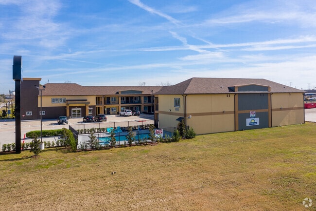


Property Detail
11922 N L St
0401790000008
TRS 3 & 3M ABST 5 E BRINSON
Hotel
HARRIS
B and X Area of moderate flood hazard, usually the area between the limits of the 100-year and 500-year floods.
Texas
2025
0.92 AC
2025
Houston East/Baytown
343301
Houston
23,296 SF
Houston-Pasadena-The Woodlands, TX
NEARBY LISTINGS FOR SALE OR LEASE
DEMOGRAPHICS near 11922 N L St
1 mile
3 mile
5 mile
2025 Total Population
2,559
29,968
74,009
2030 Population
2,763
32,137
79,172
Pop Growth 2025-2030
+ 7.97%
+ 7.24%
+ 6.98%
Average Age
39
39
39
2025 Total Households
901
10,656
26,297
HH Growth 2025-2030
+ 7.99%
+ 7.16%
+ 7.07%
Median Household Inc
$90,427
$98,672
$89,122
Avg Household Size
2.80
2.70
2.80
2025 Avg HH Vehicles
3.00
2.00
2.00
Median Home Value
$280,416
$257,535
$262,360
Median Year Built
1992
1986
1983
Nearby Places
Map Layers
Map Styles
 Street
 Aerial
Layers
 Traffic
 Biking
Places
Listings with unknown addresses are not visible on the map
- Restaurants
- Banks
- Shops
- Fitness
- Groceries
PUBLIC TRANSPORTATION
AIRPORT
William P Hobby
Drive
Walk
Distance
William P Hobby
35 min
17.9 mi
George Bush Intcntl/Houston
Drive
Walk
Distance
George Bush Intcntl/Houston
45 min
34.5 mi
Freight Ports
Port of Houston
Drive
Walk
Distance
Port of Houston
27 min
17.5 mi
Nearby Properties
Address
Land Use
TOTAL SIZE
Lot Size
Zoning
Address
Land Use
TOTAL SIZE
Lot Size
Zoning
55.98 AC
Address
Land Use
TOTAL SIZE
Lot Size
Zoning
Address
Land Use
TOTAL SIZE
Lot Size
Zoning
45.75 AC
Address
Land Use
TOTAL SIZE
Lot Size
Zoning
45.78 AC
Address
Land Use
TOTAL SIZE
Lot Size
Zoning
36.31 AC
Address
Land Use
TOTAL SIZE
Lot Size
Zoning
38.27 AC
Address
Land Use
TOTAL SIZE
Lot Size
Zoning
47.21 AC
Address
Land Use
TOTAL SIZE
Lot Size
Zoning
61.40 AC
Address
Land Use
TOTAL SIZE
Lot Size
Zoning
900,000 SF
42.88 AC
Address
Land Use
TOTAL SIZE
Lot Size
Zoning
120.26 AC
Address
Land Use
TOTAL SIZE
Lot Size
Zoning
Address
Land Use
TOTAL SIZE
Lot Size
Zoning
46.10 AC
Address
Land Use
TOTAL SIZE
Lot Size
Zoning
1,120,800 SF
35.24 AC
Address
Land Use
TOTAL SIZE
Lot Size
Zoning
711,094 SF
35.47 AC
Address
Land Use
TOTAL SIZE
Lot Size
Zoning
748,500 SF
42.13 AC
Address
Land Use
TOTAL SIZE
Lot Size
Zoning
610,402 SF
34.69 AC
Address
Land Use
TOTAL SIZE
Lot Size
Zoning
602,060 SF
34.15 AC
Address
Land Use
TOTAL SIZE
Lot Size
Zoning
348,294 SF
18.02 AC
Address
Land Use
TOTAL SIZE
Lot Size
Zoning
102.68 AC
Address
Land Use
TOTAL SIZE
Lot Size
Zoning
287,729 SF
20 AC
Address
Land Use
TOTAL SIZE
Lot Size
Zoning
Address
Land Use
TOTAL SIZE
Lot Size
Zoning
38.51 AC
Address
Land Use
TOTAL SIZE
Lot Size
Zoning
416,005 SF
21.47 AC
Address
Land Use
TOTAL SIZE
Lot Size
Zoning
415,662 SF
21.49 AC
Address
Land Use
TOTAL SIZE
Lot Size
Zoning
403,572 SF
24.68 AC
Address
Land Use
TOTAL SIZE
Lot Size
Zoning
45.18 AC
Address
Land Use
TOTAL SIZE
Lot Size
Zoning
26.28 AC
Address
Land Use
TOTAL SIZE
Lot Size
Zoning
95.07 AC
Address
Land Use
TOTAL SIZE
Lot Size
Zoning
356,565 SF
18.07 AC
Address
Land Use
TOTAL SIZE
Lot Size
Zoning
365,728 SF
25.30 AC
The World's #1 Commercial Real Estate Marketplace
Connect with us
© 2026 CoStar Group
The information above has been obtained from sources believed reliable. While we do not doubt its accuracy we have not verified it and make no guarantee, warranty or representation about it. It is your responsibility to independently confirm its accuracy and completeness. Any projections, opinions, assumptions, or estimates used are for example only and do not represent the current or future performance of the property. The value of this transaction to you depends on tax and other factors which should be evaluated by your tax, financial, and legal advisors. You and your advisors should conduct a careful, independent investigation of the property to determine to your satisfaction the suitability of the property for your needs.