Property Record
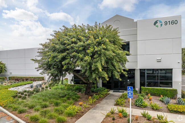
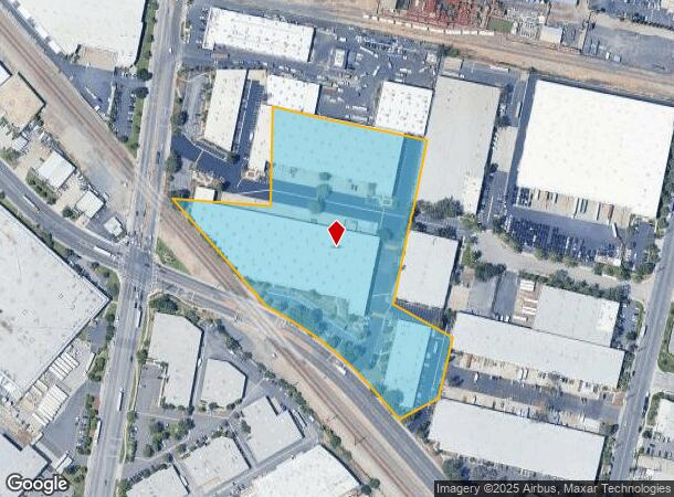
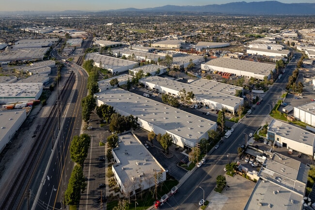
9100 Norwalk Blvd, Santa Fe Springs, CA 90670
NEARBY LISTINGS FOR SALE OR LEASE
Property Detail
9100 Norwalk Blvd
Los Angeles-Long Beach-Glendale, CA
5925
8168-001-028
PARCEL MAP AS PER BK 189 P 49-52 OF PM* THAT POR IN TRA 5925 OF LOT 3
Lightindustrial
Los Angeles
X
California
06037C1829F
3
2024
8.19 AC
2025
Santa Fe Springs/La Mirada
504200
Los Angeles
202,529 SF
DEMOGRAPHICS near 9100 Norwalk Blvd
1 Mile
3 Mile
5 Mile
2024 Total Population
11,507
207,072
508,034
2029 Population
11,037
199,257
489,153
Pop Growth 2024-2029
(4.08%)
(3.77%)
(3.72%)
Average Age
39
39
39
2024 Total Households
2,954
60,091
147,790
HH Growth 2024-2029
(4.47%)
(4.04%)
(3.97%)
Median Household Inc
$76,842
$81,089
$81,723
Avg Household Size
3.60
3.30
3.30
2024 Avg HH Vehicles
2.00
2.00
2.00
Median Home Value
$626,170
$679,004
$689,648
Median Year Built
1956
1955
1957
Nearby Places
- Restaurants
- Banks
- Shops
- Fitness
- Groceries
PUBLIC TRANSPORTATION
COMMUTER RAIL
Norwalk/Santa Fe Springs (91 Line - Southern California Regional Rail Authority (Metrolink), Orange County Line - Southern California Regional Rail Authority (Metrolink))
DRIVE
WALK
Distance
Norwalk/Santa Fe Springs (91 Line - Southern California Regional Rail Authority (Metrolink), Orange County Line - Southern California Regional Rail Authority (Metrolink))
8 min
3.9 mi
Montebello/Commerce (Riverside Line - Southern California Regional Rail Authority (Metrolink))
DRIVE
WALK
Distance
Montebello/Commerce (Riverside Line - Southern California Regional Rail Authority (Metrolink))
12 min
6.0 mi
AIRPORT
Long Beach (Daugherty Field)
DRIVE
WALK
Distance
Long Beach (Daugherty Field)
25 min
16.2 mi
Los Angeles International
DRIVE
WALK
Distance
Los Angeles International
33 min
24.4 mi
John Wayne/Orange County
DRIVE
WALK
Distance
John Wayne/Orange County
36 min
27.3 mi
Freight Ports
Port of Long Beach
DRIVE
WALK
Distance
Port of Long Beach
32 min
21.9 mi
SALE & LEASE HISTORY
LISTING DATE
SALE/LEASE

Oct 14, 2024
For Lease
Jun 26, 2020
For Lease
Feb 20, 2019
For Lease
Nearby Properties
Address
Land Use
TOTAL SIZE
Lot Size
Zoning
Address
Land Use
TOTAL SIZE
Lot Size
Zoning
519,516 SF
25.37 AC
WHR3*
Address
Land Use
TOTAL SIZE
Lot Size
Zoning
1,100,900 SF
22.36 AC
SSM2*
Address
Land Use
TOTAL SIZE
Lot Size
Zoning
166,712 SF
8.53 AC
NOM1(PF)-P
Address
Land Use
TOTAL SIZE
Lot Size
Zoning
322,048 SF
15.54 AC
SSM2-M1*
Address
Land Use
TOTAL SIZE
Lot Size
Zoning
304,549 SF
7.13 AC
SSM2*
Address
Land Use
TOTAL SIZE
Lot Size
Zoning
518,296 SF
13.94 AC
NOCO(PF)*
Address
Land Use
TOTAL SIZE
Lot Size
Zoning
234,324 SF
10.05 AC
SSM2*
Address
Land Use
TOTAL SIZE
Lot Size
Zoning
300,148 SF
13.01 AC
SSM2*
Address
Land Use
TOTAL SIZE
Lot Size
Zoning
244,768 SF
10.59 AC
PR1G
Address
Land Use
TOTAL SIZE
Lot Size
Zoning
288,000 SF
13.56 AC
SSM2-BP*
Address
Land Use
TOTAL SIZE
Lot Size
Zoning
170,222 SF
7.50 AC
PR1G
Address
Land Use
TOTAL SIZE
Lot Size
Zoning
176,103 SF
SSM2YY
Address
Land Use
TOTAL SIZE
Lot Size
Zoning
188,940 SF
9 AC
PR1G
Address
Land Use
TOTAL SIZE
Lot Size
Zoning
41,100 SF
8.42 AC
SSM2*
Address
Land Use
TOTAL SIZE
Lot Size
Zoning
513,222 SF
13.35 AC
PR1G
Address
Land Use
TOTAL SIZE
Lot Size
Zoning
289,454 SF
13.66 AC
SSM2*
Address
Land Use
TOTAL SIZE
Lot Size
Zoning
183,000 SF
7.76 AC
SSM2*
Address
Land Use
TOTAL SIZE
Lot Size
Zoning
158,272 SF
7.09 AC
SSPF*
Address
Land Use
TOTAL SIZE
Lot Size
Zoning
657,978 SF
31.68 AC
SSM2*
Address
Land Use
TOTAL SIZE
Lot Size
Zoning
89,899 SF
SSM2*
Address
Land Use
TOTAL SIZE
Lot Size
Zoning
73,661 SF
4.25 AC
SSR1
Address
Land Use
TOTAL SIZE
Lot Size
Zoning
74,018 SF
14.92 AC
WHM1*
Address
Land Use
TOTAL SIZE
Lot Size
Zoning
89,514 SF
21.28 AC
WHC2*
Address
Land Use
TOTAL SIZE
Lot Size
Zoning
500,374 SF
9.46 AC
SSM2*
Address
Land Use
TOTAL SIZE
Lot Size
Zoning
425,816 SF
30.02 AC
SSM2*
Address
Land Use
TOTAL SIZE
Lot Size
Zoning
62,612 SF
21.49 AC
SSM2
Address
Land Use
TOTAL SIZE
Lot Size
Zoning
320,030 SF
8.81 AC
WHM2*
Address
Land Use
TOTAL SIZE
Lot Size
Zoning
184,230 SF
4.55 AC
SSM2*
Address
Land Use
TOTAL SIZE
Lot Size
Zoning
500,374 SF
12.66 AC
SSM2*
The World's #1 Commercial Real Estate Marketplace
Connect with us
© 2025 CoStar Group
The information above has been obtained from sources believed reliable. While we do not doubt its accuracy we have not verified it and make no guarantee, warranty or representation about it. It is your responsibility to independently confirm its accuracy and completeness. Any projections, opinions, assumptions, or estimates used are for example only and do not represent the current or future performance of the property. The value of this transaction to you depends on tax and other factors which should be evaluated by your tax, financial, and legal advisors. You and your advisors should conduct a careful, independent investigation of the property to determine to your satisfaction the suitability of the property for your needs.