Property Record
11925 N Oracle Rd, Tucson, AZ 85737

Save to a Folder
{{folder.Name}}
{{folder.ListingIds.length}} Properties
{{folder.ListingIds.length}} Property
Create a New Folder
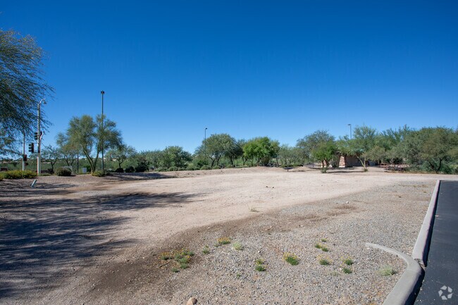
Property Detail
11925 N Oracle Rd
Tucson, AZ
ORO VALLEY MARKETPLACE AMENDED LOT 15
220-04-3260
PIMA
Regionalshoppingcenterormallwithanchorstore
Arizona
PAD
15
B and X Area of moderate flood hazard, usually the area between the limits of the 100-year and 500-year floods.
1.15 AC
2025
North/Oro Valley
2026
Tucson
004635
NEARBY LISTINGS FOR SALE OR LEASE
DEMOGRAPHICS near 11925 N Oracle Rd
1 mile
3 mile
5 mile
2025 Total Population
2,403
25,301
54,046
2030 Population
2,540
26,483
56,051
Pop Growth 2025-2030
+ 5.70%
+ 4.67%
+ 3.71%
Average Age
48
51
50
2025 Total Households
1,126
11,496
23,643
HH Growth 2025-2030
+ 5.86%
+ 4.79%
+ 3.87%
Median Household Inc
$107,440
$106,627
$109,756
Avg Household Size
2.10
2.10
2.20
2025 Avg HH Vehicles
2.00
2.00
2.00
Median Home Value
$479,866
$458,953
$467,549
Median Year Built
1997
1997
1996
Nearby Places
Map Layers
Map Styles
 Street
 Aerial
Layers
 Traffic
 Biking
Places
Listings with unknown addresses are not visible on the map
- Restaurants
- Banks
- Shops
- Fitness
- Groceries
PUBLIC TRANSPORTATION
AIRPORT
Tucson International
Drive
Walk
Distance
Tucson International
43 min
23.8 mi
Nearby Properties
Address
Land Use
TOTAL SIZE
Lot Size
Zoning
Address
Land Use
TOTAL SIZE
Lot Size
Zoning
368,956 SF
58.86 AC
CPI
Address
Land Use
TOTAL SIZE
Lot Size
Zoning
26,560 SF
9.02 AC
PAD
Address
Land Use
TOTAL SIZE
Lot Size
Zoning
231,366 SF
34.15 AC
PAD
Address
Land Use
TOTAL SIZE
Lot Size
Zoning
362,401 SF
19.55 AC
PAD
Address
Land Use
TOTAL SIZE
Lot Size
Zoning
551,678 SF
27.49 AC
PAD
Address
Land Use
TOTAL SIZE
Lot Size
Zoning
Address
Land Use
TOTAL SIZE
Lot Size
Zoning
320,757 SF
15.73 AC
Address
Land Use
TOTAL SIZE
Lot Size
Zoning
187,045 SF
16.70 AC
PAD
Address
Land Use
TOTAL SIZE
Lot Size
Zoning
214,008 SF
9.20 AC
Address
Land Use
TOTAL SIZE
Lot Size
Zoning
194,629 SF
17.47 AC
PAD
Address
Land Use
TOTAL SIZE
Lot Size
Zoning
206,109 SF
7.12 AC
PAD
Address
Land Use
TOTAL SIZE
Lot Size
Zoning
9,240 SF
17.07 AC
PAD
Address
Land Use
TOTAL SIZE
Lot Size
Zoning
287,745 SF
13.03 AC
Address
Land Use
TOTAL SIZE
Lot Size
Zoning
4,977 SF
1.75 AC
Address
Land Use
TOTAL SIZE
Lot Size
Zoning
5.40 AC
PAD
Address
Land Use
TOTAL SIZE
Lot Size
Zoning
330,372 SF
8.78 AC
Address
Land Use
TOTAL SIZE
Lot Size
Zoning
136,060 SF
13.36 AC
R1144
Address
Land Use
TOTAL SIZE
Lot Size
Zoning
69,865 SF
0.84 AC
PAD
Address
Land Use
TOTAL SIZE
Lot Size
Zoning
97,858 SF
11.54 AC
PAD
Address
Land Use
TOTAL SIZE
Lot Size
Zoning
343,624 SF
27.10 AC
Address
Land Use
TOTAL SIZE
Lot Size
Zoning
1.47 AC
PAD
Address
Land Use
TOTAL SIZE
Lot Size
Zoning
103,699 SF
4.34 AC
R4
Address
Land Use
TOTAL SIZE
Lot Size
Zoning
27,464 SF
4.63 AC
PAD
Address
Land Use
TOTAL SIZE
Lot Size
Zoning
3,598 SF
1.87 AC
PAD
Address
Land Use
TOTAL SIZE
Lot Size
Zoning
1.34 AC
PAD
Address
Land Use
TOTAL SIZE
Lot Size
Zoning
130,481 SF
10.69 AC
PAD
Address
Land Use
TOTAL SIZE
Lot Size
Zoning
62,040 SF
9.47 AC
PAD
Address
Land Use
TOTAL SIZE
Lot Size
Zoning
87,310 SF
9.36 AC
PAD
Address
Land Use
TOTAL SIZE
Lot Size
Zoning
48,452 SF
3.24 AC
The World's #1 Commercial Real Estate Marketplace
Connect with us
© 2026 CoStar Group
The information above has been obtained from sources believed reliable. While we do not doubt its accuracy we have not verified it and make no guarantee, warranty or representation about it. It is your responsibility to independently confirm its accuracy and completeness. Any projections, opinions, assumptions, or estimates used are for example only and do not represent the current or future performance of the property. The value of this transaction to you depends on tax and other factors which should be evaluated by your tax, financial, and legal advisors. You and your advisors should conduct a careful, independent investigation of the property to determine to your satisfaction the suitability of the property for your needs.