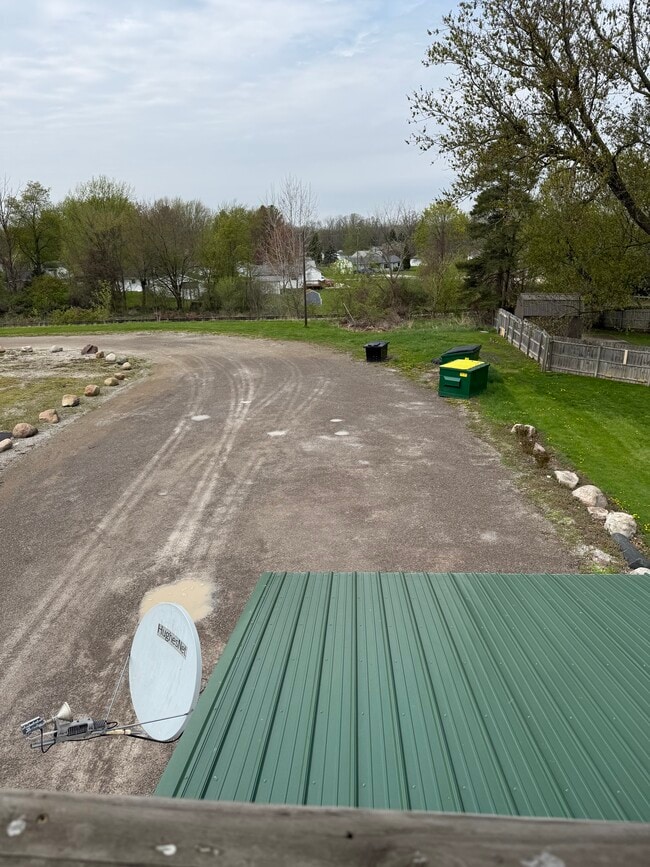
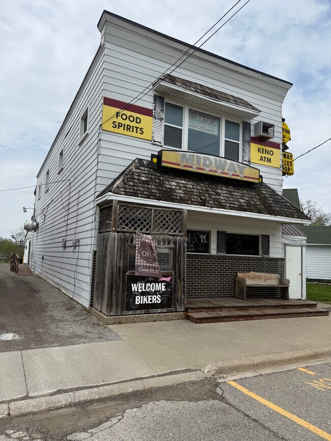
Property Record
11935 E Lennon Rd, Lennon, MI 48449

Save to a Folder
{{folder.Name}}
{{folder.ListingIds.length}} Properties
{{folder.ListingIds.length}} Property
Create a New Folder
Property Detail
11935 E Lennon Rd
Owosso, MI
VILLAGE OF LENNON ORIGINAL PLAT COM AT SE COR OF LOT 1 BLK 2 NW'LY 132 FT SW'LY 33 FT SE'LY 132 FT NE'LY 33 FT TO BEG ALSO CO
008-60-002-003
SHIAWASSEE
Commercialnec
Michigan
B and X Area of moderate flood hazard, usually the area between the limits of the 100-year and 500-year floods.
1
2025
0.24 AC
2026
Midland/Flint
030100
Other Market Areas
NEARBY LISTINGS FOR SALE OR LEASE
-
-
View all Lennon listings for sale on LoopNet.com
DEMOGRAPHICS near 11935 E Lennon Rd
1 mile
3 mile
5 mile
2025 Total Population
659
3,916
12,441
2030 Population
653
4,035
12,399
Pop Growth 2025-2030
(0.91%)
+ 3.04%
(0.34%)
Average Age
44
44
44
2025 Total Households
268
1,607
5,042
HH Growth 2025-2030
(1.12%)
+ 3.17%
(0.14%)
Median Household Inc
$70,086
$66,996
$77,127
Avg Household Size
2.40
2.40
2.40
2025 Avg HH Vehicles
2.00
2.00
2.00
Median Home Value
$189,319
$181,808
$191,230
Median Year Built
1965
1973
1971
Nearby Places
Map Layers
Map Styles
 Street
 Aerial
Layers
 Traffic
 Biking
Places
Listings with unknown addresses are not visible on the map
- Restaurants
- Banks
- Shops
- Fitness
- Groceries
PUBLIC TRANSPORTATION
COMMUTER RAIL
Drive
Walk
Distance
14 min
7.0 mi
AIRPORT
Bishop International
Drive
Walk
Distance
Bishop International
26 min
13.5 mi
Capital Region International
Drive
Walk
Distance
Capital Region International
51 min
44.6 mi
SALE & LEASE HISTORY
LISTING DATE
SALE/LEASE

May 08, 2025
For Sale
Nearby Properties
Address
Land Use
TOTAL SIZE
Lot Size
Zoning
Address
Land Use
TOTAL SIZE
Lot Size
Zoning
Address
Land Use
TOTAL SIZE
Lot Size
Zoning
4,241 SF
107.20 AC
RMH,MOB
Address
Land Use
TOTAL SIZE
Lot Size
Zoning
Address
Land Use
TOTAL SIZE
Lot Size
Zoning
Address
Land Use
TOTAL SIZE
Lot Size
Zoning
11.10 AC
Address
Land Use
TOTAL SIZE
Lot Size
Zoning
32.90 AC
Address
Land Use
TOTAL SIZE
Lot Size
Zoning
157.53 AC
Address
Land Use
TOTAL SIZE
Lot Size
Zoning
3,278 SF
197.90 AC
RA,AGRI
Address
Land Use
TOTAL SIZE
Lot Size
Zoning
27.60 AC
Address
Land Use
TOTAL SIZE
Lot Size
Zoning
120 AC
Address
Land Use
TOTAL SIZE
Lot Size
Zoning
7.70 AC
Address
Land Use
TOTAL SIZE
Lot Size
Zoning
21,104 SF
7.83 AC
GC,GENE
Address
Land Use
TOTAL SIZE
Lot Size
Zoning
118.44 AC
Address
Land Use
TOTAL SIZE
Lot Size
Zoning
156.80 AC
Address
Land Use
TOTAL SIZE
Lot Size
Zoning
2.40 AC
Address
Land Use
TOTAL SIZE
Lot Size
Zoning
10.10 AC
Address
Land Use
TOTAL SIZE
Lot Size
Zoning
11,336 SF
4.73 AC
LC,LOCA
Address
Land Use
TOTAL SIZE
Lot Size
Zoning
1,288 SF
122.65 AC
RA,AGRI
Address
Land Use
TOTAL SIZE
Lot Size
Zoning
100 AC
Address
Land Use
TOTAL SIZE
Lot Size
Zoning
1.90 AC
Address
Land Use
TOTAL SIZE
Lot Size
Zoning
Address
Land Use
TOTAL SIZE
Lot Size
Zoning
100 AC
Address
Land Use
TOTAL SIZE
Lot Size
Zoning
119 AC
Address
Land Use
TOTAL SIZE
Lot Size
Zoning
1,764 SF
40 AC
RA,AGRI
Address
Land Use
TOTAL SIZE
Lot Size
Zoning
Address
Land Use
TOTAL SIZE
Lot Size
Zoning
92.10 AC
Address
Land Use
TOTAL SIZE
Lot Size
Zoning
2,128 SF
76 AC
RA,AGRI
Address
Land Use
TOTAL SIZE
Lot Size
Zoning
2,515 SF
70.94 AC
RA,AGRI
Address
Land Use
TOTAL SIZE
Lot Size
Zoning
98.10 AC
Address
Land Use
TOTAL SIZE
Lot Size
Zoning
The World's #1 Commercial Real Estate Marketplace
Connect with us
© 2026 CoStar Group
The information above has been obtained from sources believed reliable. While we do not doubt its accuracy we have not verified it and make no guarantee, warranty or representation about it. It is your responsibility to independently confirm its accuracy and completeness. Any projections, opinions, assumptions, or estimates used are for example only and do not represent the current or future performance of the property. The value of this transaction to you depends on tax and other factors which should be evaluated by your tax, financial, and legal advisors. You and your advisors should conduct a careful, independent investigation of the property to determine to your satisfaction the suitability of the property for your needs.