Property Record
1194 Pershall Rd, Saint Louis, MO 63137

NEARBY LISTINGS FOR SALE OR LEASE
Property Detail
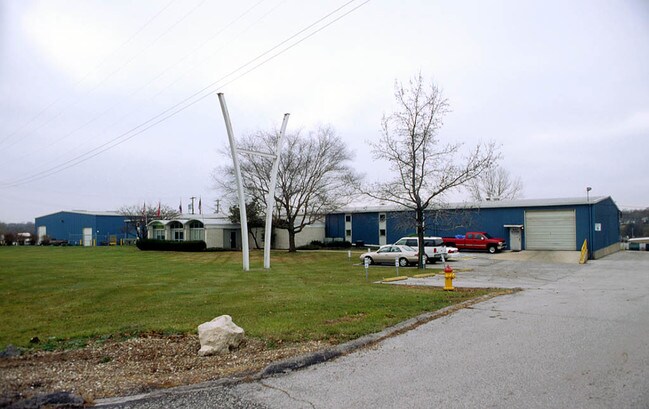
1194 Pershall Rd
St. Louis, MO-IL
Whisler Park Plat 3 Lots E & F & Whisler
10E-61-0186
WHISLER PARK PLAT 3 LOTS E & F & WHISLER PARK PLAT 3 LOT H & WHISLER PARK PLAT N 112-47-7 BDY ADJ LOT H BDY ADJ LOT E
Warehouse
St. Louis
X
Missouri
29183C0350G
e,f,h
2024
2.90 AC
2025
North County
210200
St. Louis
33,126 SF
DEMOGRAPHICS near 1194 Pershall Rd
1 Mile
3 Mile
5 Mile
2024 Total Population
9,595
55,721
129,026
2029 Population
9,681
55,716
128,464
Pop Growth 2024-2029
+ 0.90%
(0.01%)
(0.44%)
Average Age
34
38
39
2024 Total Households
3,741
21,560
51,640
HH Growth 2024-2029
+ 0.86%
(0.08%)
(0.52%)
Median Household Inc
$37,265
$43,192
$42,014
Avg Household Size
2.50
2.50
2.40
2024 Avg HH Vehicles
1.00
2.00
1.00
Median Home Value
$75,955
$94,764
$99,158
Median Year Built
1965
1963
1962
Nearby Places
Map Layers
Map Styles
 Street
 Aerial
- Restaurants
- Banks
- Shops
- Fitness
- Groceries
PUBLIC TRANSPORTATION
AIRPORT
St Louis Lambert International
DRIVE
WALK
Distance
St Louis Lambert International
17 min
10.7 mi
Scott AFB/Midamerica St Louis
DRIVE
WALK
Distance
Scott AFB/Midamerica St Louis
57 min
37.8 mi
SALE & LEASE HISTORY
LISTING DATE
SALE/LEASE

Jun 06, 2018
For Sale
Nearby Properties
Address
Land Use
TOTAL SIZE
Lot Size
Zoning
Address
Land Use
TOTAL SIZE
Lot Size
Zoning
1,925 SF
21.27 AC
C-8
Address
Land Use
TOTAL SIZE
Lot Size
Zoning
75.13 AC
R3
Address
Land Use
TOTAL SIZE
Lot Size
Zoning
205,268 SF
36.09 AC
88R-1
Address
Land Use
TOTAL SIZE
Lot Size
Zoning
48.23 AC
R3
Address
Land Use
TOTAL SIZE
Lot Size
Zoning
643,294 SF
32.09 AC
R7
Address
Land Use
TOTAL SIZE
Lot Size
Zoning
39.86 AC
A
Address
Land Use
TOTAL SIZE
Lot Size
Zoning
293,117 SF
26 AC
R3
Address
Land Use
TOTAL SIZE
Lot Size
Zoning
47,184 SF
119.33 AC
PS
Address
Land Use
TOTAL SIZE
Lot Size
Zoning
77,616 SF
10.56 AC
C-8
Address
Land Use
TOTAL SIZE
Lot Size
Zoning
20.62 AC
R3
Address
Land Use
TOTAL SIZE
Lot Size
Zoning
18.86 AC
R3
Address
Land Use
TOTAL SIZE
Lot Size
Zoning
218,822 SF
15.94 AC
R6
Address
Land Use
TOTAL SIZE
Lot Size
Zoning
10,362 SF
19.03 AC
81R-2
Address
Land Use
TOTAL SIZE
Lot Size
Zoning
179,262 SF
9.58 AC
R2
Address
Land Use
TOTAL SIZE
Lot Size
Zoning
92,740 SF
27.63 AC
NU
Address
Land Use
TOTAL SIZE
Lot Size
Zoning
10 AC
R3
Address
Land Use
TOTAL SIZE
Lot Size
Zoning
120.20 AC
PS
Address
Land Use
TOTAL SIZE
Lot Size
Zoning
64,372 SF
4.95 AC
C-8
Address
Land Use
TOTAL SIZE
Lot Size
Zoning
8.66 AC
R3
Address
Land Use
TOTAL SIZE
Lot Size
Zoning
10.24 AC
R-4
Address
Land Use
TOTAL SIZE
Lot Size
Zoning
3,256 SF
38.63 AC
88R-3
Address
Land Use
TOTAL SIZE
Lot Size
Zoning
217,644 SF
12.07 AC
R6
Address
Land Use
TOTAL SIZE
Lot Size
Zoning
30.81 AC
R3
Address
Land Use
TOTAL SIZE
Lot Size
Zoning
31,800 SF
17.34 AC
C-8
Address
Land Use
TOTAL SIZE
Lot Size
Zoning
90,985 SF
7.77 AC
C-8
Address
Land Use
TOTAL SIZE
Lot Size
Zoning
171,193 SF
11.63 AC
R6
Address
Land Use
TOTAL SIZE
Lot Size
Zoning
111,847 SF
10.71 AC
22C-1
Address
Land Use
TOTAL SIZE
Lot Size
Zoning
69.24 AC
A
Address
Land Use
TOTAL SIZE
Lot Size
Zoning
5 AC
R5
Address
Land Use
TOTAL SIZE
Lot Size
Zoning
4.36 AC
NU
The World's #1 Commercial Real Estate Marketplace
Connect with us
© 2026 CoStar Group
The information above has been obtained from sources believed reliable. While we do not doubt its accuracy we have not verified it and make no guarantee, warranty or representation about it. It is your responsibility to independently confirm its accuracy and completeness. Any projections, opinions, assumptions, or estimates used are for example only and do not represent the current or future performance of the property. The value of this transaction to you depends on tax and other factors which should be evaluated by your tax, financial, and legal advisors. You and your advisors should conduct a careful, independent investigation of the property to determine to your satisfaction the suitability of the property for your needs.