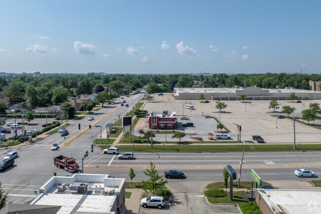
Property Record
1195 E Oakton St, Des Plaines, IL 60018


NEARBY LISTINGS FOR SALE OR LEASE
Property Detail
1195 E Oakton St
Commercialbuilding
Cook
X
Illinois
17031C0219J
0.67 AC
2023
O'Hare
2025
Chicago
770602
Chicago-Naperville-Elgin, IL-IN
1,976 SF
09-29-106-014-0000
DEMOGRAPHICS near 1195 E Oakton St
1 mile
3 mile
5 mile
2024 Total Population
17,271
112,698
308,405
2029 Population
16,759
109,361
299,356
Pop Growth 2024-2029
(2.96%)
(2.96%)
(2.93%)
Average Age
42
42
42
2024 Total Households
6,083
42,619
117,657
HH Growth 2024-2029
(3.30%)
(3.21%)
(3.23%)
Median Household Inc
$73,516
$77,769
$83,227
Avg Household Size
2.70
2.50
2.50
2024 Avg HH Vehicles
2.00
2.00
2.00
Median Home Value
$279,526
$308,052
$341,132
Median Year Built
1958
1967
1966
Nearby Places
Map Layers
Map Styles
 Street
 Aerial
Transit
 Traffic
 Biking
Places
Listings with unknown addresses are not visible on the map
- Restaurants
- Banks
- Shops
- Fitness
- Groceries
PUBLIC TRANSPORTATION
COMMUTER RAIL
Des Plaines Station (Union Pacific Northwest Line - Northeast Illinois Regional Commuter Railroad (Metra))
Drive
Walk
Distance
Des Plaines Station (Union Pacific Northwest Line - Northeast Illinois Regional Commuter Railroad (Metra))
4 min
1.5 mi
Dee Road Station (Union Pacific Northwest Line - Northeast Illinois Regional Commuter Railroad (Metra))
Drive
Walk
Distance
Dee Road Station (Union Pacific Northwest Line - Northeast Illinois Regional Commuter Railroad (Metra))
5 min
2.2 mi
AIRPORT
Chicago O'Hare International
Drive
Walk
Distance
Chicago O'Hare International
10 min
5.0 mi
Chicago Midway International
Drive
Walk
Distance
Chicago Midway International
40 min
22.5 mi
Nearby Properties
Address
Land Use
TOTAL SIZE
Lot Size
Zoning
Address
Land Use
TOTAL SIZE
Lot Size
Zoning
1,127,595 SF
Address
Land Use
TOTAL SIZE
Lot Size
Zoning
380,895 SF
5.36 AC
Address
Land Use
TOTAL SIZE
Lot Size
Zoning
Address
Land Use
TOTAL SIZE
Lot Size
Zoning
270,512 SF
2.26 AC
Address
Land Use
TOTAL SIZE
Lot Size
Zoning
Address
Land Use
TOTAL SIZE
Lot Size
Zoning
845,318 SF
7.09 AC
Address
Land Use
TOTAL SIZE
Lot Size
Zoning
29,850 SF
37.75 AC
Address
Land Use
TOTAL SIZE
Lot Size
Zoning
13.44 AC
Address
Land Use
TOTAL SIZE
Lot Size
Zoning
611,799 SF
17.61 AC
Address
Land Use
TOTAL SIZE
Lot Size
Zoning
Address
Land Use
TOTAL SIZE
Lot Size
Zoning
413,338 SF
23.92 AC
Address
Land Use
TOTAL SIZE
Lot Size
Zoning
72,504 SF
1.70 AC
Address
Land Use
TOTAL SIZE
Lot Size
Zoning
6.28 AC
Address
Land Use
TOTAL SIZE
Lot Size
Zoning
508,246 SF
32.81 AC
Address
Land Use
TOTAL SIZE
Lot Size
Zoning
405,484 SF
Address
Land Use
TOTAL SIZE
Lot Size
Zoning
85,014 SF
2.38 AC
Address
Land Use
TOTAL SIZE
Lot Size
Zoning
1,037,760 SF
17.44 AC
Address
Land Use
TOTAL SIZE
Lot Size
Zoning
59,013 SF
1.90 AC
Address
Land Use
TOTAL SIZE
Lot Size
Zoning
667,821 SF
20.55 AC
Address
Land Use
TOTAL SIZE
Lot Size
Zoning
23.45 AC
Address
Land Use
TOTAL SIZE
Lot Size
Zoning
131,687 SF
2.89 AC
Address
Land Use
TOTAL SIZE
Lot Size
Zoning
489,538 SF
5.94 AC
Address
Land Use
TOTAL SIZE
Lot Size
Zoning
4.43 AC
Address
Land Use
TOTAL SIZE
Lot Size
Zoning
282,366 SF
2.48 AC
Address
Land Use
TOTAL SIZE
Lot Size
Zoning
10,404 SF
45.11 AC
Address
Land Use
TOTAL SIZE
Lot Size
Zoning
Address
Land Use
TOTAL SIZE
Lot Size
Zoning
660,826 SF
8.33 AC
Address
Land Use
TOTAL SIZE
Lot Size
Zoning
271,166 SF
8.50 AC
Address
Land Use
TOTAL SIZE
Lot Size
Zoning
291,226 SF
3.57 AC
Address
Land Use
TOTAL SIZE
Lot Size
Zoning
308,369 SF
13.37 AC
The World's #1 Commercial Real Estate Marketplace
Connect with us
© 2026 CoStar Group
The information above has been obtained from sources believed reliable. While we do not doubt its accuracy we have not verified it and make no guarantee, warranty or representation about it. It is your responsibility to independently confirm its accuracy and completeness. Any projections, opinions, assumptions, or estimates used are for example only and do not represent the current or future performance of the property. The value of this transaction to you depends on tax and other factors which should be evaluated by your tax, financial, and legal advisors. You and your advisors should conduct a careful, independent investigation of the property to determine to your satisfaction the suitability of the property for your needs.