Property Record
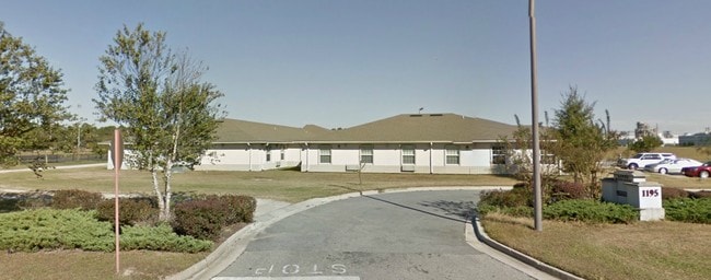
1195 Old Statenville Rd, Valdosta, GA 31601

NEARBY LISTINGS FOR SALE OR LEASE
-
-
View all Valdosta listings for sale on LoopNet.com
Property Detail
1195 Old Statenville Rd
0159D-016A
Mary Ollie
Governmentalpublicusegeneral
LL108 LD11 2.58 AC + 2.48AC
X
Lowndes
13185C0210E
Georgia
0
5.06 AC
2024
Valdosta/Lake Park
010801
Other Market Areas
47,645 SF
Valdosta, GA
DEMOGRAPHICS near 1195 Old Statenville Rd
1 Mile
3 Mile
5 Mile
2024 Total Population
3,884
26,986
60,187
2029 Population
4,069
28,191
62,570
Pop Growth 2024-2029
+ 4.76%
+ 4.47%
+ 3.96%
Average Age
35
34
35
2024 Total Households
1,533
10,033
23,703
HH Growth 2024-2029
+ 4.89%
+ 4.80%
+ 4.15%
Median Household Inc
$23,333
$24,000
$29,868
Avg Household Size
2.50
2.40
2.30
2024 Avg HH Vehicles
1.00
1.00
2.00
Median Home Value
$104,598
$89,001
$140,443
Median Year Built
1992
1980
1985
Nearby Places
Map Layers
Map Styles
 Street
 Aerial
- Restaurants
- Banks
- Shops
- Fitness
- Groceries
PUBLIC TRANSPORTATION
AIRPORT
Valdosta Regional
DRIVE
WALK
Distance
Valdosta Regional
8 min
4.0 mi
Freight Ports
Jacksonville Port
DRIVE
WALK
Distance
Jacksonville Port
146 min
125.5 mi
Nearby Properties
Address
Land Use
TOTAL SIZE
Lot Size
Zoning
Address
Land Use
TOTAL SIZE
Lot Size
Zoning
60,000 SF
56.32 AC
M-1
Address
Land Use
TOTAL SIZE
Lot Size
Zoning
210,020 SF
4.22 AC
C-C
Address
Land Use
TOTAL SIZE
Lot Size
Zoning
339 SF
23.53 AC
E-R
Address
Land Use
TOTAL SIZE
Lot Size
Zoning
150,802 SF
11.97 AC
M-1
Address
Land Use
TOTAL SIZE
Lot Size
Zoning
2,496 SF
63.73 AC
M-2
Address
Land Use
TOTAL SIZE
Lot Size
Zoning
142,140 SF
24.29 AC
DR-10
Address
Land Use
TOTAL SIZE
Lot Size
Zoning
7,200 SF
9.92 AC
M-1
Address
Land Use
TOTAL SIZE
Lot Size
Zoning
120,400 SF
9.12 AC
M-1
Address
Land Use
TOTAL SIZE
Lot Size
Zoning
166,300 SF
43.05 AC
M-2
Address
Land Use
TOTAL SIZE
Lot Size
Zoning
48,000 SF
9.06 AC
C-C
Address
Land Use
TOTAL SIZE
Lot Size
Zoning
72,832 SF
114.10 AC
M-1
Address
Land Use
TOTAL SIZE
Lot Size
Zoning
100,000 SF
25.27 AC
M-1
Address
Land Use
TOTAL SIZE
Lot Size
Zoning
108,800 SF
15 AC
M-2
Address
Land Use
TOTAL SIZE
Lot Size
Zoning
56,879 SF
63 AC
CON
Address
Land Use
TOTAL SIZE
Lot Size
Zoning
103,468 SF
9.38 AC
C-H
Address
Land Use
TOTAL SIZE
Lot Size
Zoning
2,610 SF
10 AC
R-M
Address
Land Use
TOTAL SIZE
Lot Size
Zoning
52,220 SF
181.31 AC
M-2
Address
Land Use
TOTAL SIZE
Lot Size
Zoning
480 SF
10 AC
R-M
Address
Land Use
TOTAL SIZE
Lot Size
Zoning
4,776 SF
6.95 AC
R-M
Address
Land Use
TOTAL SIZE
Lot Size
Zoning
9,000 SF
72.18 AC
E-A
Address
Land Use
TOTAL SIZE
Lot Size
Zoning
18,936 SF
6.45 AC
R-M
Address
Land Use
TOTAL SIZE
Lot Size
Zoning
8,320 SF
61 AC
E-A
Address
Land Use
TOTAL SIZE
Lot Size
Zoning
21,558 SF
30.25 AC
M-2
Address
Land Use
TOTAL SIZE
Lot Size
Zoning
66,395 SF
1.49 AC
M-1
Address
Land Use
TOTAL SIZE
Lot Size
Zoning
576 SF
6,986.68 AC
E-A
Address
Land Use
TOTAL SIZE
Lot Size
Zoning
54,000 SF
9.15 AC
M-2
Address
Land Use
TOTAL SIZE
Lot Size
Zoning
90,710 SF
33.43 AC
PRD-10
Address
Land Use
TOTAL SIZE
Lot Size
Zoning
8,136 SF
3.46 AC
R-M
Address
Land Use
TOTAL SIZE
Lot Size
Zoning
12,650 SF
55.68 AC
M-2
The World's #1 Commercial Real Estate Marketplace
Connect with us
© 2026 CoStar Group
The information above has been obtained from sources believed reliable. While we do not doubt its accuracy we have not verified it and make no guarantee, warranty or representation about it. It is your responsibility to independently confirm its accuracy and completeness. Any projections, opinions, assumptions, or estimates used are for example only and do not represent the current or future performance of the property. The value of this transaction to you depends on tax and other factors which should be evaluated by your tax, financial, and legal advisors. You and your advisors should conduct a careful, independent investigation of the property to determine to your satisfaction the suitability of the property for your needs.