Property Record
11950 De Palma Rd, Corona, CA 92883

Save to a Folder
{{folder.Name}}
{{folder.ListingIds.length}} Properties
{{folder.ListingIds.length}} Property
Create a New Folder
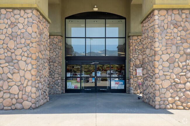
Property Detail
11950 De Palma Rd
290-670-030
.76 ACRES M/L IN POR PAR 5 PM 229/096 PM 36022
Storebuilding
Riverside
SPZONE
California
B and X Area of moderate flood hazard, usually the area between the limits of the 100-year and 500-year floods.
5
2024
0.96 AC
2025
South Riverside
041914
Inland Empire (California)
12,900 SF
Riverside-San Bernardino-Ontario, CA
NEARBY LISTINGS FOR SALE OR LEASE
DEMOGRAPHICS near 11950 De Palma Rd
1 mile
3 mile
5 mile
2025 Total Population
4,027
18,596
34,673
2030 Population
4,056
19,102
35,612
Pop Growth 2025-2030
+ 0.72%
+ 2.72%
+ 2.71%
Average Age
37
38
39
2025 Total Households
1,113
5,494
10,496
HH Growth 2025-2030
+ 0.18%
+ 2.38%
+ 2.27%
Median Household Inc
$162,925
$136,174
$123,662
Avg Household Size
3.40
3.30
3.20
2025 Avg HH Vehicles
3.00
3.00
2.00
Median Home Value
$750,584
$732,169
$717,141
Median Year Built
2006
2003
2001
Nearby Places
Map Layers
Map Styles
 Street
 Aerial
Layers
 Traffic
 Biking
Places
Listings with unknown addresses are not visible on the map
- Restaurants
- Banks
- Shops
- Fitness
- Groceries
PUBLIC TRANSPORTATION
AIRPORT
Ontario International
Drive
Walk
Distance
Ontario International
34 min
25.9 mi
John Wayne/Orange County
Drive
Walk
Distance
John Wayne/Orange County
50 min
41.0 mi
Freight Ports
Port of Long Beach
Drive
Walk
Distance
Port of Long Beach
73 min
55.0 mi
Nearby Properties
Address
Land Use
TOTAL SIZE
Lot Size
Zoning
Address
Land Use
TOTAL SIZE
Lot Size
Zoning
213,435 SF
4.86 AC
Address
Land Use
TOTAL SIZE
Lot Size
Zoning
35.63 AC
MRA
Address
Land Use
TOTAL SIZE
Lot Size
Zoning
3,000 SF
25.66 AC
MRA
Address
Land Use
TOTAL SIZE
Lot Size
Zoning
37.59 AC
MIX
Address
Land Use
TOTAL SIZE
Lot Size
Zoning
5,900 SF
22.98 AC
Address
Land Use
TOTAL SIZE
Lot Size
Zoning
48,078 SF
1.73 AC
SP
Address
Land Use
TOTAL SIZE
Lot Size
Zoning
11,786 SF
7.41 AC
C1CP
Address
Land Use
TOTAL SIZE
Lot Size
Zoning
22.29 AC
CBOOK
Address
Land Use
TOTAL SIZE
Lot Size
Zoning
3,551 SF
1.65 AC
MSC
Address
Land Use
TOTAL SIZE
Lot Size
Zoning
61,723 SF
3.97 AC
M-SC
Address
Land Use
TOTAL SIZE
Lot Size
Zoning
5,213 SF
0.99 AC
SP
Address
Land Use
TOTAL SIZE
Lot Size
Zoning
18,000 SF
12.48 AC
MSC
Address
Land Use
TOTAL SIZE
Lot Size
Zoning
19,978 SF
0.85 AC
SP
Address
Land Use
TOTAL SIZE
Lot Size
Zoning
6,286 SF
1.94 AC
MSC
Address
Land Use
TOTAL SIZE
Lot Size
Zoning
65.18 AC
Address
Land Use
TOTAL SIZE
Lot Size
Zoning
16,310 SF
14.36 AC
Address
Land Use
TOTAL SIZE
Lot Size
Zoning
3,590 SF
1.15 AC
CT
Address
Land Use
TOTAL SIZE
Lot Size
Zoning
1.50 AC
RR
Address
Land Use
TOTAL SIZE
Lot Size
Zoning
10.79 AC
Address
Land Use
TOTAL SIZE
Lot Size
Zoning
29,540 SF
5.26 AC
CPS
Address
Land Use
TOTAL SIZE
Lot Size
Zoning
119.43 AC
NA
Address
Land Use
TOTAL SIZE
Lot Size
Zoning
115.88 AC
MRA
The World's #1 Commercial Real Estate Marketplace
Connect with us
© 2026 CoStar Group
The information above has been obtained from sources believed reliable. While we do not doubt its accuracy we have not verified it and make no guarantee, warranty or representation about it. It is your responsibility to independently confirm its accuracy and completeness. Any projections, opinions, assumptions, or estimates used are for example only and do not represent the current or future performance of the property. The value of this transaction to you depends on tax and other factors which should be evaluated by your tax, financial, and legal advisors. You and your advisors should conduct a careful, independent investigation of the property to determine to your satisfaction the suitability of the property for your needs.