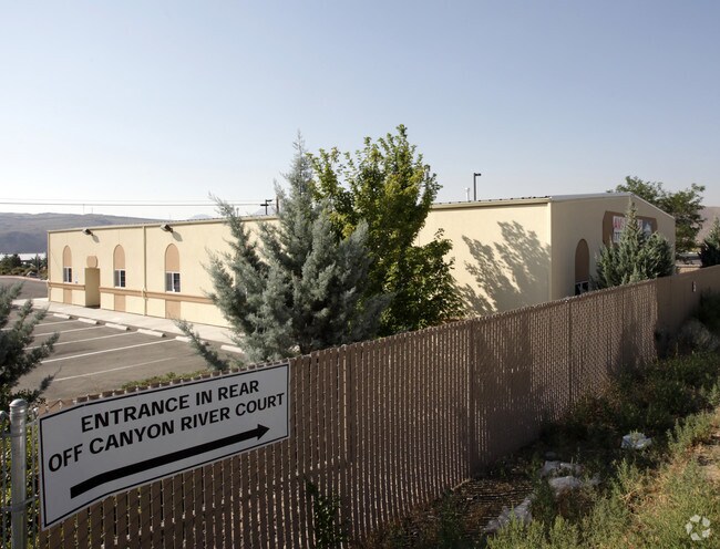
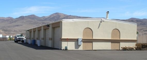
Property Record
11975 Interstate 80 E, Sparks, NV 89434

Property Detail
11975 Interstate 80 E
084-090-10
FRAC NW4 NW4 SEC 15 TWP 19N RGE 21E
Commercialnec
Washoe
I
Nevada
B and X Area of moderate flood hazard, usually the area between the limits of the 100-year and 500-year floods.
3.13 AC
2025
N Outlying Washoe Cty
2026
Reno/Sparks
003501
Reno, NV
11,880 SF
NEARBY LISTINGS FOR SALE OR LEASE
-
-
View all Sparks listings for sale on LoopNet.com
DEMOGRAPHICS near 11975 Interstate 80 E
1 mile
3 mile
5 mile
2025 Total Population
200
1,154
9,744
2030 Population
200
1,158
9,961
Pop Growth 2025-2030
0.00%
+ 0.35%
+ 2.23%
Average Age
46
46
44
2025 Total Households
85
494
4,043
HH Growth 2025-2030
+ 1.18%
+ 0.40%
+ 2.25%
Median Household Inc
$84,166
$84,593
$95,364
Avg Household Size
2.30
2.30
2.40
2025 Avg HH Vehicles
2.00
2.00
2.00
Median Home Value
$291,176
$289,847
$571,643
Median Year Built
1992
1992
1999
Nearby Places
Map Layers
Map Styles
 Street
 Aerial
Layers
 Traffic
 Biking
Places
Listings with unknown addresses are not visible on the map
- Restaurants
- Banks
- Shops
- Fitness
- Groceries
PUBLIC TRANSPORTATION
AIRPORT
Reno/Tahoe International
Drive
Walk
Distance
Reno/Tahoe International
35 min
15.4 mi
Freight Ports
Port of Stockton
Drive
Walk
Distance
Port of Stockton
220 min
189.7 mi
Nearby Properties
Address
Land Use
TOTAL SIZE
Lot Size
Zoning
Address
Land Use
TOTAL SIZE
Lot Size
Zoning
561,000 SF
45.75 AC
I
Address
Land Use
TOTAL SIZE
Lot Size
Zoning
351,452 SF
71.90 AC
I
Address
Land Use
TOTAL SIZE
Lot Size
Zoning
53,248 SF
19.50 AC
I
Address
Land Use
TOTAL SIZE
Lot Size
Zoning
45,150 SF
4.50 AC
I
Address
Land Use
TOTAL SIZE
Lot Size
Zoning
12,156 SF
1,534.49 AC
I-2;INDUST
Address
Land Use
TOTAL SIZE
Lot Size
Zoning
64,539 SF
10 AC
I2
Address
Land Use
TOTAL SIZE
Lot Size
Zoning
99.81 AC
GR
Address
Land Use
TOTAL SIZE
Lot Size
Zoning
80,879 SF
8.75 AC
I-1;INDUST
Address
Land Use
TOTAL SIZE
Lot Size
Zoning
1,280 SF
43.32 AC
I
Address
Land Use
TOTAL SIZE
Lot Size
Zoning
2,680 SF
36.57 AC
I
Address
Land Use
TOTAL SIZE
Lot Size
Zoning
31,440 SF
29.38 AC
GR
Address
Land Use
TOTAL SIZE
Lot Size
Zoning
8,715 SF
30.03 AC
Address
Land Use
TOTAL SIZE
Lot Size
Zoning
8,500 SF
35.23 AC
P
Address
Land Use
TOTAL SIZE
Lot Size
Zoning
9,120 SF
6.75 AC
I
Address
Land Use
TOTAL SIZE
Lot Size
Zoning
1.18 AC
F;FORESTED
Address
Land Use
TOTAL SIZE
Lot Size
Zoning
21.81 AC
I 95%/RDS
Address
Land Use
TOTAL SIZE
Lot Size
Zoning
2.78 AC
PUD /;PUB
Address
Land Use
TOTAL SIZE
Lot Size
Zoning
20,000 SF
2.56 AC
I
Address
Land Use
TOTAL SIZE
Lot Size
Zoning
9,900 SF
3.02 AC
I
Address
Land Use
TOTAL SIZE
Lot Size
Zoning
7,700 SF
2.68 AC
I
Address
Land Use
TOTAL SIZE
Lot Size
Zoning
542.79 AC
GR
Address
Land Use
TOTAL SIZE
Lot Size
Zoning
331.98 AC
GR
Address
Land Use
TOTAL SIZE
Lot Size
Zoning
2,368 SF
1.77 AC
I
Address
Land Use
TOTAL SIZE
Lot Size
Zoning
7,497 SF
624.08 AC
PR 27% / G
Address
Land Use
TOTAL SIZE
Lot Size
Zoning
18.52 AC
GR
Address
Land Use
TOTAL SIZE
Lot Size
Zoning
1,056 SF
4.23 AC
I
Address
Land Use
TOTAL SIZE
Lot Size
Zoning
40.90 AC
Address
Land Use
TOTAL SIZE
Lot Size
Zoning
15.49 AC
GR
Address
Land Use
TOTAL SIZE
Lot Size
Zoning
500 SF
645 AC
GR
The World's #1 Commercial Real Estate Marketplace
Connect with us
© 2026 CoStar Group
The information above has been obtained from sources believed reliable. While we do not doubt its accuracy we have not verified it and make no guarantee, warranty or representation about it. It is your responsibility to independently confirm its accuracy and completeness. Any projections, opinions, assumptions, or estimates used are for example only and do not represent the current or future performance of the property. The value of this transaction to you depends on tax and other factors which should be evaluated by your tax, financial, and legal advisors. You and your advisors should conduct a careful, independent investigation of the property to determine to your satisfaction the suitability of the property for your needs.