Property Record
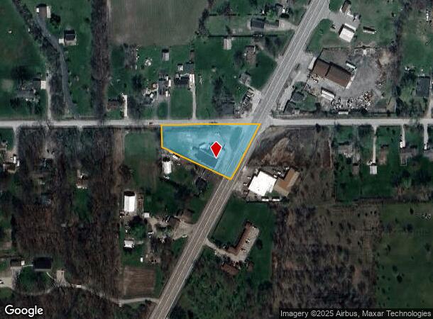
11983 Telegraph Rd, Carleton, MI 48117
NEARBY LISTINGS FOR SALE OR LEASE
-
-
View all Carleton listings for sale on LoopNet.com
Property Detail
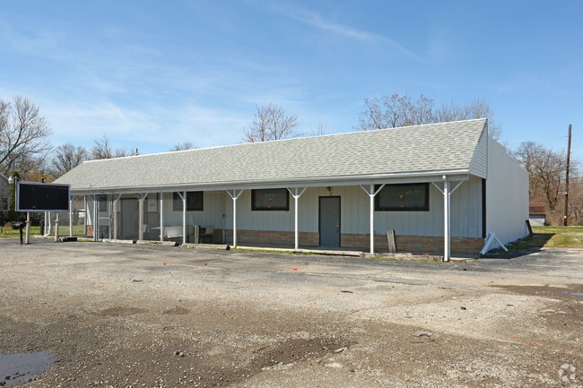
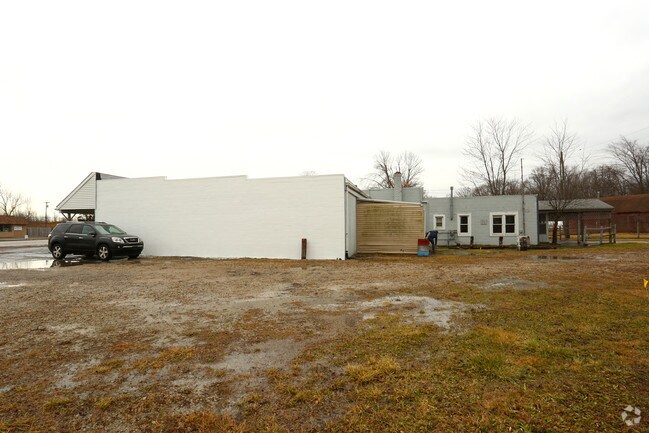
11983 Telegraph Rd
01-023-017-10
785-820 787-720 852-924 871-844 SEC 23 T5S R9E 2 AC COM AT A PT ON N LI OF SD SEC 680.38 FT N 88 DEG 52'24"W FR NE COR OF SEC
Storebuilding
Monroe
X
Michigan
26115C0112E
2 AC
2024
Monroe County
2025
Detroit
830300
Monroe, MI
5,320 SF
DEMOGRAPHICS near 11983 Telegraph Rd
1 Mile
3 Mile
5 Mile
2024 Total Population
1,201
7,266
36,801
2029 Population
1,253
7,471
36,628
Pop Growth 2024-2029
+ 4.33%
+ 2.82%
(0.47%)
Average Age
43
43
40
2024 Total Households
461
2,853
14,297
HH Growth 2024-2029
+ 4.34%
+ 2.84%
(0.41%)
Median Household Inc
$57,737
$67,951
$71,048
Avg Household Size
2.60
2.50
2.50
2024 Avg HH Vehicles
3.00
2.00
2.00
Median Home Value
$283,333
$235,510
$215,039
Median Year Built
1977
1988
1985
Nearby Places
Map Layers
Map Styles
 Street
 Aerial
- Restaurants
- Banks
- Shops
- Fitness
- Groceries
PUBLIC TRANSPORTATION
AIRPORT
Detroit Metro Wayne County
DRIVE
WALK
Distance
Detroit Metro Wayne County
18 min
17.8 mi
Detroit City
DRIVE
WALK
Distance
Detroit City
41 min
34.9 mi
Freight Ports
Port of Baltimore
DRIVE
WALK
Distance
Port of Baltimore
1 min
401.6 mi
SALE & LEASE HISTORY
LISTING DATE
SALE/LEASE

Jan 24, 2018
For Sale
Apr 21, 2017
For Sale
Nearby Properties
Address
Land Use
TOTAL SIZE
Lot Size
Zoning
Address
Land Use
TOTAL SIZE
Lot Size
Zoning
41,920 SF
48.72 AC
Address
Land Use
TOTAL SIZE
Lot Size
Zoning
18,520 SF
326.27 AC
Address
Land Use
TOTAL SIZE
Lot Size
Zoning
4,419 SF
64.34 AC
MHP
Address
Land Use
TOTAL SIZE
Lot Size
Zoning
3,272 SF
121.75 AC
MHP
Address
Land Use
TOTAL SIZE
Lot Size
Zoning
91,075 SF
9.07 AC
Address
Land Use
TOTAL SIZE
Lot Size
Zoning
70,205 SF
12.66 AC
Address
Land Use
TOTAL SIZE
Lot Size
Zoning
39,078 SF
2.08 AC
Address
Land Use
TOTAL SIZE
Lot Size
Zoning
22,536 SF
275.85 AC
Address
Land Use
TOTAL SIZE
Lot Size
Zoning
11,700 SF
9.36 AC
Address
Land Use
TOTAL SIZE
Lot Size
Zoning
2,472 SF
46.65 AC
Address
Land Use
TOTAL SIZE
Lot Size
Zoning
14,118 SF
37.23 AC
Address
Land Use
TOTAL SIZE
Lot Size
Zoning
7,184 SF
29.93 AC
Address
Land Use
TOTAL SIZE
Lot Size
Zoning
6,106 SF
2.15 AC
Address
Land Use
TOTAL SIZE
Lot Size
Zoning
3,060 SF
9.58 AC
Address
Land Use
TOTAL SIZE
Lot Size
Zoning
6,000 SF
7.24 AC
Address
Land Use
TOTAL SIZE
Lot Size
Zoning
12,000 SF
3.44 AC
Address
Land Use
TOTAL SIZE
Lot Size
Zoning
3.38 AC
Address
Land Use
TOTAL SIZE
Lot Size
Zoning
1,330 SF
55.20 AC
Address
Land Use
TOTAL SIZE
Lot Size
Zoning
2,114 SF
35.70 AC
Address
Land Use
TOTAL SIZE
Lot Size
Zoning
3,275 SF
5.46 AC
Address
Land Use
TOTAL SIZE
Lot Size
Zoning
8,890 SF
1.15 AC
Address
Land Use
TOTAL SIZE
Lot Size
Zoning
2,076 SF
77.07 AC
Address
Land Use
TOTAL SIZE
Lot Size
Zoning
2,283 SF
49 AC
AG
Address
Land Use
TOTAL SIZE
Lot Size
Zoning
9.47 AC
Address
Land Use
TOTAL SIZE
Lot Size
Zoning
Address
Land Use
TOTAL SIZE
Lot Size
Zoning
9,950 SF
3.21 AC
Address
Land Use
TOTAL SIZE
Lot Size
Zoning
2,700 SF
80 AC
Address
Land Use
TOTAL SIZE
Lot Size
Zoning
12,950 SF
1.57 AC
Address
Land Use
TOTAL SIZE
Lot Size
Zoning
2,926 SF
77.80 AC
AG
Address
Land Use
TOTAL SIZE
Lot Size
Zoning
3,360 SF
20.77 AC
The World's #1 Commercial Real Estate Marketplace
Connect with us
© 2025 CoStar Group
The information above has been obtained from sources believed reliable. While we do not doubt its accuracy we have not verified it and make no guarantee, warranty or representation about it. It is your responsibility to independently confirm its accuracy and completeness. Any projections, opinions, assumptions, or estimates used are for example only and do not represent the current or future performance of the property. The value of this transaction to you depends on tax and other factors which should be evaluated by your tax, financial, and legal advisors. You and your advisors should conduct a careful, independent investigation of the property to determine to your satisfaction the suitability of the property for your needs.