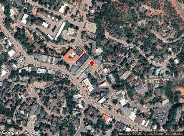
Property Record
12 Arcade, Manitou Springs, CO 80829

NEARBY LISTINGS FOR SALE OR LEASE
Property Detail
12 Arcade
Colorado Springs, CO
Manitou City Of
74053-43-006
PART OF LOT 37 BLK A MANITOU SPGS AS FOLS, BEG AT A PT ON NELY LN OF MANITOU AVE, SD PT BEING THE SELY COR OF A TR DES IN BK 2004-702, TH SELY ALG SD NELY LN OF MANITOU AVE ALG A CUR TO THE R, A RAD OF 473.01 FT, AN ARC DIST OF 107.27 FT, TH N 40<40
Commercialbuilding
El Paso
AE
Colorado
08041C0706G
37
2024
0.05 AC
2025
Southwest
006701
Colorado Springs
1,750 SF
DEMOGRAPHICS near 12 Arcade
1 Mile
3 Mile
5 Mile
2024 Total Population
3,056
12,851
54,029
2029 Population
3,202
13,441
56,593
Pop Growth 2024-2029
+ 4.78%
+ 4.59%
+ 4.75%
Average Age
44
47
44
2024 Total Households
1,605
6,242
25,021
HH Growth 2024-2029
+ 4.98%
+ 4.87%
+ 5.02%
Median Household Inc
$72,340
$74,152
$72,844
Avg Household Size
1.90
2.00
2.10
2024 Avg HH Vehicles
2.00
2.00
2.00
Median Home Value
$538,272
$482,104
$465,070
Median Year Built
1947
1965
1979
Nearby Places
Map Layers
Map Styles
 Street
 Aerial
- Restaurants
- Banks
- Shops
- Fitness
- Groceries
PUBLIC TRANSPORTATION
AIRPORT
City of Colorado Springs Municipal
DRIVE
WALK
Distance
City of Colorado Springs Municipal
30 min
16.7 mi
Freight Ports
Tulsa Port Of Catoosa
DRIVE
WALK
Distance
Tulsa Port Of Catoosa
753 min
700.7 mi
Nearby Properties
Address
Land Use
TOTAL SIZE
Lot Size
Zoning
Address
Land Use
TOTAL SIZE
Lot Size
Zoning
2,422 SF
616.19 AC
PK MX-I PD
Address
Land Use
TOTAL SIZE
Lot Size
Zoning
75,349 SF
27.75 AC
EPC
Address
Land Use
TOTAL SIZE
Lot Size
Zoning
45,268 SF
8.37 AC
PDZ UV
Address
Land Use
TOTAL SIZE
Lot Size
Zoning
4.78 AC
R-T
Address
Land Use
TOTAL SIZE
Lot Size
Zoning
157,471 SF
0.02 AC
PUD,HS
Address
Land Use
TOTAL SIZE
Lot Size
Zoning
20,147 SF
38.98 AC
PK HS
Address
Land Use
TOTAL SIZE
Lot Size
Zoning
127.25 AC
PK HS
Address
Land Use
TOTAL SIZE
Lot Size
Zoning
34,296 SF
0.85 AC
Address
Land Use
TOTAL SIZE
Lot Size
Zoning
3,058 SF
28.22 AC
HLDR
Address
Land Use
TOTAL SIZE
Lot Size
Zoning
6,658 SF
189.56 AC
R-E PK HS
Address
Land Use
TOTAL SIZE
Lot Size
Zoning
4,062 SF
355.88 AC
PK HS
Address
Land Use
TOTAL SIZE
Lot Size
Zoning
15,964 SF
6.04 AC
R-2 HS CU
Address
Land Use
TOTAL SIZE
Lot Size
Zoning
24,433 SF
1.69 AC
R-1 6
Address
Land Use
TOTAL SIZE
Lot Size
Zoning
925 SF
3.55 AC
R-T
Address
Land Use
TOTAL SIZE
Lot Size
Zoning
38,885 SF
5.82 AC
R-1 6
Address
Land Use
TOTAL SIZE
Lot Size
Zoning
6,899 SF
2.77 AC
R-2 HS CU
Address
Land Use
TOTAL SIZE
Lot Size
Zoning
7,364 SF
0.34 AC
C
Address
Land Use
TOTAL SIZE
Lot Size
Zoning
72,616 SF
4.79 AC
BP HS CU
Address
Land Use
TOTAL SIZE
Lot Size
Zoning
625 SF
2.42 AC
GR
Address
Land Use
TOTAL SIZE
Lot Size
Zoning
21,989 SF
0.79 AC
Address
Land Use
TOTAL SIZE
Lot Size
Zoning
171.67 AC
PK
Address
Land Use
TOTAL SIZE
Lot Size
Zoning
30,532 SF
17.08 AC
GR
Address
Land Use
TOTAL SIZE
Lot Size
Zoning
14,248 SF
0.93 AC
C
Address
Land Use
TOTAL SIZE
Lot Size
Zoning
11,452 SF
2.12 AC
R-5 HS
Address
Land Use
TOTAL SIZE
Lot Size
Zoning
54,398 SF
1.20 AC
Address
Land Use
TOTAL SIZE
Lot Size
Zoning
122.07 AC
PK
Address
Land Use
TOTAL SIZE
Lot Size
Zoning
36,745 SF
0.95 AC
Address
Land Use
TOTAL SIZE
Lot Size
Zoning
254 SF
4.74 AC
Address
Land Use
TOTAL SIZE
Lot Size
Zoning
50.72 AC
PK HS
Address
Land Use
TOTAL SIZE
Lot Size
Zoning
625 SF
0.37 AC
R-E HS
The World's #1 Commercial Real Estate Marketplace
Connect with us
© 2025 CoStar Group
The information above has been obtained from sources believed reliable. While we do not doubt its accuracy we have not verified it and make no guarantee, warranty or representation about it. It is your responsibility to independently confirm its accuracy and completeness. Any projections, opinions, assumptions, or estimates used are for example only and do not represent the current or future performance of the property. The value of this transaction to you depends on tax and other factors which should be evaluated by your tax, financial, and legal advisors. You and your advisors should conduct a careful, independent investigation of the property to determine to your satisfaction the suitability of the property for your needs.