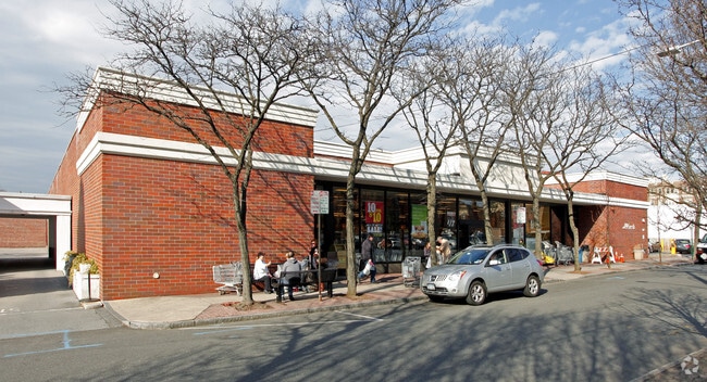
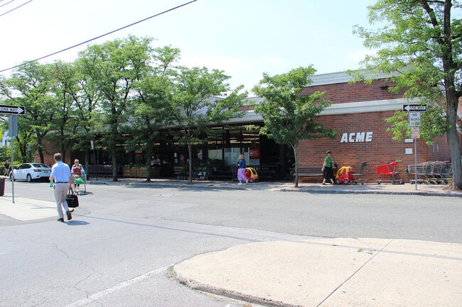
Property Record
12 Cedar St, Bronxville, NY 10708

NEARBY LISTINGS FOR SALE OR LEASE
-
-
-
-
-
-
-
-
-
-
-
-
-
-
-
-
-
No Photo
-
-
View all Bronxville listings for sale on LoopNet.com
Property Detail
12 Cedar St
2401-004-000-03-000-017-B
Westchester
Supermarket
New York
X
17.b
36119C0329F
0.74 AC
2025
Southeast
2024
Westchester/So Connecticut
004600
New York-Jersey City-White Plains, NY-NJ
27,699 SF
DEMOGRAPHICS near 12 Cedar St
1 Mile
3 Mile
5 Mile
2024 Total Population
28,199
253,809
676,702
2029 Population
27,790
245,001
646,029
Pop Growth 2024-2029
(1.45%)
(3.47%)
(4.53%)
Average Age
44
41
41
2024 Total Households
11,882
94,220
251,102
HH Growth 2024-2029
(1.52%)
(3.56%)
(4.73%)
Median Household Inc
$120,950
$88,731
$77,700
Avg Household Size
2.20
2.60
2.60
2024 Avg HH Vehicles
1.00
1.00
1.00
Median Home Value
$581,258
$554,730
$577,226
Median Year Built
1948
1949
1953
Nearby Places
Map Layers
Map Styles
 Street
 Aerial
- Restaurants
- Banks
- Shops
- Fitness
- Groceries
PUBLIC TRANSPORTATION
TRANSIT/SUBWAY
Bronxville Station (Harlem Line - Metro-North Commuter Railroad Company (Metro-North))
DRIVE
WALK
Distance
Bronxville Station (Harlem Line - Metro-North Commuter Railroad Company (Metro-North))
2 min
6 min
0.3 mi
Tuckahoe Station (Harlem Line - Metro-North Commuter Railroad Company (Metro-North))
DRIVE
WALK
Distance
Tuckahoe Station (Harlem Line - Metro-North Commuter Railroad Company (Metro-North))
3 min
19 min
1.0 mi
COMMUTER RAIL
Bronxville Station (Harlem Line - Metro-North Commuter Railroad Company (Metro-North))
DRIVE
WALK
Distance
Bronxville Station (Harlem Line - Metro-North Commuter Railroad Company (Metro-North))
2 min
6 min
0.3 mi
Tuckahoe Station (Harlem Line - Metro-North Commuter Railroad Company (Metro-North))
DRIVE
WALK
Distance
Tuckahoe Station (Harlem Line - Metro-North Commuter Railroad Company (Metro-North))
3 min
1.1 mi
AIRPORT
Westchester County
DRIVE
WALK
Distance
Westchester County
27 min
15.7 mi
LaGuardia
DRIVE
WALK
Distance
LaGuardia
31 min
16.9 mi
John F Kennedy International
DRIVE
WALK
Distance
John F Kennedy International
37 min
24.4 mi
Freight Ports
NY - Red Hook Container Terminal
DRIVE
WALK
Distance
NY - Red Hook Container Terminal
44 min
25.0 mi
SALE & LEASE HISTORY
LISTING DATE
SALE/LEASE

Sep 20, 2024
For Sale
Feb 02, 2024
For Sale
Nearby Properties
Address
Land Use
TOTAL SIZE
Lot Size
Zoning
Address
Land Use
TOTAL SIZE
Lot Size
Zoning
18,000 SF
13.85 AC
A
Address
Land Use
TOTAL SIZE
Lot Size
Zoning
201,590 SF
4.13 AC
BA
Address
Land Use
TOTAL SIZE
Lot Size
Zoning
301,156 SF
13.94 AC
A
Address
Land Use
TOTAL SIZE
Lot Size
Zoning
70,737 SF
1.67 AC
BB
Address
Land Use
TOTAL SIZE
Lot Size
Zoning
Address
Land Use
TOTAL SIZE
Lot Size
Zoning
Address
Land Use
TOTAL SIZE
Lot Size
Zoning
64,165 SF
3.24 AC
B
Address
Land Use
TOTAL SIZE
Lot Size
Zoning
165,529 SF
7.05 AC
RA3
Address
Land Use
TOTAL SIZE
Lot Size
Zoning
5,170 SF
9.08 AC
B
Address
Land Use
TOTAL SIZE
Lot Size
Zoning
Address
Land Use
TOTAL SIZE
Lot Size
Zoning
38,912 SF
19.25 AC
R4
Address
Land Use
TOTAL SIZE
Lot Size
Zoning
7,855 SF
1.10 AC
C
Address
Land Use
TOTAL SIZE
Lot Size
Zoning
Address
Land Use
TOTAL SIZE
Lot Size
Zoning
36,413 SF
0.89 AC
A
Address
Land Use
TOTAL SIZE
Lot Size
Zoning
34,560 SF
0.28 AC
BA
Address
Land Use
TOTAL SIZE
Lot Size
Zoning
96,420 SF
4.89 AC
RB1
Address
Land Use
TOTAL SIZE
Lot Size
Zoning
23,116 SF
1.82 AC
C
Address
Land Use
TOTAL SIZE
Lot Size
Zoning
7,771 SF
1.21 AC
A
Address
Land Use
TOTAL SIZE
Lot Size
Zoning
162.42 AC
T
Address
Land Use
TOTAL SIZE
Lot Size
Zoning
1,658 SF
3.28 AC
A
Address
Land Use
TOTAL SIZE
Lot Size
Zoning
36,000 SF
0.28 AC
BA
Address
Land Use
TOTAL SIZE
Lot Size
Zoning
4,732 SF
16.18 AC
BUS
Address
Land Use
TOTAL SIZE
Lot Size
Zoning
15,132 SF
0.28 AC
A
Address
Land Use
TOTAL SIZE
Lot Size
Zoning
60,689 SF
0.35 AC
RA2
Address
Land Use
TOTAL SIZE
Lot Size
Zoning
66,549 SF
4.74 AC
OFF1
Address
Land Use
TOTAL SIZE
Lot Size
Zoning
41,910 SF
0.65 AC
C
Address
Land Use
TOTAL SIZE
Lot Size
Zoning
Address
Land Use
TOTAL SIZE
Lot Size
Zoning
29,420 SF
0.97 AC
BA
Address
Land Use
TOTAL SIZE
Lot Size
Zoning
30,521 SF
0.24 AC
B1
The World's #1 Commercial Real Estate Marketplace
Connect with us
© 2026 CoStar Group
The information above has been obtained from sources believed reliable. While we do not doubt its accuracy we have not verified it and make no guarantee, warranty or representation about it. It is your responsibility to independently confirm its accuracy and completeness. Any projections, opinions, assumptions, or estimates used are for example only and do not represent the current or future performance of the property. The value of this transaction to you depends on tax and other factors which should be evaluated by your tax, financial, and legal advisors. You and your advisors should conduct a careful, independent investigation of the property to determine to your satisfaction the suitability of the property for your needs.