Property Record
12 Centerra Pky, Lebanon, NH 03766


NEARBY LISTINGS FOR SALE OR LEASE
Property Detail
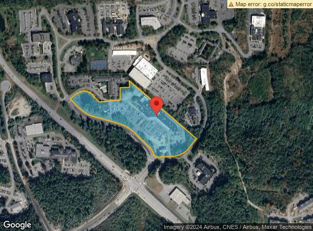
12 Centerra Pky
LBAN-000010-000011-000100
Grafton
Commercialnec
New Hampshire
X
100
33009C0892E
10.74 AC
2024
Concord/New Hampshire North Area
2024
Other Market Areas
961701
Lebanon-Claremont, NH-VT
DEMOGRAPHICS near 12 Centerra Pky
1 Mile
3 Mile
5 Mile
2024 Total Population
1,378
20,873
33,355
2029 Population
1,523
21,835
34,694
Pop Growth 2024-2029
+ 10.52%
+ 4.61%
+ 4.01%
Average Age
39
39
41
2024 Total Households
665
8,345
13,965
HH Growth 2024-2029
+ 11.13%
+ 5.12%
+ 4.20%
Median Household Inc
$94,876
$96,399
$92,973
Avg Household Size
2.00
2.10
2.10
2024 Avg HH Vehicles
2.00
2.00
2.00
Median Home Value
$402,041
$340,198
$335,192
Median Year Built
2010
1980
1979
Nearby Places
Map Layers
Map Styles
 Street
 Aerial
- Restaurants
- Banks
- Shops
- Fitness
- Groceries
PUBLIC TRANSPORTATION
COMMUTER RAIL
White River Junction Amtrak Station (Vermonter - Amtrak)
DRIVE
WALK
Distance
White River Junction Amtrak Station (Vermonter - Amtrak)
13 min
7.3 mi
Freight Ports
Portland, ME
DRIVE
WALK
Distance
Portland, ME
197 min
165.0 mi
SALE & LEASE HISTORY
LISTING DATE
SALE/LEASE

Nov 19, 2018
For Lease
Jan 25, 2017
For Lease
Nearby Properties
Address
Land Use
TOTAL SIZE
Lot Size
Zoning
Address
Land Use
TOTAL SIZE
Lot Size
Zoning
1.13 AC
I
Address
Land Use
TOTAL SIZE
Lot Size
Zoning
163,845 SF
MC
Address
Land Use
TOTAL SIZE
Lot Size
Zoning
0.86 AC
I
Address
Land Use
TOTAL SIZE
Lot Size
Zoning
0.90 AC
I
Address
Land Use
TOTAL SIZE
Lot Size
Zoning
3,136 SF
53.32 AC
R1
Address
Land Use
TOTAL SIZE
Lot Size
Zoning
0.53 AC
I
Address
Land Use
TOTAL SIZE
Lot Size
Zoning
137,168 SF
11.39 AC
GC
Address
Land Use
TOTAL SIZE
Lot Size
Zoning
16,384 SF
4.46 AC
I
Address
Land Use
TOTAL SIZE
Lot Size
Zoning
31.50 AC
Address
Land Use
TOTAL SIZE
Lot Size
Zoning
Address
Land Use
TOTAL SIZE
Lot Size
Zoning
0.34 AC
I
Address
Land Use
TOTAL SIZE
Lot Size
Zoning
1,315 SF
16.35 AC
RL3
Address
Land Use
TOTAL SIZE
Lot Size
Zoning
4.30 AC
I
Address
Land Use
TOTAL SIZE
Lot Size
Zoning
194,496 SF
28.26 AC
I
Address
Land Use
TOTAL SIZE
Lot Size
Zoning
356.40 AC
RL3
Address
Land Use
TOTAL SIZE
Lot Size
Zoning
191,951 SF
17.70 AC
R1
Address
Land Use
TOTAL SIZE
Lot Size
Zoning
49.33 AC
Address
Land Use
TOTAL SIZE
Lot Size
Zoning
430,065 SF
23.35 AC
I
Address
Land Use
TOTAL SIZE
Lot Size
Zoning
86.78 AC
IC
Address
Land Use
TOTAL SIZE
Lot Size
Zoning
18.38 AC
R3
Address
Land Use
TOTAL SIZE
Lot Size
Zoning
27.89 AC
I
Address
Land Use
TOTAL SIZE
Lot Size
Zoning
202,868 SF
5.74 AC
LD
Address
Land Use
TOTAL SIZE
Lot Size
Zoning
75,575 SF
0.78 AC
D1
Address
Land Use
TOTAL SIZE
Lot Size
Zoning
1.55 AC
I
Address
Land Use
TOTAL SIZE
Lot Size
Zoning
15,481 SF
1.47 AC
I
Address
Land Use
TOTAL SIZE
Lot Size
Zoning
15,481 SF
1.47 AC
I
Address
Land Use
TOTAL SIZE
Lot Size
Zoning
23.33 AC
R3
Address
Land Use
TOTAL SIZE
Lot Size
Zoning
9.80 AC
I
Address
Land Use
TOTAL SIZE
Lot Size
Zoning
Address
Land Use
TOTAL SIZE
Lot Size
Zoning
1.23 AC
I
The World's #1 Commercial Real Estate Marketplace
Connect with us
© 2026 CoStar Group
The information above has been obtained from sources believed reliable. While we do not doubt its accuracy we have not verified it and make no guarantee, warranty or representation about it. It is your responsibility to independently confirm its accuracy and completeness. Any projections, opinions, assumptions, or estimates used are for example only and do not represent the current or future performance of the property. The value of this transaction to you depends on tax and other factors which should be evaluated by your tax, financial, and legal advisors. You and your advisors should conduct a careful, independent investigation of the property to determine to your satisfaction the suitability of the property for your needs.