Property Record
12 Crestwood Dr, Waterville, ME 04901


NEARBY LISTINGS FOR SALE OR LEASE
Property Detail
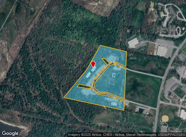
12 Crestwood Dr
Apartment
Kennebec
X
Maine
23011C0168D
19.09 AC
2025
Maine South & Augusta
2025
Other Market Areas
024202
Augusta-Waterville, ME
12,516 SF
WAVL-000022-000000-000130
DEMOGRAPHICS near 12 Crestwood Dr
1 Mile
3 Mile
5 Mile
2024 Total Population
2,039
19,032
31,597
2029 Population
2,130
19,696
32,710
Pop Growth 2024-2029
+ 4.46%
+ 3.49%
+ 3.52%
Average Age
45
42
42
2024 Total Households
860
8,268
13,547
HH Growth 2024-2029
+ 4.77%
+ 3.58%
+ 3.59%
Median Household Inc
$39,666
$49,748
$54,674
Avg Household Size
1.80
2.10
2.10
2024 Avg HH Vehicles
2.00
2.00
2.00
Median Home Value
$131,060
$161,832
$172,311
Median Year Built
1984
1965
1970
Nearby Places
Map Layers
Map Styles
 Street
 Aerial
- Restaurants
- Banks
- Shops
- Fitness
- Groceries
Nearby Properties
Address
Land Use
TOTAL SIZE
Lot Size
Zoning
Address
Land Use
TOTAL SIZE
Lot Size
Zoning
115.09 AC
Address
Land Use
TOTAL SIZE
Lot Size
Zoning
Address
Land Use
TOTAL SIZE
Lot Size
Zoning
167,845 SF
33 AC
Address
Land Use
TOTAL SIZE
Lot Size
Zoning
1.02 AC
Address
Land Use
TOTAL SIZE
Lot Size
Zoning
174,750 SF
17.60 AC
Address
Land Use
TOTAL SIZE
Lot Size
Zoning
38,304 SF
0.94 AC
Address
Land Use
TOTAL SIZE
Lot Size
Zoning
99,914 SF
8.36 AC
MU
Address
Land Use
TOTAL SIZE
Lot Size
Zoning
26.20 AC
HIGHWA
Address
Land Use
TOTAL SIZE
Lot Size
Zoning
20.88 AC
Address
Land Use
TOTAL SIZE
Lot Size
Zoning
71,838 SF
Address
Land Use
TOTAL SIZE
Lot Size
Zoning
100 SF
16.24 AC
Address
Land Use
TOTAL SIZE
Lot Size
Zoning
31,845 SF
0.35 AC
Address
Land Use
TOTAL SIZE
Lot Size
Zoning
10.25 AC
Address
Land Use
TOTAL SIZE
Lot Size
Zoning
Address
Land Use
TOTAL SIZE
Lot Size
Zoning
90,966 SF
26.70 AC
Address
Land Use
TOTAL SIZE
Lot Size
Zoning
104,839 SF
0.77 AC
Address
Land Use
TOTAL SIZE
Lot Size
Zoning
238,560 SF
5.14 AC
Address
Land Use
TOTAL SIZE
Lot Size
Zoning
46,400 SF
5.43 AC
ID
Address
Land Use
TOTAL SIZE
Lot Size
Zoning
116,680 SF
16.20 AC
ID
Address
Land Use
TOTAL SIZE
Lot Size
Zoning
13,544 SF
6.67 AC
MU
Address
Land Use
TOTAL SIZE
Lot Size
Zoning
42,000 SF
4.98 AC
ID
Address
Land Use
TOTAL SIZE
Lot Size
Zoning
59,261 SF
56 AC
Address
Land Use
TOTAL SIZE
Lot Size
Zoning
92,224 SF
16.68 AC
Address
Land Use
TOTAL SIZE
Lot Size
Zoning
5.41 AC
DOWNTO
Address
Land Use
TOTAL SIZE
Lot Size
Zoning
20,410 SF
6.80 AC
HIGHWA
Address
Land Use
TOTAL SIZE
Lot Size
Zoning
36,194 SF
174 SF
Address
Land Use
TOTAL SIZE
Lot Size
Zoning
35,000 SF
4.58 AC
HIGHWA
Address
Land Use
TOTAL SIZE
Lot Size
Zoning
70,000 SF
12.54 AC
ID
Address
Land Use
TOTAL SIZE
Lot Size
Zoning
24.45 AC
The World's #1 Commercial Real Estate Marketplace
Connect with us
© 2026 CoStar Group
The information above has been obtained from sources believed reliable. While we do not doubt its accuracy we have not verified it and make no guarantee, warranty or representation about it. It is your responsibility to independently confirm its accuracy and completeness. Any projections, opinions, assumptions, or estimates used are for example only and do not represent the current or future performance of the property. The value of this transaction to you depends on tax and other factors which should be evaluated by your tax, financial, and legal advisors. You and your advisors should conduct a careful, independent investigation of the property to determine to your satisfaction the suitability of the property for your needs.