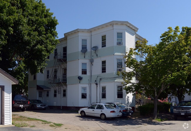
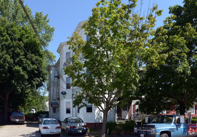
Property Record
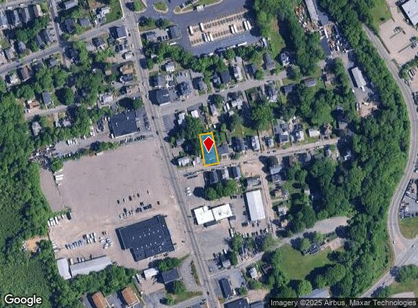
12 Holmes St, Brockton, MA 02301
NEARBY LISTINGS FOR SALE OR LEASE
Property Detail
12 Holmes St
Apartment
Plymouth
X
Massachusetts
25023C0167J
0.17 AC
2025
South Plymouth County
2025
Boston
511602
Boston-Cambridge-Newton, MA-NH
3,816 SF
BROC-000118-000025
DEMOGRAPHICS near 12 Holmes St
1 Mile
3 Mile
5 Mile
2024 Total Population
14,148
79,505
157,755
2029 Population
13,921
78,587
156,350
Pop Growth 2024-2029
(1.60%)
(1.15%)
(0.89%)
Average Age
39
39
40
2024 Total Households
4,759
26,427
54,962
HH Growth 2024-2029
(1.64%)
(1.20%)
(0.93%)
Median Household Inc
$73,878
$75,896
$83,243
Avg Household Size
2.80
2.80
2.70
2024 Avg HH Vehicles
1.00
2.00
2.00
Median Home Value
$358,390
$378,027
$395,002
Median Year Built
1957
1953
1961
Nearby Places
Map Layers
Map Styles
 Street
 Aerial
- Restaurants
- Banks
- Shops
- Fitness
- Groceries
PUBLIC TRANSPORTATION
COMMUTER RAIL
Campello (Middleborough/Lakeville Line - Massachusetts Bay Transportation Authority Commuter Rail (Purple Line))
DRIVE
WALK
Distance
Campello (Middleborough/Lakeville Line - Massachusetts Bay Transportation Authority Commuter Rail (Purple Line))
2 min
12 min
0.7 mi
Brockton (Middleborough/Lakeville Line - Massachusetts Bay Transportation Authority Commuter Rail (Purple Line))
DRIVE
WALK
Distance
Brockton (Middleborough/Lakeville Line - Massachusetts Bay Transportation Authority Commuter Rail (Purple Line))
4 min
2.3 mi
AIRPORT
General Edward Lawrence Logan International
DRIVE
WALK
Distance
General Edward Lawrence Logan International
42 min
28.0 mi
Freight Ports
Port of Boston
DRIVE
WALK
Distance
Port of Boston
39 min
25.8 mi
Nearby Properties
Address
Land Use
TOTAL SIZE
Lot Size
Zoning
Address
Land Use
TOTAL SIZE
Lot Size
Zoning
3,088 SF
1.42 AC
C3
Address
Land Use
TOTAL SIZE
Lot Size
Zoning
95.27 AC
R1C
Address
Land Use
TOTAL SIZE
Lot Size
Zoning
1,352 SF
66.81 AC
R1B
Address
Land Use
TOTAL SIZE
Lot Size
Zoning
780 SF
10.81 AC
C5
Address
Land Use
TOTAL SIZE
Lot Size
Zoning
449,704 SF
3.56 AC
C2
Address
Land Use
TOTAL SIZE
Lot Size
Zoning
8.09 AC
R1C
Address
Land Use
TOTAL SIZE
Lot Size
Zoning
412,500 SF
48.94 AC
100
Address
Land Use
TOTAL SIZE
Lot Size
Zoning
733 SF
16.41 AC
R1C
Address
Land Use
TOTAL SIZE
Lot Size
Zoning
27,951 SF
1.19 AC
R3
Address
Land Use
TOTAL SIZE
Lot Size
Zoning
920 SF
13.48 AC
R1C
Address
Land Use
TOTAL SIZE
Lot Size
Zoning
3,088 SF
1.38 AC
C3
Address
Land Use
TOTAL SIZE
Lot Size
Zoning
3,438 SF
1.15 AC
C2
Address
Land Use
TOTAL SIZE
Lot Size
Zoning
223,200 SF
5.26 AC
C2
Address
Land Use
TOTAL SIZE
Lot Size
Zoning
21.12 AC
Address
Land Use
TOTAL SIZE
Lot Size
Zoning
88,957 SF
0.57 AC
R2
Address
Land Use
TOTAL SIZE
Lot Size
Zoning
4,074 SF
3.82 AC
R3
Address
Land Use
TOTAL SIZE
Lot Size
Zoning
2,062 SF
5.01 AC
C2
Address
Land Use
TOTAL SIZE
Lot Size
Zoning
130,640 SF
10.27 AC
R1C
Address
Land Use
TOTAL SIZE
Lot Size
Zoning
3,812 SF
0.64 AC
C3
Address
Land Use
TOTAL SIZE
Lot Size
Zoning
1,172 SF
32.67 AC
R1C
Address
Land Use
TOTAL SIZE
Lot Size
Zoning
6,110 SF
14.03 AC
R1A
Address
Land Use
TOTAL SIZE
Lot Size
Zoning
254,946 SF
11.22 AC
R2
Address
Land Use
TOTAL SIZE
Lot Size
Zoning
3,255 SF
1 AC
C3
Address
Land Use
TOTAL SIZE
Lot Size
Zoning
2,884 SF
3.18 AC
R2
Address
Land Use
TOTAL SIZE
Lot Size
Zoning
1,217 SF
13.79 AC
R1C
Address
Land Use
TOTAL SIZE
Lot Size
Zoning
210,600 SF
19.86 AC
Address
Land Use
TOTAL SIZE
Lot Size
Zoning
463,305 SF
116.22 AC
100
Address
Land Use
TOTAL SIZE
Lot Size
Zoning
647 SF
53.67 AC
I3
Address
Land Use
TOTAL SIZE
Lot Size
Zoning
22.54 AC
C2
Address
Land Use
TOTAL SIZE
Lot Size
Zoning
1,576 SF
5.83 AC
C5
The World's #1 Commercial Real Estate Marketplace
Connect with us
© 2025 CoStar Group
The information above has been obtained from sources believed reliable. While we do not doubt its accuracy we have not verified it and make no guarantee, warranty or representation about it. It is your responsibility to independently confirm its accuracy and completeness. Any projections, opinions, assumptions, or estimates used are for example only and do not represent the current or future performance of the property. The value of this transaction to you depends on tax and other factors which should be evaluated by your tax, financial, and legal advisors. You and your advisors should conduct a careful, independent investigation of the property to determine to your satisfaction the suitability of the property for your needs.