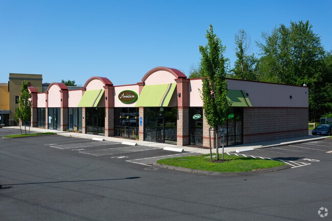
Property Record
12 Knotter Dr, Southington, CT 06489
NEARBY LISTINGS FOR SALE OR LEASE
Property Detail
12 Knotter Dr
SOUT-000020-000000-000003
Hartford
Commercialacreage
Connecticut
X
3
09009C0135H
2.23 AC
2025
Southington
2025
Hartford
430100
Hartford-West Hartford-East Hartford, CT
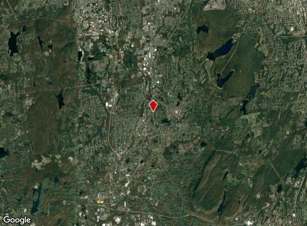
DEMOGRAPHICS near 12 Knotter Dr
1 Mile
3 Mile
5 Mile
2024 Total Population
1,730
30,366
97,894
2029 Population
1,675
30,165
97,535
Pop Growth 2024-2029
(3.18%)
(0.66%)
(0.37%)
Average Age
44
42
42
2024 Total Households
657
11,181
37,861
HH Growth 2024-2029
(3.65%)
(0.86%)
(0.43%)
Median Household Inc
$113,758
$103,673
$97,326
Avg Household Size
2.40
2.50
2.50
2024 Avg HH Vehicles
2.00
2.00
2.00
Median Home Value
$308,823
$324,036
$300,590
Median Year Built
1965
1967
1969
Nearby Places
Map Layers
Map Styles
 Street
 Aerial
- Restaurants
- Banks
- Shops
- Fitness
- Groceries
PUBLIC TRANSPORTATION
AIRPORT
Tweed/New Haven
DRIVE
WALK
Distance
Tweed/New Haven
40 min
27.1 mi
Bradley International
DRIVE
WALK
Distance
Bradley International
56 min
32.3 mi
Freight Ports
Port of New Haven
DRIVE
WALK
Distance
Port of New Haven
35 min
24.8 mi
SALE & LEASE HISTORY
LISTING DATE
SALE/LEASE

May 01, 2017
For Lease
Nearby Properties
Address
Land Use
TOTAL SIZE
Lot Size
Zoning
Address
Land Use
TOTAL SIZE
Lot Size
Zoning
100,304 SF
28.80 AC
IP-1
Address
Land Use
TOTAL SIZE
Lot Size
Zoning
395,492 SF
54.09 AC
R-20/2
Address
Land Use
TOTAL SIZE
Lot Size
Zoning
106,970 SF
7.92 AC
R-12
Address
Land Use
TOTAL SIZE
Lot Size
Zoning
86,019 SF
7.51 AC
B
Address
Land Use
TOTAL SIZE
Lot Size
Zoning
128,599 SF
14.75 AC
R-20/2
Address
Land Use
TOTAL SIZE
Lot Size
Zoning
130,912 SF
11 AC
R-12
Address
Land Use
TOTAL SIZE
Lot Size
Zoning
14,307 SF
13.39 AC
R-20/2
Address
Land Use
TOTAL SIZE
Lot Size
Zoning
502,440 SF
27.87 AC
I-2
Address
Land Use
TOTAL SIZE
Lot Size
Zoning
17.62 AC
B
Address
Land Use
TOTAL SIZE
Lot Size
Zoning
149,912 SF
13.66 AC
B
Address
Land Use
TOTAL SIZE
Lot Size
Zoning
130,252 SF
14.82 AC
B
Address
Land Use
TOTAL SIZE
Lot Size
Zoning
137,510 SF
12.95 AC
B
Address
Land Use
TOTAL SIZE
Lot Size
Zoning
16.04 AC
B
Address
Land Use
TOTAL SIZE
Lot Size
Zoning
150,972 SF
9.99 AC
I-1
Address
Land Use
TOTAL SIZE
Lot Size
Zoning
98,463 SF
5.01 AC
I-1
Address
Land Use
TOTAL SIZE
Lot Size
Zoning
109,212 SF
20.15 AC
B
Address
Land Use
TOTAL SIZE
Lot Size
Zoning
121,648 SF
6.96 AC
I-1
Address
Land Use
TOTAL SIZE
Lot Size
Zoning
134,876 SF
19.44 AC
R-12
Address
Land Use
TOTAL SIZE
Lot Size
Zoning
95,940 SF
12 AC
B
Address
Land Use
TOTAL SIZE
Lot Size
Zoning
12.28 AC
R-20/2
Address
Land Use
TOTAL SIZE
Lot Size
Zoning
9.07 AC
B
Address
Land Use
TOTAL SIZE
Lot Size
Zoning
101,250 SF
16.91 AC
B
Address
Land Use
TOTAL SIZE
Lot Size
Zoning
40 AC
I-2
Address
Land Use
TOTAL SIZE
Lot Size
Zoning
101,495 SF
9.74 AC
B
Address
Land Use
TOTAL SIZE
Lot Size
Zoning
67,503 SF
2.53 AC
B
Address
Land Use
TOTAL SIZE
Lot Size
Zoning
46,395 SF
11.80 AC
I-2
Address
Land Use
TOTAL SIZE
Lot Size
Zoning
68,669 SF
5.35 AC
B
Address
Land Use
TOTAL SIZE
Lot Size
Zoning
76,113 SF
18.68 AC
R-20/2
Address
Land Use
TOTAL SIZE
Lot Size
Zoning
22,512 SF
3.31 AC
CB
Address
Land Use
TOTAL SIZE
Lot Size
Zoning
32,076 SF
16.33 AC
R-20/2
The World's #1 Commercial Real Estate Marketplace
Connect with us
© 2025 CoStar Group
The information above has been obtained from sources believed reliable. While we do not doubt its accuracy we have not verified it and make no guarantee, warranty or representation about it. It is your responsibility to independently confirm its accuracy and completeness. Any projections, opinions, assumptions, or estimates used are for example only and do not represent the current or future performance of the property. The value of this transaction to you depends on tax and other factors which should be evaluated by your tax, financial, and legal advisors. You and your advisors should conduct a careful, independent investigation of the property to determine to your satisfaction the suitability of the property for your needs.