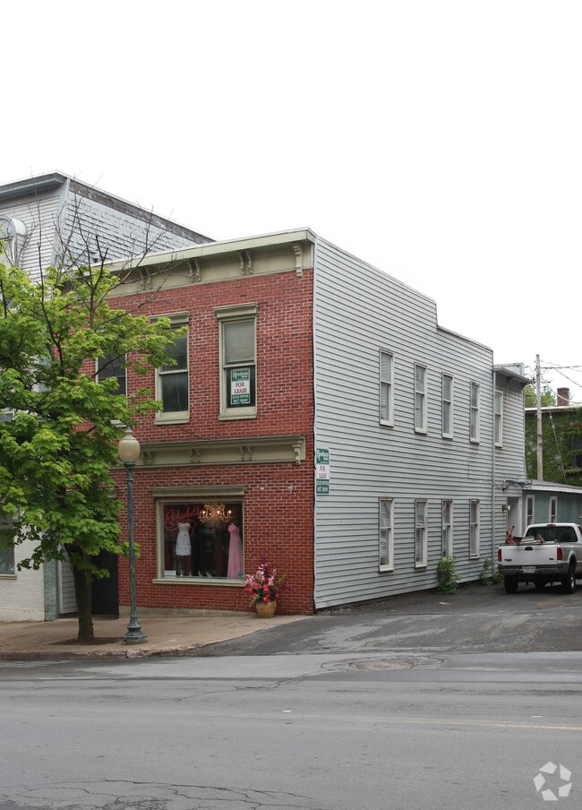
Property Record
1012 Route 29, Saratoga Springs, NY 12866
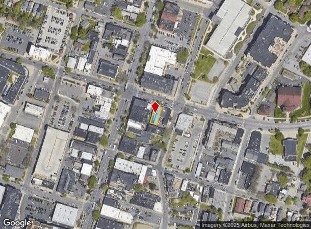
NEARBY LISTINGS FOR SALE OR LEASE
Property Detail
1012 Route 29
Albany-Schenectady-Troy, NY
S-10 B-V L-17-18 INSIDE
411501 165.60-1-3
Saratoga
Commercialofficeresidentialmixeduse
New York
2024
3.000
2024
0.10 AC
061102
Saratoga County
9,198 SF
Albany/Schenectady/Troy
DEMOGRAPHICS near 1012 Route 29
1 Mile
3 Mile
5 Mile
2024 Total Population
13,300
26,568
51,332
2029 Population
13,947
27,933
53,791
Pop Growth 2024-2029
+ 4.86%
+ 5.14%
+ 4.79%
Average Age
45
45
44
2024 Total Households
7,067
12,992
23,107
HH Growth 2024-2029
+ 4.98%
+ 5.22%
+ 4.88%
Median Household Inc
$80,174
$82,686
$90,299
Avg Household Size
1.80
2.00
2.20
2024 Avg HH Vehicles
1.00
2.00
2.00
Median Home Value
$491,830
$418,390
$376,941
Median Year Built
1955
1976
1988
Nearby Places
- Restaurants
- Banks
- Shops
- Fitness
- Groceries
PUBLIC TRANSPORTATION
COMMUTER RAIL
Saratoga Springs Amtrak Station (Adirondack - Amtrak, Ethan Allen Express - Amtrak)
DRIVE
WALK
Distance
Saratoga Springs Amtrak Station (Adirondack - Amtrak, Ethan Allen Express - Amtrak)
3 min
1.5 mi
AIRPORT
Albany International
DRIVE
WALK
Distance
Albany International
35 min
25.5 mi
Freight Ports
Albany, NY Port
DRIVE
WALK
Distance
Albany, NY Port
50 min
35.9 mi
Nearby Properties
Address
Land Use
TOTAL SIZE
Lot Size
Zoning
Address
Land Use
TOTAL SIZE
Lot Size
Zoning
22,880 SF
295.11 AC
INSED
Address
Land Use
TOTAL SIZE
Lot Size
Zoning
249,750 SF
10.47 AC
C4
Address
Land Use
TOTAL SIZE
Lot Size
Zoning
3,000 SF
37.95 AC
C-1
Address
Land Use
TOTAL SIZE
Lot Size
Zoning
214,000 SF
127.30 AC
INSHT
Address
Land Use
TOTAL SIZE
Lot Size
Zoning
246,647 SF
160.43 AC
INSHT
Address
Land Use
TOTAL SIZE
Lot Size
Zoning
507,600 SF
55.01 AC
INSED
Address
Land Use
TOTAL SIZE
Lot Size
Zoning
173,482 SF
5.27 AC
C1
Address
Land Use
TOTAL SIZE
Lot Size
Zoning
606,904 SF
93.59 AC
C-1
Address
Land Use
TOTAL SIZE
Lot Size
Zoning
178,182 SF
36.63 AC
OR
Address
Land Use
TOTAL SIZE
Lot Size
Zoning
76,938 SF
10.53 AC
PUD
Address
Land Use
TOTAL SIZE
Lot Size
Zoning
42,840 SF
8.07 AC
C-1
Address
Land Use
TOTAL SIZE
Lot Size
Zoning
90,950 SF
12.09 AC
INSED
Address
Land Use
TOTAL SIZE
Lot Size
Zoning
200,242 SF
21.65 AC
C-1
Address
Land Use
TOTAL SIZE
Lot Size
Zoning
78,848 SF
6.54 AC
PUD
Address
Land Use
TOTAL SIZE
Lot Size
Zoning
35,733 SF
6.71 AC
INSED
Address
Land Use
TOTAL SIZE
Lot Size
Zoning
268,548 SF
52.25 AC
IM
Address
Land Use
TOTAL SIZE
Lot Size
Zoning
268,548 SF
52.25 AC
IM
Address
Land Use
TOTAL SIZE
Lot Size
Zoning
1,380 SF
55 AC
R-M
Address
Land Use
TOTAL SIZE
Lot Size
Zoning
113,052 SF
2.86 AC
UR5
Address
Land Use
TOTAL SIZE
Lot Size
Zoning
4,400 SF
13.96 AC
UR4
Address
Land Use
TOTAL SIZE
Lot Size
Zoning
28,437 SF
61.38 AC
INSPR
Address
Land Use
TOTAL SIZE
Lot Size
Zoning
905,719 SF
62.10 AC
INDG
Address
Land Use
TOTAL SIZE
Lot Size
Zoning
39,632 SF
19.11 AC
C7
Address
Land Use
TOTAL SIZE
Lot Size
Zoning
4,740 SF
37.10 AC
C7
Address
Land Use
TOTAL SIZE
Lot Size
Zoning
137,617 SF
19.08 AC
C-1
Address
Land Use
TOTAL SIZE
Lot Size
Zoning
198,381 SF
10.06 AC
PUD
Address
Land Use
TOTAL SIZE
Lot Size
Zoning
5,152 SF
30.20 AC
UR1
Address
Land Use
TOTAL SIZE
Lot Size
Zoning
2,700 SF
162.85 AC
C1
Address
Land Use
TOTAL SIZE
Lot Size
Zoning
139,794 SF
21.32 AC
C2
Address
Land Use
TOTAL SIZE
Lot Size
Zoning
5,276 SF
9.20 AC
C-1
The World's #1 Commercial Real Estate Marketplace
Connect with us
© 2025 CoStar Group
The information above has been obtained from sources believed reliable. While we do not doubt its accuracy we have not verified it and make no guarantee, warranty or representation about it. It is your responsibility to independently confirm its accuracy and completeness. Any projections, opinions, assumptions, or estimates used are for example only and do not represent the current or future performance of the property. The value of this transaction to you depends on tax and other factors which should be evaluated by your tax, financial, and legal advisors. You and your advisors should conduct a careful, independent investigation of the property to determine to your satisfaction the suitability of the property for your needs.