Property Record
12 Lake St, Sloatsburg, NY 10974
NEARBY LISTINGS FOR SALE OR LEASE
-
-
View all Sloatsburg listings for sale on LoopNet.com
Property Detail
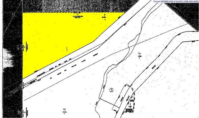
12 Lake St
New York-Jersey City-White Plains, NY-NJ
Torne Vly Open Sp
392689-039-018-0001-001-000-0000
MAP #1440 LOT #5
Multifamilydwelling
Rockland
A
New York
36087C0068G
1.0
2023
40.42 AC
2024
Ramapo
011700
Northern New Jersey
4,979 SF
DEMOGRAPHICS near 12 Lake St
1 Mile
3 Mile
5 Mile
2024 Total Population
40
15,730
61,830
2029 Population
43
15,751
62,092
Pop Growth 2024-2029
+ 7.50%
+ 0.13%
+ 0.42%
Average Age
42
41
40
2024 Total Households
15
5,645
20,815
HH Growth 2024-2029
+ 6.67%
+ 0.18%
+ 0.46%
Median Household Inc
$124,999
$103,716
$107,254
Avg Household Size
2.70
2.70
2.80
2024 Avg HH Vehicles
3.00
2.00
2.00
Median Home Value
$781,249
$425,581
$550,499
Median Year Built
2003
1962
1974
Nearby Places
- Restaurants
- Banks
- Shops
- Fitness
- Groceries
PUBLIC TRANSPORTATION
COMMUTER RAIL
Suffern (Bergen County/Port Jervis Line - NJ Transit Commuter Rail (NJ Transit), Main/Port Jervis Line - NJ Transit Commuter Rail (NJ Transit))
DRIVE
WALK
Distance
Suffern (Bergen County/Port Jervis Line - NJ Transit Commuter Rail (NJ Transit), Main/Port Jervis Line - NJ Transit Commuter Rail (NJ Transit))
7 min
3.0 mi
Sloatsburg (Bergen County/Port Jervis Line - NJ Transit Commuter Rail (NJ Transit), Main/Port Jervis Line - NJ Transit Commuter Rail (NJ Transit))
DRIVE
WALK
Distance
Sloatsburg (Bergen County/Port Jervis Line - NJ Transit Commuter Rail (NJ Transit), Main/Port Jervis Line - NJ Transit Commuter Rail (NJ Transit))
10 min
4.7 mi
AIRPORT
Westchester County
DRIVE
WALK
Distance
Westchester County
49 min
34.4 mi
New York Stewart International
DRIVE
WALK
Distance
New York Stewart International
49 min
35.8 mi
LaGuardia
DRIVE
WALK
Distance
LaGuardia
57 min
36.4 mi
Freight Ports
Port Newark Container Terminal
DRIVE
WALK
Distance
Port Newark Container Terminal
57 min
38.4 mi
Nearby Properties
Address
Land Use
TOTAL SIZE
Lot Size
Zoning
Address
Land Use
TOTAL SIZE
Lot Size
Zoning
1,056 SF
99.35 AC
OP200
Address
Land Use
TOTAL SIZE
Lot Size
Zoning
23.32 AC
Address
Land Use
TOTAL SIZE
Lot Size
Zoning
Address
Land Use
TOTAL SIZE
Lot Size
Zoning
68.78 AC
OP20
Address
Land Use
TOTAL SIZE
Lot Size
Zoning
19.60 AC
OP200
Address
Land Use
TOTAL SIZE
Lot Size
Zoning
539,911 SF
38.80 AC
05
Address
Land Use
TOTAL SIZE
Lot Size
Zoning
33.50 AC
GI80
Address
Land Use
TOTAL SIZE
Lot Size
Zoning
219,765 SF
29.88 AC
07
Address
Land Use
TOTAL SIZE
Lot Size
Zoning
0.44 AC
OP20
Address
Land Use
TOTAL SIZE
Lot Size
Zoning
9 AC
B40
Address
Land Use
TOTAL SIZE
Lot Size
Zoning
928 AC
POS
Address
Land Use
TOTAL SIZE
Lot Size
Zoning
58,473 SF
0.70 AC
HCS
Address
Land Use
TOTAL SIZE
Lot Size
Zoning
5.02 AC
B12
Address
Land Use
TOTAL SIZE
Lot Size
Zoning
76,083 SF
0.96 AC
05
Address
Land Use
TOTAL SIZE
Lot Size
Zoning
11.90 AC
C200
Address
Land Use
TOTAL SIZE
Lot Size
Zoning
290,428 SF
35.56 AC
R35
Address
Land Use
TOTAL SIZE
Lot Size
Zoning
2.18 AC
B12
Address
Land Use
TOTAL SIZE
Lot Size
Zoning
859,490 SF
49.12 AC
PI
Address
Land Use
TOTAL SIZE
Lot Size
Zoning
4,686 SF
33.17 AC
03
Address
Land Use
TOTAL SIZE
Lot Size
Zoning
1,568 SF
2.08 AC
B40
Address
Land Use
TOTAL SIZE
Lot Size
Zoning
5.56 AC
Address
Land Use
TOTAL SIZE
Lot Size
Zoning
335,851 SF
9.96 AC
07
Address
Land Use
TOTAL SIZE
Lot Size
Zoning
7.33 AC
Address
Land Use
TOTAL SIZE
Lot Size
Zoning
1.25 AC
Address
Land Use
TOTAL SIZE
Lot Size
Zoning
5.44 AC
B40
Address
Land Use
TOTAL SIZE
Lot Size
Zoning
16,708 SF
10.50 AC
B40
Address
Land Use
TOTAL SIZE
Lot Size
Zoning
3.70 AC
R5
Address
Land Use
TOTAL SIZE
Lot Size
Zoning
200 AC
POS
Address
Land Use
TOTAL SIZE
Lot Size
Zoning
1,545 SF
1.53 AC
05
Address
Land Use
TOTAL SIZE
Lot Size
Zoning
37.91 AC
GI200
The World's #1 Commercial Real Estate Marketplace
Connect with us
© 2025 CoStar Group
The information above has been obtained from sources believed reliable. While we do not doubt its accuracy we have not verified it and make no guarantee, warranty or representation about it. It is your responsibility to independently confirm its accuracy and completeness. Any projections, opinions, assumptions, or estimates used are for example only and do not represent the current or future performance of the property. The value of this transaction to you depends on tax and other factors which should be evaluated by your tax, financial, and legal advisors. You and your advisors should conduct a careful, independent investigation of the property to determine to your satisfaction the suitability of the property for your needs.