Property Record
12 Latti Farm Rd, Millbury, MA 01527


NEARBY LISTINGS FOR SALE OR LEASE
Property Detail
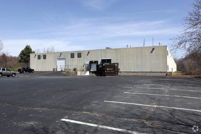
12 Latti Farm Rd
Warehouse
Worcester
X
Massachusetts
25027C0809E
8.41 AC
2025
Worcester Metro
2025
Boston
737300
Worcester, MA
103,460 SF
MILB-000014-000000-000027
DEMOGRAPHICS near 12 Latti Farm Rd
1 Mile
3 Mile
5 Mile
2024 Total Population
2,084
71,409
201,568
2029 Population
2,080
70,576
199,481
Pop Growth 2024-2029
(0.19%)
(1.17%)
(1.04%)
Average Age
41
39
39
2024 Total Households
836
27,388
78,846
HH Growth 2024-2029
(0.24%)
(1.12%)
(1.00%)
Median Household Inc
$100,619
$71,748
$66,695
Avg Household Size
2.50
2.40
2.40
2024 Avg HH Vehicles
2.00
2.00
2.00
Median Home Value
$356,745
$330,374
$344,673
Median Year Built
1966
1955
1954
Nearby Places
Map Layers
Map Styles
 Street
 Aerial
- Restaurants
- Banks
- Shops
- Fitness
- Groceries
PUBLIC TRANSPORTATION
COMMUTER RAIL
DRIVE
WALK
Distance
10 min
4.2 mi
Worcester (Framingham/Worcester Line - Massachusetts Bay Transportation Authority Commuter Rail (Purple Line))
DRIVE
WALK
Distance
Worcester (Framingham/Worcester Line - Massachusetts Bay Transportation Authority Commuter Rail (Purple Line))
10 min
4.3 mi
AIRPORT
Worcester Regional
DRIVE
WALK
Distance
Worcester Regional
20 min
9.5 mi
Rhode Island Tf Green International
DRIVE
WALK
Distance
Rhode Island Tf Green International
62 min
45.3 mi
Freight Ports
Port of Boston
DRIVE
WALK
Distance
Port of Boston
61 min
44.9 mi
SALE & LEASE HISTORY
LISTING DATE
SALE/LEASE

Sep 26, 2016
For Lease
Sep 25, 2016
For Lease
Sep 25, 2016
For Lease
Mar 30, 2017
For Lease
Dec 03, 2019
For Lease
Apr 03, 2019
For Lease
Nearby Properties
Address
Land Use
TOTAL SIZE
Lot Size
Zoning
Address
Land Use
TOTAL SIZE
Lot Size
Zoning
25,000 SF
99.10 AC
MG-.5
Address
Land Use
TOTAL SIZE
Lot Size
Zoning
19,319 SF
10.67 AC
RG-5
Address
Land Use
TOTAL SIZE
Lot Size
Zoning
591,515 SF
33.04 AC
MG-1
Address
Land Use
TOTAL SIZE
Lot Size
Zoning
210,168 SF
45.75 AC
RL-7
Address
Land Use
TOTAL SIZE
Lot Size
Zoning
159,355 SF
207.62 AC
RL-7
Address
Land Use
TOTAL SIZE
Lot Size
Zoning
27.89 AC
RL-7
Address
Land Use
TOTAL SIZE
Lot Size
Zoning
64.46 AC
RS-7
Address
Land Use
TOTAL SIZE
Lot Size
Zoning
78.19 AC
RL-7
Address
Land Use
TOTAL SIZE
Lot Size
Zoning
7,700 SF
80.72 AC
ML-.5
Address
Land Use
TOTAL SIZE
Lot Size
Zoning
Address
Land Use
TOTAL SIZE
Lot Size
Zoning
53.52 AC
RL-7
Address
Land Use
TOTAL SIZE
Lot Size
Zoning
222,474 SF
22.75 AC
MG-1
Address
Land Use
TOTAL SIZE
Lot Size
Zoning
279,977 SF
17.80 AC
Address
Land Use
TOTAL SIZE
Lot Size
Zoning
93,092 SF
162.83 AC
OLI
Address
Land Use
TOTAL SIZE
Lot Size
Zoning
153,745 SF
10.99 AC
MG-2
Address
Land Use
TOTAL SIZE
Lot Size
Zoning
210,001 SF
13.14 AC
Address
Land Use
TOTAL SIZE
Lot Size
Zoning
70,400 SF
17.10 AC
Address
Land Use
TOTAL SIZE
Lot Size
Zoning
8.77 AC
BL-1
Address
Land Use
TOTAL SIZE
Lot Size
Zoning
151.20 AC
Address
Land Use
TOTAL SIZE
Lot Size
Zoning
133,482 SF
15.80 AC
BG-2
Address
Land Use
TOTAL SIZE
Lot Size
Zoning
18.10 AC
I1
Address
Land Use
TOTAL SIZE
Lot Size
Zoning
115,564 SF
9.33 AC
RL-7
Address
Land Use
TOTAL SIZE
Lot Size
Zoning
Address
Land Use
TOTAL SIZE
Lot Size
Zoning
19.76 AC
BL-1
Address
Land Use
TOTAL SIZE
Lot Size
Zoning
95,184 SF
2.44 AC
BL-1
Address
Land Use
TOTAL SIZE
Lot Size
Zoning
13,417 SF
28.90 AC
MG-.5
Address
Land Use
TOTAL SIZE
Lot Size
Zoning
169,822 SF
18.80 AC
RL-7
Address
Land Use
TOTAL SIZE
Lot Size
Zoning
21.72 AC
Address
Land Use
TOTAL SIZE
Lot Size
Zoning
97,436 SF
2.65 AC
RG-5
The World's #1 Commercial Real Estate Marketplace
Connect with us
© 2026 CoStar Group
The information above has been obtained from sources believed reliable. While we do not doubt its accuracy we have not verified it and make no guarantee, warranty or representation about it. It is your responsibility to independently confirm its accuracy and completeness. Any projections, opinions, assumptions, or estimates used are for example only and do not represent the current or future performance of the property. The value of this transaction to you depends on tax and other factors which should be evaluated by your tax, financial, and legal advisors. You and your advisors should conduct a careful, independent investigation of the property to determine to your satisfaction the suitability of the property for your needs.