Property Record
12 Maple Ave, Pine Brook, NJ 07058


Property Detail
12 Maple Ave
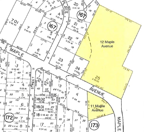
21-00167-0000-00025
INCL BLK 167 LOT 25 BLK 173 LOT 5
Industrialgeneral
Morris
I1A
New Jersey
AE The base floodplain where base flood elevations are provided. AE Zones are now used on new format FIRMs instead of A1-A30 Zones.
25
2024
3.35 AC
2025
Eastern Morris
040803
Northern New Jersey
7,504 SF
Newark, NJ
NEARBY LISTINGS FOR SALE OR LEASE
DEMOGRAPHICS near 12 Maple Ave
1 mile
3 mile
5 mile
2025 Total Population
4,492
46,632
166,726
2030 Population
4,851
48,797
174,115
Pop Growth 2025-2030
+ 7.99%
+ 4.64%
+ 4.43%
Average Age
38
43
43
2025 Total Households
1,684
17,221
61,129
HH Growth 2025-2030
+ 8.08%
+ 4.75%
+ 4.47%
Median Household Inc
$118,071
$139,335
$145,909
Avg Household Size
2.60
2.70
2.70
2025 Avg HH Vehicles
2.00
2.00
2.00
Median Home Value
$660,714
$680,117
$684,005
Median Year Built
1989
1968
1968
Nearby Places
Map Layers
Map Styles
 Street
 Aerial
Transit
 Traffic
 Biking
Places
Listings with unknown addresses are not visible on the map
- Restaurants
- Banks
- Shops
- Fitness
- Groceries
PUBLIC TRANSPORTATION
COMMUTER RAIL
Towaco (Montclair-Boonton Line - NJ Transit Commuter Rail (NJ Transit))
Drive
Walk
Distance
Towaco (Montclair-Boonton Line - NJ Transit Commuter Rail (NJ Transit))
13 min
6.7 mi
Boonton (Montclair-Boonton Line - NJ Transit Commuter Rail (NJ Transit))
Drive
Walk
Distance
Boonton (Montclair-Boonton Line - NJ Transit Commuter Rail (NJ Transit))
11 min
7.9 mi
AIRPORT
Newark Liberty International
Drive
Walk
Distance
Newark Liberty International
33 min
23.7 mi
LaGuardia
Drive
Walk
Distance
LaGuardia
50 min
36.1 mi
John F Kennedy International
Drive
Walk
Distance
John F Kennedy International
64 min
47.2 mi
Freight Ports
Maher Terminal
Drive
Walk
Distance
Maher Terminal
38 min
22.4 mi
SALE & LEASE HISTORY
LISTING DATE
SALE/LEASE

Sep 24, 2016
For Lease
Sep 23, 2016
For Sale
Jan 12, 2022
For Lease
Jan 12, 2022
For Sale
Nearby Properties
Address
Land Use
TOTAL SIZE
Lot Size
Zoning
Address
Land Use
TOTAL SIZE
Lot Size
Zoning
48.85 AC
R-3B
Address
Land Use
TOTAL SIZE
Lot Size
Zoning
98.27 AC
AH1
Address
Land Use
TOTAL SIZE
Lot Size
Zoning
147,871 SF
26.50 AC
PB-3
Address
Land Use
TOTAL SIZE
Lot Size
Zoning
4.60 AC
Address
Land Use
TOTAL SIZE
Lot Size
Zoning
119,552 SF
129 AC
I1A
Address
Land Use
TOTAL SIZE
Lot Size
Zoning
8,600 SF
27.27 AC
L3
Address
Land Use
TOTAL SIZE
Lot Size
Zoning
84.70 AC
Address
Land Use
TOTAL SIZE
Lot Size
Zoning
17.90 AC
B-2
Address
Land Use
TOTAL SIZE
Lot Size
Zoning
67.49 AC
Address
Land Use
TOTAL SIZE
Lot Size
Zoning
61.69 AC
Address
Land Use
TOTAL SIZE
Lot Size
Zoning
27.50 AC
M-2
Address
Land Use
TOTAL SIZE
Lot Size
Zoning
197,023 SF
22.08 AC
AHMU
Address
Land Use
TOTAL SIZE
Lot Size
Zoning
91,872 SF
31.16 AC
B-1
Address
Land Use
TOTAL SIZE
Lot Size
Zoning
38.40 AC
Address
Land Use
TOTAL SIZE
Lot Size
Zoning
28.06 AC
OB-3
Address
Land Use
TOTAL SIZE
Lot Size
Zoning
7,507 SF
18.82 AC
L-1
Address
Land Use
TOTAL SIZE
Lot Size
Zoning
259,325 SF
13.62 AC
I1A
Address
Land Use
TOTAL SIZE
Lot Size
Zoning
140,560 SF
49.81 AC
R27A
Address
Land Use
TOTAL SIZE
Lot Size
Zoning
10.69 AC
M-2
Address
Land Use
TOTAL SIZE
Lot Size
Zoning
92,287 SF
7.80 AC
B-3
Address
Land Use
TOTAL SIZE
Lot Size
Zoning
598 SF
68.65 AC
HDL1
Address
Land Use
TOTAL SIZE
Lot Size
Zoning
143,548 SF
16.25 AC
M-2
Address
Land Use
TOTAL SIZE
Lot Size
Zoning
19.88 AC
I-3
Address
Land Use
TOTAL SIZE
Lot Size
Zoning
Address
Land Use
TOTAL SIZE
Lot Size
Zoning
18.45 AC
RM
Address
Land Use
TOTAL SIZE
Lot Size
Zoning
153,809 SF
13.20 AC
OB-3
Address
Land Use
TOTAL SIZE
Lot Size
Zoning
251,480 SF
36.14 AC
I1A
Address
Land Use
TOTAL SIZE
Lot Size
Zoning
147,540 SF
15.72 AC
M-2
Address
Land Use
TOTAL SIZE
Lot Size
Zoning
2,166 SF
207.90 AC
OS
Address
Land Use
TOTAL SIZE
Lot Size
Zoning
11.72 AC
OB-3
The World's #1 Commercial Real Estate Marketplace
Connect with us
© 2026 CoStar Group
The information above has been obtained from sources believed reliable. While we do not doubt its accuracy we have not verified it and make no guarantee, warranty or representation about it. It is your responsibility to independently confirm its accuracy and completeness. Any projections, opinions, assumptions, or estimates used are for example only and do not represent the current or future performance of the property. The value of this transaction to you depends on tax and other factors which should be evaluated by your tax, financial, and legal advisors. You and your advisors should conduct a careful, independent investigation of the property to determine to your satisfaction the suitability of the property for your needs.