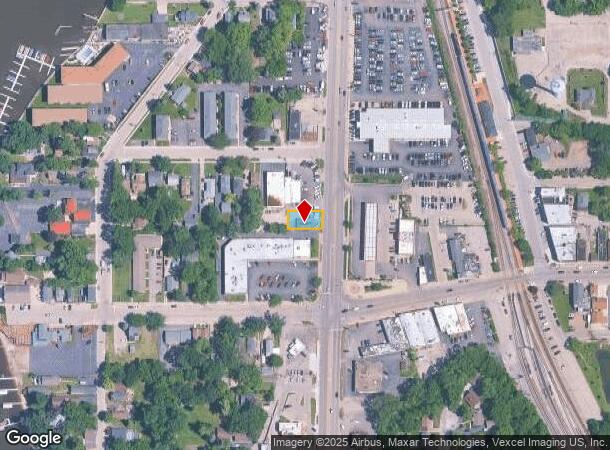
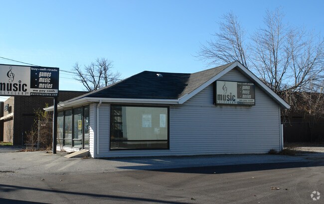
Property Record
12 N Us Highway 12, Fox Lake, IL 60020

NEARBY LISTINGS FOR SALE OR LEASE
Property Detail
12 N Us Highway 12
Chicago-Naperville-Elgin, IL-IN-WI
J.L.Tweed-S Pistakee Lake Sub
05-09-212-019
J.L.TWEED-S PISTAKEE LAKE SUB (EX N150FT)LOTS 23 & 24
Commercialbuilding
Lake
X
Illinois
17097C0020K
23,24
2023
0.12 AC
2024
Central Northwest
860908
Chicago
DEMOGRAPHICS near 12 N Us Highway 12
1 Mile
3 Mile
5 Mile
2024 Total Population
4,630
32,436
83,468
2029 Population
4,666
32,612
83,539
Pop Growth 2024-2029
+ 0.78%
+ 0.54%
+ 0.09%
Average Age
44
43
41
2024 Total Households
2,128
13,507
31,993
HH Growth 2024-2029
+ 0.70%
+ 0.53%
+ 0.15%
Median Household Inc
$59,961
$76,848
$85,266
Avg Household Size
2.10
2.40
2.60
2024 Avg HH Vehicles
2.00
2.00
2.00
Median Home Value
$196,642
$217,427
$228,529
Median Year Built
1959
1973
1983
Nearby Places
Map Layers
Map Styles
 Street
 Aerial
- Restaurants
- Banks
- Shops
- Fitness
- Groceries
PUBLIC TRANSPORTATION
COMMUTER RAIL
Fox Lake Station (Milwaukee District North Line - Northeast Illinois Regional Commuter Railroad (Metra))
DRIVE
WALK
Distance
Fox Lake Station (Milwaukee District North Line - Northeast Illinois Regional Commuter Railroad (Metra))
1 min
13 min
0.1 mi
Ingleside Station (Milwaukee District North Line - Northeast Illinois Regional Commuter Railroad (Metra))
DRIVE
WALK
Distance
Ingleside Station (Milwaukee District North Line - Northeast Illinois Regional Commuter Railroad (Metra))
6 min
2.1 mi
AIRPORT
Chicago O'Hare International
DRIVE
WALK
Distance
Chicago O'Hare International
74 min
42.6 mi
Freight Ports
Port Milwaukee
DRIVE
WALK
Distance
Port Milwaukee
74 min
55.9 mi
Nearby Properties
Address
Land Use
TOTAL SIZE
Lot Size
Zoning
Address
Land Use
TOTAL SIZE
Lot Size
Zoning
6.18 AC
Address
Land Use
TOTAL SIZE
Lot Size
Zoning
10.91 AC
Address
Land Use
TOTAL SIZE
Lot Size
Zoning
6.54 AC
Address
Land Use
TOTAL SIZE
Lot Size
Zoning
11.05 AC
Address
Land Use
TOTAL SIZE
Lot Size
Zoning
Address
Land Use
TOTAL SIZE
Lot Size
Zoning
2.34 AC
Address
Land Use
TOTAL SIZE
Lot Size
Zoning
4.04 AC
Address
Land Use
TOTAL SIZE
Lot Size
Zoning
Address
Land Use
TOTAL SIZE
Lot Size
Zoning
3.43 AC
Address
Land Use
TOTAL SIZE
Lot Size
Zoning
4.28 AC
Address
Land Use
TOTAL SIZE
Lot Size
Zoning
4.40 AC
Address
Land Use
TOTAL SIZE
Lot Size
Zoning
Address
Land Use
TOTAL SIZE
Lot Size
Zoning
10.02 AC
Address
Land Use
TOTAL SIZE
Lot Size
Zoning
21.50 AC
Address
Land Use
TOTAL SIZE
Lot Size
Zoning
7,600 SF
0.50 AC
Address
Land Use
TOTAL SIZE
Lot Size
Zoning
Address
Land Use
TOTAL SIZE
Lot Size
Zoning
1.95 AC
Address
Land Use
TOTAL SIZE
Lot Size
Zoning
10.22 AC
Address
Land Use
TOTAL SIZE
Lot Size
Zoning
0.38 AC
Address
Land Use
TOTAL SIZE
Lot Size
Zoning
7,200 SF
4.99 AC
Address
Land Use
TOTAL SIZE
Lot Size
Zoning
37,010 SF
2.90 AC
Address
Land Use
TOTAL SIZE
Lot Size
Zoning
1.39 AC
Address
Land Use
TOTAL SIZE
Lot Size
Zoning
2.16 AC
Address
Land Use
TOTAL SIZE
Lot Size
Zoning
0.40 AC
Address
Land Use
TOTAL SIZE
Lot Size
Zoning
0.61 AC
Address
Land Use
TOTAL SIZE
Lot Size
Zoning
Address
Land Use
TOTAL SIZE
Lot Size
Zoning
4.99 AC
Address
Land Use
TOTAL SIZE
Lot Size
Zoning
29,802 SF
4.40 AC
Address
Land Use
TOTAL SIZE
Lot Size
Zoning
0.19 AC
Address
Land Use
TOTAL SIZE
Lot Size
Zoning
28,216 SF
2.93 AC
The World's #1 Commercial Real Estate Marketplace
Connect with us
© 2025 CoStar Group
The information above has been obtained from sources believed reliable. While we do not doubt its accuracy we have not verified it and make no guarantee, warranty or representation about it. It is your responsibility to independently confirm its accuracy and completeness. Any projections, opinions, assumptions, or estimates used are for example only and do not represent the current or future performance of the property. The value of this transaction to you depends on tax and other factors which should be evaluated by your tax, financial, and legal advisors. You and your advisors should conduct a careful, independent investigation of the property to determine to your satisfaction the suitability of the property for your needs.