Property Record
12 Old Charlotte Hwy, Asheville, NC 28803


NEARBY LISTINGS FOR SALE OR LEASE
Property Detail
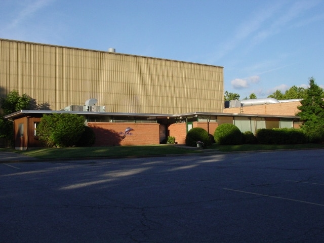
12 Old Charlotte Hwy
Asheville, NC
Lmc
9668-00-2840-00000
SUBDIV: LMC BLOCK: LOT: 2 SECTION: PLAT: 0126-0185
Industrialgeneral
Buncombe
X
North Carolina
3700966800J
2
2024
10.10 AC
2025
East Asheville
001900
Asheville
81,624 SF
DEMOGRAPHICS near 12 Old Charlotte Hwy
1 Mile
3 Mile
5 Mile
2024 Total Population
3,361
34,220
79,545
2029 Population
3,490
35,433
82,558
Pop Growth 2024-2029
+ 3.84%
+ 3.54%
+ 3.79%
Average Age
44
44
43
2024 Total Households
1,672
16,113
36,620
HH Growth 2024-2029
+ 3.41%
+ 3.02%
+ 3.31%
Median Household Inc
$55,989
$62,532
$64,890
Avg Household Size
2.00
2.10
2.00
2024 Avg HH Vehicles
2.00
2.00
2.00
Median Home Value
$258,638
$331,206
$377,325
Median Year Built
1981
1985
1982
Nearby Places
Map Layers
Map Styles
 Street
 Aerial
- Restaurants
- Banks
- Shops
- Fitness
- Groceries
PUBLIC TRANSPORTATION
AIRPORT
Asheville Regional
DRIVE
WALK
Distance
Asheville Regional
23 min
12.6 mi
Freight Ports
North Charleston Terminal
DRIVE
WALK
Distance
North Charleston Terminal
295 min
256.3 mi
SALE & LEASE HISTORY
LISTING DATE
SALE/LEASE

Sep 27, 2017
For Lease
Sep 22, 2022
For Lease
Aug 06, 2020
For Lease
Nearby Properties
Address
Land Use
TOTAL SIZE
Lot Size
Zoning
Address
Land Use
TOTAL SIZE
Lot Size
Zoning
1,663,129 SF
27.85 AC
INST
Address
Land Use
TOTAL SIZE
Lot Size
Zoning
316,968 SF
102.56 AC
PS
Address
Land Use
TOTAL SIZE
Lot Size
Zoning
125,122 SF
13.63 AC
UP
Address
Land Use
TOTAL SIZE
Lot Size
Zoning
81,765 SF
23.53 AC
HB
Address
Land Use
TOTAL SIZE
Lot Size
Zoning
170,226 SF
29.47 AC
INST
Address
Land Use
TOTAL SIZE
Lot Size
Zoning
426,688 SF
40.88 AC
UP
Address
Land Use
TOTAL SIZE
Lot Size
Zoning
93,321 SF
30.95 AC
NS
Address
Land Use
TOTAL SIZE
Lot Size
Zoning
79,701 SF
15.26 AC
RM16
Address
Land Use
TOTAL SIZE
Lot Size
Zoning
75,342 SF
8.07 AC
HB
Address
Land Use
TOTAL SIZE
Lot Size
Zoning
40,900 SF
13.77 AC
R-5
Address
Land Use
TOTAL SIZE
Lot Size
Zoning
74,409 SF
22.20 AC
NS
Address
Land Use
TOTAL SIZE
Lot Size
Zoning
150,650 SF
18.31 AC
IND
Address
Land Use
TOTAL SIZE
Lot Size
Zoning
71,241 SF
7.75 AC
HB
Address
Land Use
TOTAL SIZE
Lot Size
Zoning
53,842 SF
8.08 AC
RM16
Address
Land Use
TOTAL SIZE
Lot Size
Zoning
45.86 AC
INST
Address
Land Use
TOTAL SIZE
Lot Size
Zoning
100,643 SF
15.06 AC
INST
Address
Land Use
TOTAL SIZE
Lot Size
Zoning
28,047 SF
4.71 AC
INST
Address
Land Use
TOTAL SIZE
Lot Size
Zoning
130,636 SF
13.19 AC
UP
Address
Land Use
TOTAL SIZE
Lot Size
Zoning
41,094 SF
1.08 AC
R-5
Address
Land Use
TOTAL SIZE
Lot Size
Zoning
91,448 SF
8.78 AC
INST
Address
Land Use
TOTAL SIZE
Lot Size
Zoning
90,832 SF
1,103.09 AC
CR
Address
Land Use
TOTAL SIZE
Lot Size
Zoning
153,820 SF
13.79 AC
UP
Address
Land Use
TOTAL SIZE
Lot Size
Zoning
47,416 SF
7 AC
RS8
Address
Land Use
TOTAL SIZE
Lot Size
Zoning
75,979 SF
10.40 AC
R-3
Address
Land Use
TOTAL SIZE
Lot Size
Zoning
60,156 SF
18.46 AC
RM8
Address
Land Use
TOTAL SIZE
Lot Size
Zoning
103,258 SF
0.62 AC
CBII
Address
Land Use
TOTAL SIZE
Lot Size
Zoning
141,911 SF
51.27 AC
RM16
Address
Land Use
TOTAL SIZE
Lot Size
Zoning
118,407 SF
11 AC
UP
Address
Land Use
TOTAL SIZE
Lot Size
Zoning
32,858 SF
13.52 AC
INST
Address
Land Use
TOTAL SIZE
Lot Size
Zoning
220,408 SF
21.03 AC
UP
The World's #1 Commercial Real Estate Marketplace
Connect with us
© 2026 CoStar Group
The information above has been obtained from sources believed reliable. While we do not doubt its accuracy we have not verified it and make no guarantee, warranty or representation about it. It is your responsibility to independently confirm its accuracy and completeness. Any projections, opinions, assumptions, or estimates used are for example only and do not represent the current or future performance of the property. The value of this transaction to you depends on tax and other factors which should be evaluated by your tax, financial, and legal advisors. You and your advisors should conduct a careful, independent investigation of the property to determine to your satisfaction the suitability of the property for your needs.