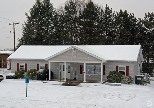
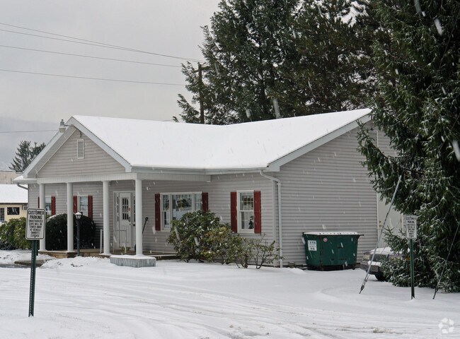
Property Record
12 Oriole Rd, Lock Haven, PA 17745

Property Detail
12 Oriole Rd
036-17802
35 & 36
Officebuilding
Clinton
B and X Area of moderate flood hazard, usually the area between the limits of the 100-year and 500-year floods.
Pennsylvania
2026
0.45 AC
2026
Pennsylvania Central Area
030300
Other Market Areas
3,804 SF
Lock Haven, PA
NEARBY LISTINGS FOR SALE OR LEASE
-
-
View all Lock Haven listings for sale on LoopNet.com
DEMOGRAPHICS near 12 Oriole Rd
1 mile
3 mile
5 mile
2025 Total Population
2,481
14,570
21,400
2030 Population
2,448
14,522
21,192
Pop Growth 2025-2030
(1.33%)
(0.33%)
(0.97%)
Average Age
42
40
41
2025 Total Households
1,048
5,843
8,545
HH Growth 2025-2030
(1.43%)
(0.43%)
(1.06%)
Median Household Inc
$56,567
$47,776
$53,824
Avg Household Size
2.30
2.20
2.30
2025 Avg HH Vehicles
2.00
2.00
2.00
Median Home Value
$195,437
$166,885
$181,815
Median Year Built
1969
1965
1967
Nearby Places
Map Layers
Map Styles
 Street
 Aerial
Layers
 Traffic
 Biking
Places
Listings with unknown addresses are not visible on the map
- Restaurants
- Banks
- Shops
- Fitness
- Groceries
PUBLIC TRANSPORTATION
AIRPORT
State College Regional
Drive
Walk
Distance
State College Regional
56 min
35.0 mi
Nearby Properties
Address
Land Use
TOTAL SIZE
Lot Size
Zoning
Address
Land Use
TOTAL SIZE
Lot Size
Zoning
277.71 AC
Address
Land Use
TOTAL SIZE
Lot Size
Zoning
12,048 SF
4.75 AC
PI
Address
Land Use
TOTAL SIZE
Lot Size
Zoning
80,760 SF
4.37 AC
PI
Address
Land Use
TOTAL SIZE
Lot Size
Zoning
10.48 AC
Address
Land Use
TOTAL SIZE
Lot Size
Zoning
85,160 SF
1.48 AC
PI
Address
Land Use
TOTAL SIZE
Lot Size
Zoning
64,140 SF
3.45 AC
Address
Land Use
TOTAL SIZE
Lot Size
Zoning
10,659 SF
12.85 AC
RM
Address
Land Use
TOTAL SIZE
Lot Size
Zoning
75,172 SF
0.28 AC
PI
Address
Land Use
TOTAL SIZE
Lot Size
Zoning
94,336 SF
1.87 AC
PI
Address
Land Use
TOTAL SIZE
Lot Size
Zoning
106,857 SF
6.56 AC
PI
Address
Land Use
TOTAL SIZE
Lot Size
Zoning
52,120 SF
1.98 AC
PI
Address
Land Use
TOTAL SIZE
Lot Size
Zoning
2,440 SF
8.02 AC
RM
Address
Land Use
TOTAL SIZE
Lot Size
Zoning
108,536 SF
1.59 AC
Address
Land Use
TOTAL SIZE
Lot Size
Zoning
33,240 SF
4.49 AC
Address
Land Use
TOTAL SIZE
Lot Size
Zoning
1,896 SF
2.19 AC
Address
Land Use
TOTAL SIZE
Lot Size
Zoning
54,138 SF
2.92 AC
Address
Land Use
TOTAL SIZE
Lot Size
Zoning
68,560 SF
1.47 AC
Address
Land Use
TOTAL SIZE
Lot Size
Zoning
76,398 SF
4.10 AC
RH
Address
Land Use
TOTAL SIZE
Lot Size
Zoning
27,540 SF
102.11 AC
AI
Address
Land Use
TOTAL SIZE
Lot Size
Zoning
57,893 SF
0.75 AC
Address
Land Use
TOTAL SIZE
Lot Size
Zoning
26,784 SF
1.97 AC
GC
Address
Land Use
TOTAL SIZE
Lot Size
Zoning
31,063 SF
1.20 AC
GC
Address
Land Use
TOTAL SIZE
Lot Size
Zoning
963,220 SF
16.93 AC
Address
Land Use
TOTAL SIZE
Lot Size
Zoning
60,026 SF
5.29 AC
GC
Address
Land Use
TOTAL SIZE
Lot Size
Zoning
20,348 SF
5.22 AC
I
Address
Land Use
TOTAL SIZE
Lot Size
Zoning
20,050 SF
42.38 AC
Address
Land Use
TOTAL SIZE
Lot Size
Zoning
1,232 SF
3.50 AC
RM
Address
Land Use
TOTAL SIZE
Lot Size
Zoning
22,084 SF
0.64 AC
Address
Land Use
TOTAL SIZE
Lot Size
Zoning
44,788 SF
3.65 AC
AI
Address
Land Use
TOTAL SIZE
Lot Size
Zoning
61,020 SF
2.07 AC
The World's #1 Commercial Real Estate Marketplace
Connect with us
© 2026 CoStar Group
The information above has been obtained from sources believed reliable. While we do not doubt its accuracy we have not verified it and make no guarantee, warranty or representation about it. It is your responsibility to independently confirm its accuracy and completeness. Any projections, opinions, assumptions, or estimates used are for example only and do not represent the current or future performance of the property. The value of this transaction to you depends on tax and other factors which should be evaluated by your tax, financial, and legal advisors. You and your advisors should conduct a careful, independent investigation of the property to determine to your satisfaction the suitability of the property for your needs.