Property Record
12 Park Ave, Hudson, NH 03051


NEARBY LISTINGS FOR SALE OR LEASE
-
-
View all Hudson listings for sale on LoopNet.com
Property Detail
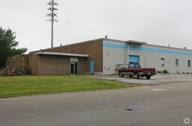
12 Park Ave
Warehouse
Hillsborough
X
New Hampshire
33011C0519D
2.17 AC
2024
Hillsborough
2024
Boston
012301
Manchester-Nashua, NH
36,068 SF
HDSO-000162-000002
DEMOGRAPHICS near 12 Park Ave
1 Mile
3 Mile
5 Mile
2024 Total Population
2,366
21,865
83,458
2029 Population
2,451
22,524
85,607
Pop Growth 2024-2029
+ 3.59%
+ 3.01%
+ 2.57%
Average Age
41
41
41
2024 Total Households
877
7,916
32,107
HH Growth 2024-2029
+ 3.53%
+ 2.98%
+ 2.50%
Median Household Inc
$123,479
$127,916
$100,113
Avg Household Size
2.70
2.70
2.50
2024 Avg HH Vehicles
2.00
2.00
2.00
Median Home Value
$370,615
$405,523
$405,242
Median Year Built
1988
1986
1976
Nearby Places
Map Layers
Map Styles
 Street
 Aerial
- Restaurants
- Banks
- Shops
- Fitness
- Groceries
PUBLIC TRANSPORTATION
AIRPORT
Manchester Boston Regional
DRIVE
WALK
Distance
Manchester Boston Regional
32 min
14.8 mi
General Edward Lawrence Logan International
DRIVE
WALK
Distance
General Edward Lawrence Logan International
60 min
43.9 mi
Freight Ports
Port of Boston
DRIVE
WALK
Distance
Port of Boston
61 min
43.6 mi
Nearby Properties
Address
Land Use
TOTAL SIZE
Lot Size
Zoning
Address
Land Use
TOTAL SIZE
Lot Size
Zoning
148,042 SF
28.53 AC
R2
Address
Land Use
TOTAL SIZE
Lot Size
Zoning
12,876 SF
12.55 AC
BD
Address
Land Use
TOTAL SIZE
Lot Size
Zoning
145,344 SF
8.80 AC
ID
Address
Land Use
TOTAL SIZE
Lot Size
Zoning
119,547 SF
3.78 AC
BD
Address
Land Use
TOTAL SIZE
Lot Size
Zoning
89,496 SF
3.04 AC
BD
Address
Land Use
TOTAL SIZE
Lot Size
Zoning
69,900 SF
18.10 AC
BD
Address
Land Use
TOTAL SIZE
Lot Size
Zoning
115,747 SF
9.99 AC
ID
Address
Land Use
TOTAL SIZE
Lot Size
Zoning
14,400 SF
4.10 AC
BD
Address
Land Use
TOTAL SIZE
Lot Size
Zoning
17,214 SF
18.60 AC
ID
Address
Land Use
TOTAL SIZE
Lot Size
Zoning
684 SF
178.86 AC
G1
Address
Land Use
TOTAL SIZE
Lot Size
Zoning
80,145 SF
6.10 AC
ID
Address
Land Use
TOTAL SIZE
Lot Size
Zoning
13,890 SF
4.56 AC
ID
Address
Land Use
TOTAL SIZE
Lot Size
Zoning
57,012 SF
6.76 AC
ID
Address
Land Use
TOTAL SIZE
Lot Size
Zoning
1,352 SF
5.53 AC
BD
Address
Land Use
TOTAL SIZE
Lot Size
Zoning
66,000 SF
4.60 AC
BD
Address
Land Use
TOTAL SIZE
Lot Size
Zoning
48,675 SF
3.83 AC
ID
Address
Land Use
TOTAL SIZE
Lot Size
Zoning
78,595 SF
5.24 AC
ID
Address
Land Use
TOTAL SIZE
Lot Size
Zoning
31,424 SF
7.03 AC
BD
Address
Land Use
TOTAL SIZE
Lot Size
Zoning
37,590 SF
3.94 AC
ID
Address
Land Use
TOTAL SIZE
Lot Size
Zoning
165.22 AC
G1
Address
Land Use
TOTAL SIZE
Lot Size
Zoning
25,140 SF
3.64 AC
ID
Address
Land Use
TOTAL SIZE
Lot Size
Zoning
3,095 SF
5.61 AC
NBD
Address
Land Use
TOTAL SIZE
Lot Size
Zoning
31,370 SF
13.05 AC
ID
Address
Land Use
TOTAL SIZE
Lot Size
Zoning
38,314 SF
3.10 AC
BD
Address
Land Use
TOTAL SIZE
Lot Size
Zoning
26,764 SF
9.22 AC
R2
Address
Land Use
TOTAL SIZE
Lot Size
Zoning
3,000 SF
28.41 AC
G1
Address
Land Use
TOTAL SIZE
Lot Size
Zoning
2,800 SF
3.49 AC
BD
Address
Land Use
TOTAL SIZE
Lot Size
Zoning
6,100 SF
4.19 AC
I
Address
Land Use
TOTAL SIZE
Lot Size
Zoning
23,100 SF
4.17 AC
I
The World's #1 Commercial Real Estate Marketplace
Connect with us
© 2025 CoStar Group
The information above has been obtained from sources believed reliable. While we do not doubt its accuracy we have not verified it and make no guarantee, warranty or representation about it. It is your responsibility to independently confirm its accuracy and completeness. Any projections, opinions, assumptions, or estimates used are for example only and do not represent the current or future performance of the property. The value of this transaction to you depends on tax and other factors which should be evaluated by your tax, financial, and legal advisors. You and your advisors should conduct a careful, independent investigation of the property to determine to your satisfaction the suitability of the property for your needs.