Property Record
12 Pryor Dr, Chattanooga, TN 37421


Save to a Folder
{{folder.Name}}
{{folder.ListingIds.length}} Properties
{{folder.ListingIds.length}} Property
Create a New Folder
Current Lease Availabilities
Property Detail
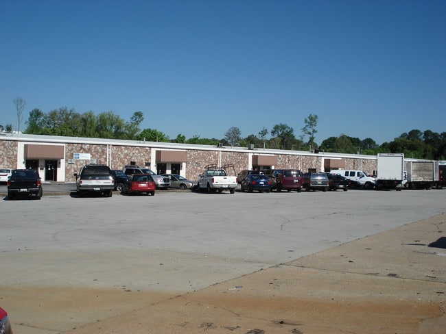
12 Pryor Dr
138A-A-002
LT 3 DIVISION OF PB 27 PG 191 REV 29-158 REV 29-175 REV 122-21 WAREHOUSE MART NO 2
Manufacturinglight
HAMILTON
M1
Tennessee
B and X Area of moderate flood hazard, usually the area between the limits of the 100-year and 500-year floods.
3
2025
3.44 AC
2025
Outlying Chattanooga
011321
Chattanooga
53,800 SF
Chattanooga, TN-GA
NEARBY LISTINGS FOR SALE OR LEASE
DEMOGRAPHICS near 12 Pryor Dr
1 mile
3 mile
5 mile
2025 Total Population
2,280
32,807
104,160
2030 Population
2,402
34,424
109,709
Pop Growth 2025-2030
+ 5.35%
+ 4.93%
+ 5.33%
Average Age
40
42
41
2025 Total Households
1,002
14,225
44,324
HH Growth 2025-2030
+ 5.49%
+ 5.10%
+ 5.51%
Median Household Inc
$70,380
$62,484
$62,295
Avg Household Size
2.20
2.20
2.20
2025 Avg HH Vehicles
2.00
2.00
2.00
Median Home Value
$195,560
$239,396
$279,504
Median Year Built
1982
1974
1975
Nearby Places
Map Layers
Map Styles
 Street
 Aerial
Layers
 Traffic
 Biking
Places
Listings with unknown addresses are not visible on the map
- Restaurants
- Banks
- Shops
- Fitness
- Groceries
PUBLIC TRANSPORTATION
AIRPORT
Lovell Field
Drive
Walk
Distance
Lovell Field
13 min
5.9 mi
Freight Ports
Georgia Ports - Savannah
Drive
Walk
Distance
Georgia Ports - Savannah
408 min
363.8 mi
Nearby Properties
Address
Land Use
TOTAL SIZE
Lot Size
Zoning
Address
Land Use
TOTAL SIZE
Lot Size
Zoning
831.19 AC
M1
Address
Land Use
TOTAL SIZE
Lot Size
Zoning
523,520 SF
12.03 AC
M1
Address
Land Use
TOTAL SIZE
Lot Size
Zoning
292,309 SF
45.28 AC
M1
Address
Land Use
TOTAL SIZE
Lot Size
Zoning
183 AC
R1
Address
Land Use
TOTAL SIZE
Lot Size
Zoning
242,788 SF
27 AC
Address
Land Use
TOTAL SIZE
Lot Size
Zoning
402,862 SF
26.14 AC
R1
Address
Land Use
TOTAL SIZE
Lot Size
Zoning
25,462 SF
16.20 AC
R1
Address
Land Use
TOTAL SIZE
Lot Size
Zoning
99,202 SF
17.32 AC
Address
Land Use
TOTAL SIZE
Lot Size
Zoning
291,314 SF
29.69 AC
M1
Address
Land Use
TOTAL SIZE
Lot Size
Zoning
82,000 SF
22.45 AC
M1
Address
Land Use
TOTAL SIZE
Lot Size
Zoning
236,880 SF
18.90 AC
R2
Address
Land Use
TOTAL SIZE
Lot Size
Zoning
6,912 SF
19.97 AC
Address
Land Use
TOTAL SIZE
Lot Size
Zoning
73.82 AC
Address
Land Use
TOTAL SIZE
Lot Size
Zoning
8,032 SF
19.80 AC
Address
Land Use
TOTAL SIZE
Lot Size
Zoning
17,800 SF
14.30 AC
R2
Address
Land Use
TOTAL SIZE
Lot Size
Zoning
94,369 SF
26.27 AC
R2
Address
Land Use
TOTAL SIZE
Lot Size
Zoning
140,200 SF
72 AC
Address
Land Use
TOTAL SIZE
Lot Size
Zoning
300,040 SF
26.51 AC
M1
Address
Land Use
TOTAL SIZE
Lot Size
Zoning
32,261 SF
6.43 AC
R1
Address
Land Use
TOTAL SIZE
Lot Size
Zoning
255,392 SF
17.92 AC
M1
Address
Land Use
TOTAL SIZE
Lot Size
Zoning
479,004 SF
22.70 AC
Address
Land Use
TOTAL SIZE
Lot Size
Zoning
67,735 SF
17.32 AC
M1
Address
Land Use
TOTAL SIZE
Lot Size
Zoning
72,906 SF
11.46 AC
M2
Address
Land Use
TOTAL SIZE
Lot Size
Zoning
121,276 SF
10.50 AC
R3
Address
Land Use
TOTAL SIZE
Lot Size
Zoning
240,000 SF
16.91 AC
IN
Address
Land Use
TOTAL SIZE
Lot Size
Zoning
207,500 SF
17.21 AC
Address
Land Use
TOTAL SIZE
Lot Size
Zoning
266,693 SF
21.57 AC
M1
Address
Land Use
TOTAL SIZE
Lot Size
Zoning
274,060 SF
20.11 AC
M1
Address
Land Use
TOTAL SIZE
Lot Size
Zoning
77,975 SF
11.93 AC
C2
Address
Land Use
TOTAL SIZE
Lot Size
Zoning
231,800 SF
11.51 AC
M1
The World's #1 Commercial Real Estate Marketplace
Connect with us
© 2026 CoStar Group
The information above has been obtained from sources believed reliable. While we do not doubt its accuracy we have not verified it and make no guarantee, warranty or representation about it. It is your responsibility to independently confirm its accuracy and completeness. Any projections, opinions, assumptions, or estimates used are for example only and do not represent the current or future performance of the property. The value of this transaction to you depends on tax and other factors which should be evaluated by your tax, financial, and legal advisors. You and your advisors should conduct a careful, independent investigation of the property to determine to your satisfaction the suitability of the property for your needs.