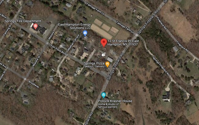
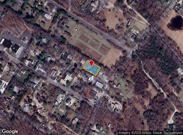
Property Record
12 St Francis Pl, East Hampton, NY 11937
This Property Is For Sale
NEARBY LISTINGS FOR SALE OR LEASE
-
-
View all East Hampton listings for sale on LoopNet.com
Property Detail
12 St Francis Pl
Nassau County-Suffolk County, NY
Montauk Manor
0300-062-00-03-00-012-001
BLK 5 LOT 1,2,3
Residentialacreage
Suffolk
X
New York
36103C0219H
12
2024
0.30 AC
2024
Eastern Suffolk
201010
Long Island (New York)
DEMOGRAPHICS near 12 St Francis Pl
1 Mile
3 Mile
5 Mile
2024 Total Population
3,723
14,995
27,940
2029 Population
3,897
15,745
29,247
Pop Growth 2024-2029
+ 4.67%
+ 5.00%
+ 4.68%
Average Age
42
43
44
2024 Total Households
1,332
5,613
10,640
HH Growth 2024-2029
+ 4.80%
+ 5.10%
+ 4.73%
Median Household Inc
$114,884
$129,882
$132,238
Avg Household Size
2.70
2.60
2.60
2024 Avg HH Vehicles
2.00
2.00
2.00
Median Home Value
$808,863
$837,121
$924,981
Median Year Built
1981
1980
1981
Nearby Places
Map Layers
Map Styles
 Street
 Aerial
- Restaurants
- Banks
- Shops
- Fitness
- Groceries
PUBLIC TRANSPORTATION
COMMUTER RAIL
Amagansett Station (Montauk Branch - Long Island Rail Road)
DRIVE
WALK
Distance
Amagansett Station (Montauk Branch - Long Island Rail Road)
9 min
4.5 mi
East Hampton Station (Montauk Branch - Long Island Rail Road)
DRIVE
WALK
Distance
East Hampton Station (Montauk Branch - Long Island Rail Road)
11 min
5.2 mi
Freight Ports
Port of New Haven
DRIVE
WALK
Distance
Port of New Haven
208 min
93.9 mi
Nearby Properties
Address
Land Use
TOTAL SIZE
Lot Size
Zoning
Address
Land Use
TOTAL SIZE
Lot Size
Zoning
0.69 AC
CR60
Address
Land Use
TOTAL SIZE
Lot Size
Zoning
Address
Land Use
TOTAL SIZE
Lot Size
Zoning
9.50 AC
Address
Land Use
TOTAL SIZE
Lot Size
Zoning
Address
Land Use
TOTAL SIZE
Lot Size
Zoning
79.86 AC
Address
Land Use
TOTAL SIZE
Lot Size
Zoning
7.30 AC
IND1
Address
Land Use
TOTAL SIZE
Lot Size
Zoning
Address
Land Use
TOTAL SIZE
Lot Size
Zoning
Address
Land Use
TOTAL SIZE
Lot Size
Zoning
165.40 AC
Address
Land Use
TOTAL SIZE
Lot Size
Zoning
189.42 AC
Address
Land Use
TOTAL SIZE
Lot Size
Zoning
Address
Land Use
TOTAL SIZE
Lot Size
Zoning
Address
Land Use
TOTAL SIZE
Lot Size
Zoning
171.95 AC
Address
Land Use
TOTAL SIZE
Lot Size
Zoning
29.30 AC
Address
Land Use
TOTAL SIZE
Lot Size
Zoning
21.80 AC
Address
Land Use
TOTAL SIZE
Lot Size
Zoning
60.10 AC
Address
Land Use
TOTAL SIZE
Lot Size
Zoning
Address
Land Use
TOTAL SIZE
Lot Size
Zoning
Address
Land Use
TOTAL SIZE
Lot Size
Zoning
Address
Land Use
TOTAL SIZE
Lot Size
Zoning
Address
Land Use
TOTAL SIZE
Lot Size
Zoning
7.64 AC
Address
Land Use
TOTAL SIZE
Lot Size
Zoning
25.60 AC
Address
Land Use
TOTAL SIZE
Lot Size
Zoning
Address
Land Use
TOTAL SIZE
Lot Size
Zoning
Address
Land Use
TOTAL SIZE
Lot Size
Zoning
Address
Land Use
TOTAL SIZE
Lot Size
Zoning
Address
Land Use
TOTAL SIZE
Lot Size
Zoning
43.84 AC
Address
Land Use
TOTAL SIZE
Lot Size
Zoning
Address
Land Use
TOTAL SIZE
Lot Size
Zoning
Address
Land Use
TOTAL SIZE
Lot Size
Zoning
The World's #1 Commercial Real Estate Marketplace
Connect with us
© 2026 CoStar Group
The information above has been obtained from sources believed reliable. While we do not doubt its accuracy we have not verified it and make no guarantee, warranty or representation about it. It is your responsibility to independently confirm its accuracy and completeness. Any projections, opinions, assumptions, or estimates used are for example only and do not represent the current or future performance of the property. The value of this transaction to you depends on tax and other factors which should be evaluated by your tax, financial, and legal advisors. You and your advisors should conduct a careful, independent investigation of the property to determine to your satisfaction the suitability of the property for your needs.