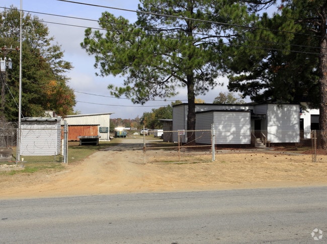
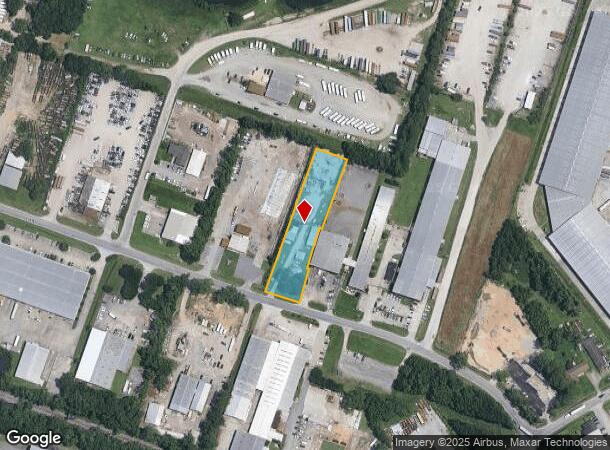
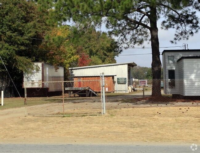
Property Record
12 Telfair Pl, Savannah, GA 31415
NEARBY LISTINGS FOR SALE OR LEASE
Property Detail
12 Telfair Pl
Savannah, GA
Sub
6073701015
LOT 26A SUB OF LOT 26 PLAZA INDU STRIAL PARK PHASE 1 BOOK 50 P
Publicstorage
Chatham
X
Georgia
13051C0134G
26,26a
2024
1.28 AC
2025
Greater Savannah
000601
Savannah
1,236 SF
DEMOGRAPHICS near 12 Telfair Pl
1 Mile
3 Mile
5 Mile
2024 Total Population
2,567
34,621
92,898
2029 Population
2,622
36,331
97,535
Pop Growth 2024-2029
+ 2.14%
+ 4.94%
+ 4.99%
Average Age
35
38
38
2024 Total Households
601
13,000
37,930
HH Growth 2024-2029
+ 1.83%
+ 5.35%
+ 5.38%
Median Household Inc
$57,181
$40,591
$48,501
Avg Household Size
2.00
2.40
2.20
2024 Avg HH Vehicles
2.00
1.00
1.00
Median Home Value
$98,147
$129,696
$225,707
Median Year Built
1998
1973
1962
Nearby Places
Map Layers
Map Styles
 Street
 Aerial
- Restaurants
- Banks
- Shops
- Fitness
- Groceries
PUBLIC TRANSPORTATION
COMMUTER RAIL
Savannah (Palmetto - Amtrak, Silver Meteor - Amtrak, Silver Star - Amtrak)
DRIVE
WALK
Distance
Savannah (Palmetto - Amtrak, Silver Meteor - Amtrak, Silver Star - Amtrak)
3 min
17 min
0.9 mi
AIRPORT
Savannah/Hilton Head International
DRIVE
WALK
Distance
Savannah/Hilton Head International
14 min
6.0 mi
Hilton Head
DRIVE
WALK
Distance
Hilton Head
63 min
46.2 mi
Freight Ports
Georgia Ports - Savannah
DRIVE
WALK
Distance
Georgia Ports - Savannah
10 min
4.4 mi
Nearby Properties
Address
Land Use
TOTAL SIZE
Lot Size
Zoning
Address
Land Use
TOTAL SIZE
Lot Size
Zoning
1,400 SF
6.97 AC
D-X
Address
Land Use
TOTAL SIZE
Lot Size
Zoning
226,440 SF
270.14 AC
I-1
Address
Land Use
TOTAL SIZE
Lot Size
Zoning
7,500 SF
382.12 AC
I-H
Address
Land Use
TOTAL SIZE
Lot Size
Zoning
3,515 SF
61.21 AC
I1
Address
Land Use
TOTAL SIZE
Lot Size
Zoning
40,848 SF
19.50 AC
RIN
Address
Land Use
TOTAL SIZE
Lot Size
Zoning
691,228 SF
48.27 AC
I-1
Address
Land Use
TOTAL SIZE
Lot Size
Zoning
489,483 SF
35 AC
PUDB
Address
Land Use
TOTAL SIZE
Lot Size
Zoning
29.50 AC
IL
Address
Land Use
TOTAL SIZE
Lot Size
Zoning
34,224 SF
20 AC
C-1
Address
Land Use
TOTAL SIZE
Lot Size
Zoning
479,600 SF
28.24 AC
IH
Address
Land Use
TOTAL SIZE
Lot Size
Zoning
21,316 SF
26.07 AC
PUDM18
Address
Land Use
TOTAL SIZE
Lot Size
Zoning
32,190 SF
22.11 AC
PUDBR
Address
Land Use
TOTAL SIZE
Lot Size
Zoning
29,304 SF
27.20 AC
R3
Address
Land Use
TOTAL SIZE
Lot Size
Zoning
33,432 SF
16.38 AC
PUDB
Address
Land Use
TOTAL SIZE
Lot Size
Zoning
495,600 SF
35.64 AC
I-H
Address
Land Use
TOTAL SIZE
Lot Size
Zoning
8,100 SF
428.50 AC
I-H
Address
Land Use
TOTAL SIZE
Lot Size
Zoning
810 SF
20 AC
Address
Land Use
TOTAL SIZE
Lot Size
Zoning
384,000 SF
48.45 AC
I-H
Address
Land Use
TOTAL SIZE
Lot Size
Zoning
500 SF
24.13 AC
I-1
Address
Land Use
TOTAL SIZE
Lot Size
Zoning
251,630 SF
20.78 AC
M
Address
Land Use
TOTAL SIZE
Lot Size
Zoning
304,675 SF
19.40 AC
I-H
Address
Land Use
TOTAL SIZE
Lot Size
Zoning
67,656 SF
59.88 AC
M
Address
Land Use
TOTAL SIZE
Lot Size
Zoning
175,552 SF
1.12 AC
RM25
Address
Land Use
TOTAL SIZE
Lot Size
Zoning
315,980 SF
25.95 AC
I-H
Address
Land Use
TOTAL SIZE
Lot Size
Zoning
31,710 SF
15.91 AC
PUDBR
Address
Land Use
TOTAL SIZE
Lot Size
Zoning
3,848 SF
9.14 AC
PBG
Address
Land Use
TOTAL SIZE
Lot Size
Zoning
304,000 SF
17.02 AC
I-H
Address
Land Use
TOTAL SIZE
Lot Size
Zoning
11,888 SF
24.99 AC
I-H
Address
Land Use
TOTAL SIZE
Lot Size
Zoning
248,000 SF
15.86 AC
I-H
Address
Land Use
TOTAL SIZE
Lot Size
Zoning
5,210 SF
57 AC
I-H
The World's #1 Commercial Real Estate Marketplace
Connect with us
© 2025 CoStar Group
The information above has been obtained from sources believed reliable. While we do not doubt its accuracy we have not verified it and make no guarantee, warranty or representation about it. It is your responsibility to independently confirm its accuracy and completeness. Any projections, opinions, assumptions, or estimates used are for example only and do not represent the current or future performance of the property. The value of this transaction to you depends on tax and other factors which should be evaluated by your tax, financial, and legal advisors. You and your advisors should conduct a careful, independent investigation of the property to determine to your satisfaction the suitability of the property for your needs.