Property Record
12 Two Rod Rd, Rochester, NH 03867

Save to a Folder
{{folder.Name}}
{{folder.ListingIds.length}} Properties
{{folder.ListingIds.length}} Property
Create a New Folder
Property Detail
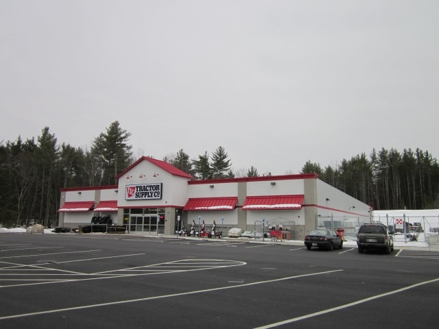
12 Two Rod Rd
RCHE-000208-000001-000002
Strafford
Storebuilding
New Hampshire
GRD
2
B and X Area of moderate flood hazard, usually the area between the limits of the 100-year and 500-year floods.
5.44 AC
2025
Strafford County
2025
Boston
084600
Boston-Cambridge-Newton, MA-NH
18,875 SF
NEARBY LISTINGS FOR SALE OR LEASE
DEMOGRAPHICS near 12 Two Rod Rd
1 mile
3 mile
5 mile
2025 Total Population
635
13,505
37,243
2030 Population
651
13,685
37,852
Pop Growth 2025-2030
+ 2.52%
+ 1.33%
+ 1.64%
Average Age
46
43
43
2025 Total Households
283
5,767
15,539
HH Growth 2025-2030
+ 2.47%
+ 1.28%
+ 1.62%
Median Household Inc
$78,629
$74,789
$74,511
Avg Household Size
2.20
2.30
2.30
2025 Avg HH Vehicles
2.00
2.00
2.00
Median Home Value
$406,896
$297,175
$315,898
Median Year Built
1988
1978
1978
Nearby Places
Map Layers
Map Styles
 Street
 Aerial
Layers
 Traffic
 Biking
Places
Listings with unknown addresses are not visible on the map
- Restaurants
- Banks
- Shops
- Fitness
- Groceries
PUBLIC TRANSPORTATION
AIRPORT
Portsmouth International at Pease
Drive
Walk
Distance
Portsmouth International at Pease
33 min
22.5 mi
Manchester Boston Regional
Drive
Walk
Distance
Manchester Boston Regional
76 min
49.9 mi
Freight Ports
Portland, ME
Drive
Walk
Distance
Portland, ME
76 min
52.4 mi
Nearby Properties
Address
Land Use
TOTAL SIZE
Lot Size
Zoning
Address
Land Use
TOTAL SIZE
Lot Size
Zoning
483,789 SF
37 AC
R2
Address
Land Use
TOTAL SIZE
Lot Size
Zoning
274,144 SF
73.08 AC
GRD
Address
Land Use
TOTAL SIZE
Lot Size
Zoning
224,153 SF
34.36 AC
GRD
Address
Land Use
TOTAL SIZE
Lot Size
Zoning
78,768 SF
10.92 AC
A
Address
Land Use
TOTAL SIZE
Lot Size
Zoning
86,420 SF
3.30 AC
DTC
Address
Land Use
TOTAL SIZE
Lot Size
Zoning
77,712 SF
10.99 AC
A
Address
Land Use
TOTAL SIZE
Lot Size
Zoning
114,867 SF
17.23 AC
HC
Address
Land Use
TOTAL SIZE
Lot Size
Zoning
59,235 SF
22.08 AC
A
Address
Land Use
TOTAL SIZE
Lot Size
Zoning
236,340 SF
27.68 AC
HC
Address
Land Use
TOTAL SIZE
Lot Size
Zoning
68,535 SF
7.10 AC
R2
Address
Land Use
TOTAL SIZE
Lot Size
Zoning
58,500 SF
11.55 AC
R2
Address
Land Use
TOTAL SIZE
Lot Size
Zoning
111,807 SF
31.93 AC
HC
Address
Land Use
TOTAL SIZE
Lot Size
Zoning
221,995 SF
35.47 AC
IND
Address
Land Use
TOTAL SIZE
Lot Size
Zoning
13.34 AC
HC
Address
Land Use
TOTAL SIZE
Lot Size
Zoning
84,700 SF
5.76 AC
GRD
Address
Land Use
TOTAL SIZE
Lot Size
Zoning
51,968 SF
5.40 AC
R2
Address
Land Use
TOTAL SIZE
Lot Size
Zoning
16,444 SF
6.41 AC
GRD
Address
Land Use
TOTAL SIZE
Lot Size
Zoning
66,786 SF
2.41 AC
R2
Address
Land Use
TOTAL SIZE
Lot Size
Zoning
2,022 SF
5.01 AC
R2
Address
Land Use
TOTAL SIZE
Lot Size
Zoning
213,745 SF
19.98 AC
IND
Address
Land Use
TOTAL SIZE
Lot Size
Zoning
66,899 SF
8.86 AC
HC
Address
Land Use
TOTAL SIZE
Lot Size
Zoning
114,452 SF
5.81 AC
NMU
Address
Land Use
TOTAL SIZE
Lot Size
Zoning
150,000 SF
20.10 AC
IND
Address
Land Use
TOTAL SIZE
Lot Size
Zoning
4,000 SF
68 AC
GRD
Address
Land Use
TOTAL SIZE
Lot Size
Zoning
87.64 AC
A
Address
Land Use
TOTAL SIZE
Lot Size
Zoning
65,452 SF
8.87 AC
HC
Address
Land Use
TOTAL SIZE
Lot Size
Zoning
169 AC
RA
Address
Land Use
TOTAL SIZE
Lot Size
Zoning
46,610 SF
3.43 AC
HC
Address
Land Use
TOTAL SIZE
Lot Size
Zoning
32,506 SF
12.36 AC
GRD
Address
Land Use
TOTAL SIZE
Lot Size
Zoning
21,784 SF
6.09 AC
GRD
The World's #1 Commercial Real Estate Marketplace
Connect with us
© 2026 CoStar Group
The information above has been obtained from sources believed reliable. While we do not doubt its accuracy we have not verified it and make no guarantee, warranty or representation about it. It is your responsibility to independently confirm its accuracy and completeness. Any projections, opinions, assumptions, or estimates used are for example only and do not represent the current or future performance of the property. The value of this transaction to you depends on tax and other factors which should be evaluated by your tax, financial, and legal advisors. You and your advisors should conduct a careful, independent investigation of the property to determine to your satisfaction the suitability of the property for your needs.