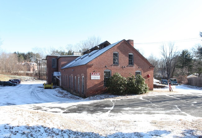
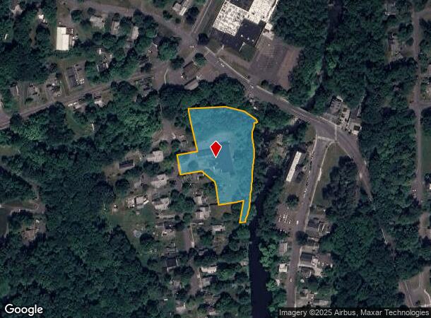
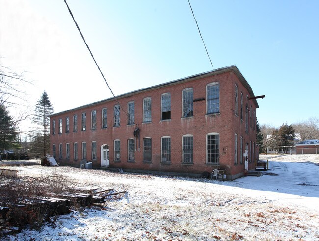
Property Record
12 Water St, Leeds, MA 01053
NEARBY LISTINGS FOR SALE OR LEASE
Property Detail
12 Water St
Springfield, MA
Hampshire
NHAM-000010B-000061-000001
Massachusetts
Manufacturinglight
1
2025
3.40 AC
2025
Hampshire County
821700
Hartford
17,834 SF
DEMOGRAPHICS near 12 Water St
1 Mile
3 Mile
5 Mile
2024 Total Population
1,636
10,820
32,160
2029 Population
1,294
8,537
25,652
Pop Growth 2024-2029
(20.90%)
(21.10%)
(20.24%)
Average Age
51
48
44
2024 Total Households
670
4,758
13,911
HH Growth 2024-2029
(21.64%)
(22.11%)
(22.08%)
Median Household Inc
$89,414
$77,927
$76,014
Avg Household Size
2.20
2.10
2.10
2024 Avg HH Vehicles
2.00
2.00
2.00
Median Home Value
$399,114
$364,248
$388,160
Median Year Built
1976
1961
1957
Nearby Places
Map Layers
Map Styles
 Street
 Aerial
- Restaurants
- Banks
- Shops
- Fitness
- Groceries
PUBLIC TRANSPORTATION
COMMUTER RAIL
DRIVE
WALK
Distance
13 min
5.3 mi
AIRPORT
Bradley International
DRIVE
WALK
Distance
Bradley International
61 min
34.6 mi
SALE & LEASE HISTORY
LISTING DATE
SALE/LEASE

Sep 25, 2016
For Lease
Nearby Properties
Address
Land Use
TOTAL SIZE
Lot Size
Zoning
Address
Land Use
TOTAL SIZE
Lot Size
Zoning
143,471 SF
22.12 AC
URA
Address
Land Use
TOTAL SIZE
Lot Size
Zoning
26.50 AC
URB
Address
Land Use
TOTAL SIZE
Lot Size
Zoning
30.42 AC
URB
Address
Land Use
TOTAL SIZE
Lot Size
Zoning
131.99 AC
HB
Address
Land Use
TOTAL SIZE
Lot Size
Zoning
4.73 AC
URA
Address
Land Use
TOTAL SIZE
Lot Size
Zoning
34,000 SF
7.60 AC
Address
Land Use
TOTAL SIZE
Lot Size
Zoning
63.16 AC
URB
Address
Land Use
TOTAL SIZE
Lot Size
Zoning
5.87 AC
SR
Address
Land Use
TOTAL SIZE
Lot Size
Zoning
16.77 AC
SI
Address
Land Use
TOTAL SIZE
Lot Size
Zoning
56,893 SF
1.22 AC
URB
Address
Land Use
TOTAL SIZE
Lot Size
Zoning
49,757 SF
11.07 AC
SR
Address
Land Use
TOTAL SIZE
Lot Size
Zoning
36,263 SF
1.49 AC
GB
Address
Land Use
TOTAL SIZE
Lot Size
Zoning
938 AC
RR
Address
Land Use
TOTAL SIZE
Lot Size
Zoning
2.88 AC
URB
Address
Land Use
TOTAL SIZE
Lot Size
Zoning
40,072 SF
0.59 AC
GB
Address
Land Use
TOTAL SIZE
Lot Size
Zoning
103.56 AC
SR
Address
Land Use
TOTAL SIZE
Lot Size
Zoning
77,732 SF
10.51 AC
SR
Address
Land Use
TOTAL SIZE
Lot Size
Zoning
34.39 AC
RR
Address
Land Use
TOTAL SIZE
Lot Size
Zoning
18.24 AC
URA
Address
Land Use
TOTAL SIZE
Lot Size
Zoning
73,696 SF
3.84 AC
GI
Address
Land Use
TOTAL SIZE
Lot Size
Zoning
545 AC
RR
Address
Land Use
TOTAL SIZE
Lot Size
Zoning
18,248 SF
1.66 AC
GB
Address
Land Use
TOTAL SIZE
Lot Size
Zoning
27,865 SF
0.75 AC
GB
Address
Land Use
TOTAL SIZE
Lot Size
Zoning
106.70 AC
RR
Address
Land Use
TOTAL SIZE
Lot Size
Zoning
3.35 AC
SI
Address
Land Use
TOTAL SIZE
Lot Size
Zoning
5.50 AC
URB
Address
Land Use
TOTAL SIZE
Lot Size
Zoning
79,786 SF
11.72 AC
GI
Address
Land Use
TOTAL SIZE
Lot Size
Zoning
1.36 AC
SI
Address
Land Use
TOTAL SIZE
Lot Size
Zoning
30.87 AC
SI
Address
Land Use
TOTAL SIZE
Lot Size
Zoning
70,295 SF
6.20 AC
URB
The World's #1 Commercial Real Estate Marketplace
Connect with us
© 2025 CoStar Group
The information above has been obtained from sources believed reliable. While we do not doubt its accuracy we have not verified it and make no guarantee, warranty or representation about it. It is your responsibility to independently confirm its accuracy and completeness. Any projections, opinions, assumptions, or estimates used are for example only and do not represent the current or future performance of the property. The value of this transaction to you depends on tax and other factors which should be evaluated by your tax, financial, and legal advisors. You and your advisors should conduct a careful, independent investigation of the property to determine to your satisfaction the suitability of the property for your needs.