Property Record
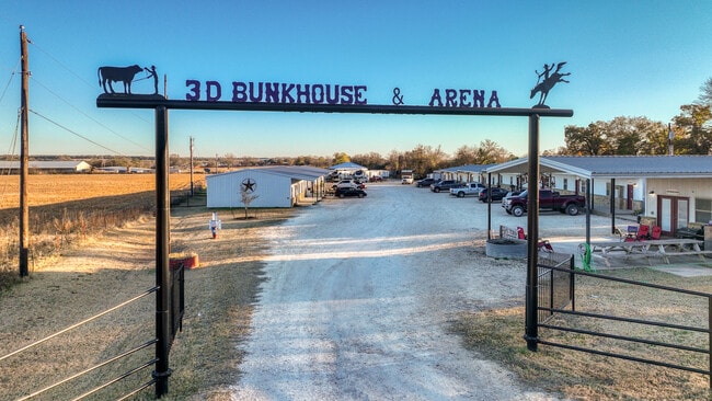
120 Bunkhouse Rd, Stephenville, TX 76401


Property Detail
120 Bunkhouse Rd
R000075446
A0683 SIMS WILLIAM; & APARTMENTS
Multifamilydwelling
ERATH
B and X Area of moderate flood hazard, usually the area between the limits of the 100-year and 500-year floods.
Texas
2025
6.26 AC
2025
Texas North Area
950600
Other Market Areas
17,836 SF
Stephenville, TX
NEARBY LISTINGS FOR SALE OR LEASE
-
-
View all Stephenville listings for sale on LoopNet.com
DEMOGRAPHICS near 120 Bunkhouse Rd
1 mile
3 mile
5 mile
2025 Total Population
877
13,612
26,961
2030 Population
916
14,158
27,695
Pop Growth 2025-2030
+ 4.45%
+ 4.01%
+ 2.72%
Average Age
36
33
34
2025 Total Households
343
5,485
9,853
HH Growth 2025-2030
+ 4.66%
+ 4.21%
+ 3.04%
Median Household Inc
$51,000
$47,278
$56,563
Avg Household Size
2.50
2.30
2.30
2025 Avg HH Vehicles
2.00
2.00
2.00
Median Home Value
$319,231
$242,513
$261,633
Median Year Built
1989
1983
1984
Nearby Places
Map Layers
Map Styles
 Street
 Aerial
Transit
 Traffic
 Biking
Places
Listings with unknown addresses are not visible on the map
- Restaurants
- Banks
- Shops
- Fitness
- Groceries
Nearby Properties
Address
Land Use
TOTAL SIZE
Lot Size
Zoning
Address
Land Use
TOTAL SIZE
Lot Size
Zoning
3,200 SF
140.44 AC
Address
Land Use
TOTAL SIZE
Lot Size
Zoning
6,877 SF
119.91 AC
Address
Land Use
TOTAL SIZE
Lot Size
Zoning
564,292 SF
40.36 AC
Address
Land Use
TOTAL SIZE
Lot Size
Zoning
233,750 SF
6.43 AC
Address
Land Use
TOTAL SIZE
Lot Size
Zoning
267,775 SF
13.79 AC
Address
Land Use
TOTAL SIZE
Lot Size
Zoning
77,006 SF
55.67 AC
Address
Land Use
TOTAL SIZE
Lot Size
Zoning
70,658 SF
41.66 AC
Address
Land Use
TOTAL SIZE
Lot Size
Zoning
177,941 SF
2.82 AC
Address
Land Use
TOTAL SIZE
Lot Size
Zoning
288,884 SF
2.01 AC
Address
Land Use
TOTAL SIZE
Lot Size
Zoning
41.68 AC
Address
Land Use
TOTAL SIZE
Lot Size
Zoning
200,128 SF
1.98 AC
Address
Land Use
TOTAL SIZE
Lot Size
Zoning
233,398 SF
3.58 AC
Address
Land Use
TOTAL SIZE
Lot Size
Zoning
200,572 SF
7.72 AC
Address
Land Use
TOTAL SIZE
Lot Size
Zoning
109,066 SF
3.92 AC
Address
Land Use
TOTAL SIZE
Lot Size
Zoning
Address
Land Use
TOTAL SIZE
Lot Size
Zoning
137,800 SF
5.55 AC
Address
Land Use
TOTAL SIZE
Lot Size
Zoning
66,929 SF
10.58 AC
Address
Land Use
TOTAL SIZE
Lot Size
Zoning
139,160 SF
624.09 AC
Address
Land Use
TOTAL SIZE
Lot Size
Zoning
91,058 SF
6.49 AC
Address
Land Use
TOTAL SIZE
Lot Size
Zoning
87,618 SF
4.63 AC
Address
Land Use
TOTAL SIZE
Lot Size
Zoning
Address
Land Use
TOTAL SIZE
Lot Size
Zoning
76,502 SF
4.93 AC
Address
Land Use
TOTAL SIZE
Lot Size
Zoning
195 SF
41.20 AC
Address
Land Use
TOTAL SIZE
Lot Size
Zoning
90,361 SF
7.73 AC
Address
Land Use
TOTAL SIZE
Lot Size
Zoning
Address
Land Use
TOTAL SIZE
Lot Size
Zoning
64,040 SF
4.99 AC
Address
Land Use
TOTAL SIZE
Lot Size
Zoning
8,870 SF
22.46 AC
Address
Land Use
TOTAL SIZE
Lot Size
Zoning
96,204 SF
10.95 AC
Address
Land Use
TOTAL SIZE
Lot Size
Zoning
3,608 SF
2.77 AC
Address
Land Use
TOTAL SIZE
Lot Size
Zoning
The World's #1 Commercial Real Estate Marketplace
Connect with us
© 2026 CoStar Group
The information above has been obtained from sources believed reliable. While we do not doubt its accuracy we have not verified it and make no guarantee, warranty or representation about it. It is your responsibility to independently confirm its accuracy and completeness. Any projections, opinions, assumptions, or estimates used are for example only and do not represent the current or future performance of the property. The value of this transaction to you depends on tax and other factors which should be evaluated by your tax, financial, and legal advisors. You and your advisors should conduct a careful, independent investigation of the property to determine to your satisfaction the suitability of the property for your needs.