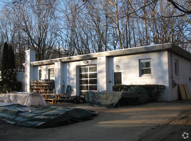
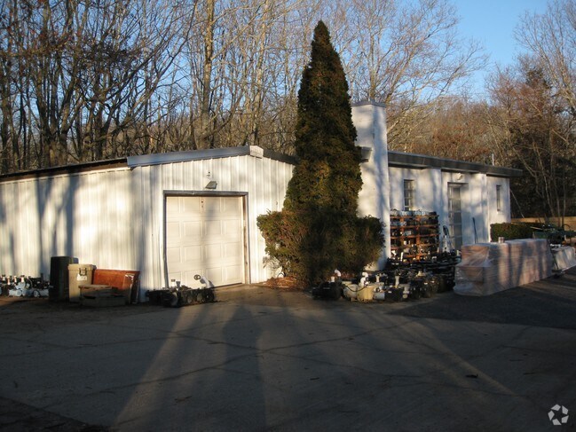
Property Record
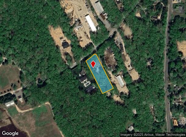
120 Clay Pit Rd, Sag Harbor, NY 11963

NEARBY LISTINGS FOR SALE OR LEASE
Property Detail
120 Clay Pit Rd
0900-025-00-01-00-027-000
N-CLAY PITS RD E-LABROZZI S-LABROZZI JR W-BORI
Commercialnec
Suffolk
X
New York
36103C0531H
27
0
1 AC
2024
Eastern Suffolk
190711
Long Island (New York)
1,456 SF
Nassau County-Suffolk County, NY
DEMOGRAPHICS near 120 Clay Pit Rd
1 Mile
3 Mile
5 Mile
2024 Total Population
1,499
12,241
24,620
2029 Population
1,527
12,592
25,701
Pop Growth 2024-2029
+ 1.87%
+ 2.87%
+ 4.39%
Average Age
46
46
46
2024 Total Households
607
5,004
9,953
HH Growth 2024-2029
+ 1.81%
+ 2.82%
+ 4.32%
Median Household Inc
$95,070
$107,941
$133,276
Avg Household Size
2.50
2.40
2.40
2024 Avg HH Vehicles
2.00
2.00
2.00
Median Home Value
$965,952
$982,956
$1,033,960
Median Year Built
1985
1981
1984
Nearby Places
- Restaurants
- Banks
- Shops
- Fitness
- Groceries
PUBLIC TRANSPORTATION
COMMUTER RAIL
Bridgehampton Station (Montauk Branch - Long Island Rail Road)
DRIVE
WALK
Distance
Bridgehampton Station (Montauk Branch - Long Island Rail Road)
7 min
3.5 mi
East Hampton Station (Montauk Branch - Long Island Rail Road)
DRIVE
WALK
Distance
East Hampton Station (Montauk Branch - Long Island Rail Road)
18 min
8.2 mi
Freight Ports
Port of New Haven
DRIVE
WALK
Distance
Port of New Haven
190 min
85.5 mi
Nearby Properties
Address
Land Use
TOTAL SIZE
Lot Size
Zoning
Address
Land Use
TOTAL SIZE
Lot Size
Zoning
633.60 AC
H2O
Address
Land Use
TOTAL SIZE
Lot Size
Zoning
3,049 SF
42.20 AC
VILLA
Address
Land Use
TOTAL SIZE
Lot Size
Zoning
4,888 SF
281 AC
CR200
Address
Land Use
TOTAL SIZE
Lot Size
Zoning
29,155 SF
11.12 AC
R20
Address
Land Use
TOTAL SIZE
Lot Size
Zoning
7,955 SF
203.49 AC
CR80
Address
Land Use
TOTAL SIZE
Lot Size
Zoning
10,129 SF
3.11 AC
VILLA
Address
Land Use
TOTAL SIZE
Lot Size
Zoning
576 SF
28.40 AC
VILLA
Address
Land Use
TOTAL SIZE
Lot Size
Zoning
10,130 SF
2.56 AC
VILLA
Address
Land Use
TOTAL SIZE
Lot Size
Zoning
26.05 AC
OSC
Address
Land Use
TOTAL SIZE
Lot Size
Zoning
5,864 SF
2.95 AC
CR80
Address
Land Use
TOTAL SIZE
Lot Size
Zoning
41,862 SF
2.64 AC
VILLA
Address
Land Use
TOTAL SIZE
Lot Size
Zoning
29.60 AC
OSC
Address
Land Use
TOTAL SIZE
Lot Size
Zoning
Address
Land Use
TOTAL SIZE
Lot Size
Zoning
17,569 SF
8.32 AC
CR80
Address
Land Use
TOTAL SIZE
Lot Size
Zoning
8,592 SF
12.60 AC
CR80
Address
Land Use
TOTAL SIZE
Lot Size
Zoning
38.61 AC
CR40
Address
Land Use
TOTAL SIZE
Lot Size
Zoning
61 AC
CR200
Address
Land Use
TOTAL SIZE
Lot Size
Zoning
216 SF
0.64 AC
VILLA
Address
Land Use
TOTAL SIZE
Lot Size
Zoning
12,320 SF
10.10 AC
CR200
Address
Land Use
TOTAL SIZE
Lot Size
Zoning
8,726 SF
2.17 AC
R40
Address
Land Use
TOTAL SIZE
Lot Size
Zoning
10,304 SF
2.80 AC
CR80
Address
Land Use
TOTAL SIZE
Lot Size
Zoning
24,587 SF
3.11 AC
LI40
Address
Land Use
TOTAL SIZE
Lot Size
Zoning
30.10 AC
CR40
Address
Land Use
TOTAL SIZE
Lot Size
Zoning
4,889 SF
0.43 AC
VILLA
Address
Land Use
TOTAL SIZE
Lot Size
Zoning
38.90 AC
CR120
Address
Land Use
TOTAL SIZE
Lot Size
Zoning
9,190 SF
0.87 AC
VILLA
Address
Land Use
TOTAL SIZE
Lot Size
Zoning
16,822 SF
5.53 AC
CR80
Address
Land Use
TOTAL SIZE
Lot Size
Zoning
31.70 AC
CR120
Address
Land Use
TOTAL SIZE
Lot Size
Zoning
16.50 AC
R80
Address
Land Use
TOTAL SIZE
Lot Size
Zoning
64,900 SF
3.03 AC
R20
The World's #1 Commercial Real Estate Marketplace
Connect with us
© 2025 CoStar Group
The information above has been obtained from sources believed reliable. While we do not doubt its accuracy we have not verified it and make no guarantee, warranty or representation about it. It is your responsibility to independently confirm its accuracy and completeness. Any projections, opinions, assumptions, or estimates used are for example only and do not represent the current or future performance of the property. The value of this transaction to you depends on tax and other factors which should be evaluated by your tax, financial, and legal advisors. You and your advisors should conduct a careful, independent investigation of the property to determine to your satisfaction the suitability of the property for your needs.