Property Record
120 E Dearborn St, Englewood, FL 34223
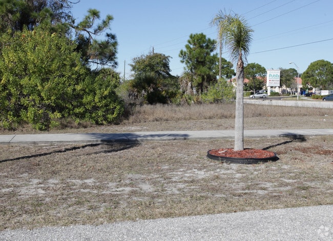

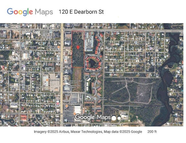
This Property Is For Sale
Property Detail
120 E Dearborn St
North Port-Bradenton-Sarasota, FL
COM AT NW COR OF SEC 31-40-20 TH ALONG N LINE OF SAID SEC 31 S 89-09-28 E 695 FT TH S 1-08-05 W 40 FT FOR POB TH S 1-08-05 W 1121.33 FT TH N 89-09-18 W 346.41 FT TH N 00-43-46 E 1121.33 FT
0853-04-0002
Sarasota
Commercialacreage
Florida
CG
6
AE The base floodplain where base flood elevations are provided. AE Zones are now used on new format FIRMs instead of A1-A30 Zones.
8.61 AC
2024
Sarasota Outlying
2025
Tampa/St Petersburg
002604
NEARBY LISTINGS FOR SALE OR LEASE
DEMOGRAPHICS near 120 E Dearborn St
1 mile
3 mile
5 mile
2025 Total Population
5,194
20,716
41,698
2030 Population
5,559
22,865
46,080
Pop Growth 2025-2030
+ 7.03%
+ 10.37%
+ 10.51%
Average Age
57
61
60
2025 Total Households
2,818
10,970
21,390
HH Growth 2025-2030
+ 6.96%
+ 10.33%
+ 10.50%
Median Household Inc
$56,501
$66,235
$72,180
Avg Household Size
1.80
1.80
1.90
2025 Avg HH Vehicles
1.00
1.00
2.00
Median Home Value
$335,294
$395,562
$421,682
Median Year Built
1977
1982
1988
Nearby Places
Map Layers
Map Styles
 Street
 Aerial
Layers
 Traffic
 Biking
Places
Listings with unknown addresses are not visible on the map
- Restaurants
- Banks
- Shops
- Fitness
- Groceries
PUBLIC TRANSPORTATION
AIRPORT
Punta Gorda
Drive
Walk
Distance
Punta Gorda
51 min
30.2 mi
Sarasota/Bradenton International
Drive
Walk
Distance
Sarasota/Bradenton International
59 min
40.6 mi
Freight Ports
Port Manatee
Drive
Walk
Distance
Port Manatee
71 min
53.2 mi
Nearby Properties
Address
Land Use
TOTAL SIZE
Lot Size
Zoning
Address
Land Use
TOTAL SIZE
Lot Size
Zoning
796,848 SF
44.28 AC
RE1
Address
Land Use
TOTAL SIZE
Lot Size
Zoning
95,649 SF
10.41 AC
OPI
Address
Land Use
TOTAL SIZE
Lot Size
Zoning
73,356 SF
8.98 AC
GU
Address
Land Use
TOTAL SIZE
Lot Size
Zoning
30,565 SF
136.67 AC
GU
Address
Land Use
TOTAL SIZE
Lot Size
Zoning
304.41 AC
PUD
Address
Land Use
TOTAL SIZE
Lot Size
Zoning
63,480 SF
6.22 AC
RMF3
Address
Land Use
TOTAL SIZE
Lot Size
Zoning
54.51 AC
SAPD
Address
Land Use
TOTAL SIZE
Lot Size
Zoning
112,350 SF
2.84 AC
CG
Address
Land Use
TOTAL SIZE
Lot Size
Zoning
103,161 SF
2.54 AC
ILW
Address
Land Use
TOTAL SIZE
Lot Size
Zoning
111,505 SF
9.53 AC
CG
Address
Land Use
TOTAL SIZE
Lot Size
Zoning
6,061 SF
13.72 AC
MES
Address
Land Use
TOTAL SIZE
Lot Size
Zoning
95,900 SF
5.56 AC
RMF3
Address
Land Use
TOTAL SIZE
Lot Size
Zoning
70,165 SF
22.18 AC
CG
Address
Land Use
TOTAL SIZE
Lot Size
Zoning
136.72 AC
OUC
Address
Land Use
TOTAL SIZE
Lot Size
Zoning
71,462 SF
24.99 AC
RE1
Address
Land Use
TOTAL SIZE
Lot Size
Zoning
2,495 SF
6.97 AC
RMH
Address
Land Use
TOTAL SIZE
Lot Size
Zoning
89,501 SF
6.52 AC
CG
Address
Land Use
TOTAL SIZE
Lot Size
Zoning
50,672 SF
77.41 AC
RMF1
Address
Land Use
TOTAL SIZE
Lot Size
Zoning
4,219 SF
69.48 AC
GU
Address
Land Use
TOTAL SIZE
Lot Size
Zoning
42,228 SF
9.24 AC
RE1
Address
Land Use
TOTAL SIZE
Lot Size
Zoning
72,168 SF
7.11 AC
CG
Address
Land Use
TOTAL SIZE
Lot Size
Zoning
1,459 SF
11.21 AC
RSF4
Address
Land Use
TOTAL SIZE
Lot Size
Zoning
38,753 SF
8.78 AC
OPI
Address
Land Use
TOTAL SIZE
Lot Size
Zoning
44,594 SF
5.70 AC
CG
Address
Land Use
TOTAL SIZE
Lot Size
Zoning
35,351 SF
7.44 AC
CG
Address
Land Use
TOTAL SIZE
Lot Size
Zoning
3.13 AC
RE2
Address
Land Use
TOTAL SIZE
Lot Size
Zoning
72,151 SF
5.09 AC
CI
Address
Land Use
TOTAL SIZE
Lot Size
Zoning
93.43 AC
RSF2
Address
Land Use
TOTAL SIZE
Lot Size
Zoning
11,475 SF
3.86 AC
RE2
Address
Land Use
TOTAL SIZE
Lot Size
Zoning
42,955 SF
15.64 AC
OUE1
The World's #1 Commercial Real Estate Marketplace
Connect with us
© 2026 CoStar Group
The information above has been obtained from sources believed reliable. While we do not doubt its accuracy we have not verified it and make no guarantee, warranty or representation about it. It is your responsibility to independently confirm its accuracy and completeness. Any projections, opinions, assumptions, or estimates used are for example only and do not represent the current or future performance of the property. The value of this transaction to you depends on tax and other factors which should be evaluated by your tax, financial, and legal advisors. You and your advisors should conduct a careful, independent investigation of the property to determine to your satisfaction the suitability of the property for your needs.