Property Record
120 Eastern Ave, Chelsea, MA 02150

Property Detail
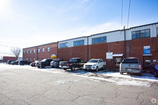
120 Eastern Ave
Officecondo
Suffolk
INDUST
Massachusetts
AE The base floodplain where base flood elevations are provided. AE Zones are now used on new format FIRMs instead of A1-A30 Zones.
Chelsea/Revere
2025
Boston
2025
Boston-Cambridge-Newton, MA-NH
160502
CHEL-000032-000000-000004G
8,560 SF
NEARBY LISTINGS FOR SALE OR LEASE
DEMOGRAPHICS near 120 Eastern Ave
1 mile
3 mile
5 mile
2025 Total Population
44,746
265,218
689,551
2030 Population
45,358
269,689
707,681
Pop Growth 2025-2030
+ 1.37%
+ 1.69%
+ 2.63%
Average Age
37
39
38
2025 Total Households
14,837
105,571
287,259
HH Growth 2025-2030
+ 1.52%
+ 2.17%
+ 3.02%
Median Household Inc
$78,480
$97,744
$109,280
Avg Household Size
2.90
2.40
2.20
2025 Avg HH Vehicles
1.00
1.00
1.00
Median Home Value
$548,509
$699,437
$786,245
Median Year Built
1947
1951
1949
Nearby Places
Map Layers
Map Styles
 Street
 Aerial
Layers
 Traffic
 Biking
Places
Listings with unknown addresses are not visible on the map
- Restaurants
- Banks
- Shops
- Fitness
- Groceries
PUBLIC TRANSPORTATION
COMMUTER RAIL
Drive
Walk
Distance
6 min
2.0 mi
North Station (Fitchburg/South Acton Line - Massachusetts Bay Transportation Authority Commuter Rail (Purple Line), Haverhill Line - Massachusetts Bay Transportation Authority Commuter Rail (Purple Line), Lowell Line - Massachusetts Bay Transportation Authority Commuter Rail (Purple Line), Newburyport/Rockport Line - Massachusetts Bay Transportation Authority Commuter Rail (Purple Line))
Drive
Walk
Distance
North Station (Fitchburg/South Acton Line - Massachusetts Bay Transportation Authority Commuter Rail (Purple Line), Haverhill Line - Massachusetts Bay Transportation Authority Commuter Rail (Purple Line), Lowell Line - Massachusetts Bay Transportation Authority Commuter Rail (Purple Line), Newburyport/Rockport Line - Massachusetts Bay Transportation Authority Commuter Rail (Purple Line))
9 min
3.6 mi
AIRPORT
General Edward Lawrence Logan International
Drive
Walk
Distance
General Edward Lawrence Logan International
6 min
2.5 mi
Freight Ports
Port of Boston
Drive
Walk
Distance
Port of Boston
12 min
5.2 mi
SALE & LEASE HISTORY
LISTING DATE
SALE/LEASE

Mar 31, 2017
For Lease
Feb 11, 2020
For Lease
Nearby Properties
Address
Land Use
TOTAL SIZE
Lot Size
Zoning
Address
Land Use
TOTAL SIZE
Lot Size
Zoning
6.39 AC
C
Address
Land Use
TOTAL SIZE
Lot Size
Zoning
171,791 SF
166.88 AC
E
Address
Land Use
TOTAL SIZE
Lot Size
Zoning
312,269 SF
0.43 AC
C
Address
Land Use
TOTAL SIZE
Lot Size
Zoning
646,546 SF
89.28 AC
ROD
Address
Land Use
TOTAL SIZE
Lot Size
Zoning
386,825 SF
10.67 AC
Address
Land Use
TOTAL SIZE
Lot Size
Zoning
6.14 AC
C
Address
Land Use
TOTAL SIZE
Lot Size
Zoning
401,310 SF
1.32 AC
C
Address
Land Use
TOTAL SIZE
Lot Size
Zoning
526,171 SF
8.39 AC
A
Address
Land Use
TOTAL SIZE
Lot Size
Zoning
569,990 SF
0.46 AC
HR
Address
Land Use
TOTAL SIZE
Lot Size
Zoning
410,642 SF
4.68 AC
CTED
Address
Land Use
TOTAL SIZE
Lot Size
Zoning
247,013 SF
1.13 AC
RC2
Address
Land Use
TOTAL SIZE
Lot Size
Zoning
230,544 SF
2.25 AC
E
Address
Land Use
TOTAL SIZE
Lot Size
Zoning
284,685 SF
0.61 AC
C
Address
Land Use
TOTAL SIZE
Lot Size
Zoning
234,450 SF
3.49 AC
I
Address
Land Use
TOTAL SIZE
Lot Size
Zoning
269,994 SF
2.88 AC
Address
Land Use
TOTAL SIZE
Lot Size
Zoning
297,396 SF
2.79 AC
CTED
Address
Land Use
TOTAL SIZE
Lot Size
Zoning
424,000 SF
2.63 AC
RC
Address
Land Use
TOTAL SIZE
Lot Size
Zoning
248,000 SF
0.58 AC
C
Address
Land Use
TOTAL SIZE
Lot Size
Zoning
241,400 SF
0.57 AC
C
Address
Land Use
TOTAL SIZE
Lot Size
Zoning
378,339 SF
3.02 AC
E
Address
Land Use
TOTAL SIZE
Lot Size
Zoning
223,214 SF
1.01 AC
E
Address
Land Use
TOTAL SIZE
Lot Size
Zoning
439,339 SF
1.11 AC
E
Address
Land Use
TOTAL SIZE
Lot Size
Zoning
236,000 SF
0.84 AC
C
Address
Land Use
TOTAL SIZE
Lot Size
Zoning
167,625 SF
0.45 AC
C
Address
Land Use
TOTAL SIZE
Lot Size
Zoning
755,000 SF
3.36 AC
C
Address
Land Use
TOTAL SIZE
Lot Size
Zoning
365,569 SF
4.81 AC
C
Address
Land Use
TOTAL SIZE
Lot Size
Zoning
145,000 SF
0.69 AC
C
Address
Land Use
TOTAL SIZE
Lot Size
Zoning
156,684 SF
1.15 AC
PUD-6
Address
Land Use
TOTAL SIZE
Lot Size
Zoning
324,870 SF
9.37 AC
E
Address
Land Use
TOTAL SIZE
Lot Size
Zoning
339,600 SF
23.09 AC
CIV
The World's #1 Commercial Real Estate Marketplace
Connect with us
© 2026 CoStar Group
The information above has been obtained from sources believed reliable. While we do not doubt its accuracy we have not verified it and make no guarantee, warranty or representation about it. It is your responsibility to independently confirm its accuracy and completeness. Any projections, opinions, assumptions, or estimates used are for example only and do not represent the current or future performance of the property. The value of this transaction to you depends on tax and other factors which should be evaluated by your tax, financial, and legal advisors. You and your advisors should conduct a careful, independent investigation of the property to determine to your satisfaction the suitability of the property for your needs.