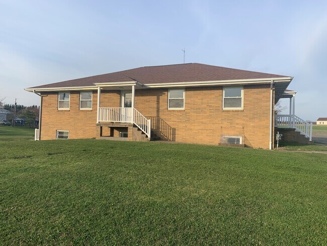
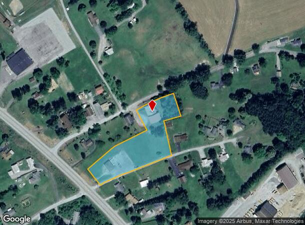
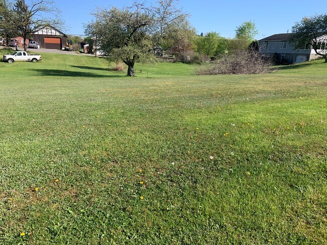
Property Record
120 Graham Rd, Kittanning, PA 16201
NEARBY LISTINGS FOR SALE OR LEASE
-
-
View all Kittanning listings for sale on LoopNet.com
Property Detail
120 Graham Rd
25-0-016003
Gel Management Llc Sub 1
Commercialofficeresidentialmixeduse
2.878A - IMPRS PB8 PG857 SL991
X
Armstrong
42005C0340D
Pennsylvania
2025
2.01 AC
2025
Armstrong County
950800
Pittsburgh
3,500 SF
Pittsburgh, PA
DEMOGRAPHICS near 120 Graham Rd
1 Mile
3 Mile
5 Mile
2024 Total Population
539
2,646
17,492
2029 Population
531
2,588
17,206
Pop Growth 2024-2029
(1.48%)
(2.19%)
(1.64%)
Average Age
48
46
45
2024 Total Households
216
1,090
7,783
HH Growth 2024-2029
(1.39%)
(2.20%)
(1.61%)
Median Household Inc
$74,765
$62,590
$51,803
Avg Household Size
2.30
2.30
2.20
2024 Avg HH Vehicles
2.00
2.00
2.00
Median Home Value
$184,027
$161,330
$113,865
Median Year Built
1978
1966
1954
Nearby Places
Map Layers
Map Styles
 Street
 Aerial
- Restaurants
- Banks
- Shops
- Fitness
- Groceries
SALE & LEASE HISTORY
LISTING DATE
SALE/LEASE

May 05, 2023
For Sale
Nearby Properties
Address
Land Use
TOTAL SIZE
Lot Size
Zoning
Address
Land Use
TOTAL SIZE
Lot Size
Zoning
260,664 SF
68 AC
Address
Land Use
TOTAL SIZE
Lot Size
Zoning
75,000 SF
121.87 AC
Address
Land Use
TOTAL SIZE
Lot Size
Zoning
45,222 SF
3.06 AC
Address
Land Use
TOTAL SIZE
Lot Size
Zoning
116,560 SF
9.03 AC
Address
Land Use
TOTAL SIZE
Lot Size
Zoning
10,324 SF
0.98 AC
Address
Land Use
TOTAL SIZE
Lot Size
Zoning
20,522 SF
4.76 AC
Address
Land Use
TOTAL SIZE
Lot Size
Zoning
13,497 SF
49.49 AC
Address
Land Use
TOTAL SIZE
Lot Size
Zoning
12,084 SF
3.19 AC
Address
Land Use
TOTAL SIZE
Lot Size
Zoning
7,069 SF
3.97 AC
Address
Land Use
TOTAL SIZE
Lot Size
Zoning
Address
Land Use
TOTAL SIZE
Lot Size
Zoning
13,752 SF
4 AC
Address
Land Use
TOTAL SIZE
Lot Size
Zoning
10,330 SF
1.01 AC
Address
Land Use
TOTAL SIZE
Lot Size
Zoning
11,664 SF
28.64 AC
Address
Land Use
TOTAL SIZE
Lot Size
Zoning
9,034 SF
0.91 AC
Address
Land Use
TOTAL SIZE
Lot Size
Zoning
11,081 SF
5.97 AC
Address
Land Use
TOTAL SIZE
Lot Size
Zoning
9,368 SF
14.81 AC
Address
Land Use
TOTAL SIZE
Lot Size
Zoning
78,008 SF
20.16 AC
Address
Land Use
TOTAL SIZE
Lot Size
Zoning
11,644 SF
2.76 AC
Address
Land Use
TOTAL SIZE
Lot Size
Zoning
Address
Land Use
TOTAL SIZE
Lot Size
Zoning
1,920 SF
5.41 AC
Address
Land Use
TOTAL SIZE
Lot Size
Zoning
10,830 SF
1.37 AC
Address
Land Use
TOTAL SIZE
Lot Size
Zoning
Address
Land Use
TOTAL SIZE
Lot Size
Zoning
5,000 SF
3.41 AC
Address
Land Use
TOTAL SIZE
Lot Size
Zoning
5,408 SF
34.76 AC
Address
Land Use
TOTAL SIZE
Lot Size
Zoning
25,200 SF
5.29 AC
Address
Land Use
TOTAL SIZE
Lot Size
Zoning
Address
Land Use
TOTAL SIZE
Lot Size
Zoning
Address
Land Use
TOTAL SIZE
Lot Size
Zoning
7,680 SF
24.61 AC
Address
Land Use
TOTAL SIZE
Lot Size
Zoning
5,700 SF
13.86 AC
Address
Land Use
TOTAL SIZE
Lot Size
Zoning
5,923 SF
2.03 AC
The World's #1 Commercial Real Estate Marketplace
Connect with us
© 2025 CoStar Group
The information above has been obtained from sources believed reliable. While we do not doubt its accuracy we have not verified it and make no guarantee, warranty or representation about it. It is your responsibility to independently confirm its accuracy and completeness. Any projections, opinions, assumptions, or estimates used are for example only and do not represent the current or future performance of the property. The value of this transaction to you depends on tax and other factors which should be evaluated by your tax, financial, and legal advisors. You and your advisors should conduct a careful, independent investigation of the property to determine to your satisfaction the suitability of the property for your needs.