Property Record
0 Gun Club Rd, Jacksonville, FL 32218
NEARBY LISTINGS FOR SALE OR LEASE
Property Detail
0 Gun Club Rd
Jacksonville, FL
Callahans S/D
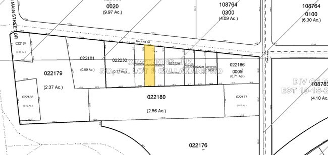
022176-0000
6-69 24-1S-26E 1.01 CALLAHANS S/D PT LOT 6 RECD O/R 20108-786 BEING PARCEL 8
Shipyard
Duval
X
Florida
12031C0192J
6
2024
4.41 AC
2025
Northeast Jacksonville
010202
Jacksonville (Florida)
DEMOGRAPHICS near 0 Gun Club Rd
1 Mile
3 Mile
5 Mile
2024 Total Population
1,993
43,793
155,810
2029 Population
2,169
46,033
164,848
Pop Growth 2024-2029
+ 8.83%
+ 5.11%
+ 5.80%
Average Age
37
39
38
2024 Total Households
904
17,241
60,723
HH Growth 2024-2029
+ 9.07%
+ 5.25%
+ 5.97%
Median Household Inc
$43,911
$43,768
$41,440
Avg Household Size
2.20
2.50
2.50
2024 Avg HH Vehicles
2.00
2.00
1.00
Median Home Value
$324,510
$150,504
$162,026
Median Year Built
1984
1969
1971
Nearby Places
- Restaurants
- Banks
- Shops
- Fitness
- Groceries
PUBLIC TRANSPORTATION
COMMUTER RAIL
Jacksonville (Silver Meteor - Amtrak, Silver Star - Amtrak)
DRIVE
WALK
Distance
Jacksonville (Silver Meteor - Amtrak, Silver Star - Amtrak)
13 min
6.4 mi
AIRPORT
Jacksonville International
DRIVE
WALK
Distance
Jacksonville International
16 min
9.1 mi
Freight Ports
Jacksonville Port
DRIVE
WALK
Distance
Jacksonville Port
11 min
4.7 mi
Nearby Properties
Address
Land Use
TOTAL SIZE
Lot Size
Zoning
Address
Land Use
TOTAL SIZE
Lot Size
Zoning
1,064,086 SF
87.81 AC
IL
Address
Land Use
TOTAL SIZE
Lot Size
Zoning
336,852 SF
32.69 AC
IL
Address
Land Use
TOTAL SIZE
Lot Size
Zoning
1,009,100 SF
62.96 AC
PUD
Address
Land Use
TOTAL SIZE
Lot Size
Zoning
1,170,252 SF
201.15 AC
IH
Address
Land Use
TOTAL SIZE
Lot Size
Zoning
1,678,675 SF
73.48 AC
IL
Address
Land Use
TOTAL SIZE
Lot Size
Zoning
823,286 SF
53.36 AC
IL
Address
Land Use
TOTAL SIZE
Lot Size
Zoning
403,103 SF
31.05 AC
PUD
Address
Land Use
TOTAL SIZE
Lot Size
Zoning
588,053 SF
33.10 AC
PUD
Address
Land Use
TOTAL SIZE
Lot Size
Zoning
556,862 SF
27.25 AC
IL
Address
Land Use
TOTAL SIZE
Lot Size
Zoning
556,016 SF
25.95 AC
IH
Address
Land Use
TOTAL SIZE
Lot Size
Zoning
477,945 SF
31.03 AC
CCG-2
Address
Land Use
TOTAL SIZE
Lot Size
Zoning
740,260 SF
59.11 AC
IL
Address
Land Use
TOTAL SIZE
Lot Size
Zoning
428,610 SF
29.57 AC
IL
Address
Land Use
TOTAL SIZE
Lot Size
Zoning
408,384 SF
23.77 AC
IL
Address
Land Use
TOTAL SIZE
Lot Size
Zoning
841,077 SF
241.17 AC
PUD
Address
Land Use
TOTAL SIZE
Lot Size
Zoning
284,023 SF
25.30 AC
RMD-C
Address
Land Use
TOTAL SIZE
Lot Size
Zoning
478,803 SF
24.43 AC
IL
Address
Land Use
TOTAL SIZE
Lot Size
Zoning
321,938 SF
29.46 AC
CCG-1
Address
Land Use
TOTAL SIZE
Lot Size
Zoning
313,741 SF
37.05 AC
RMD-C
Address
Land Use
TOTAL SIZE
Lot Size
Zoning
210,520 SF
34.87 AC
PUD
Address
Land Use
TOTAL SIZE
Lot Size
Zoning
283,689 SF
21.28 AC
RLD-60
Address
Land Use
TOTAL SIZE
Lot Size
Zoning
303,200 SF
17.47 AC
IL
Address
Land Use
TOTAL SIZE
Lot Size
Zoning
119,362 SF
20.32 AC
RMD-C
Address
Land Use
TOTAL SIZE
Lot Size
Zoning
237,480 SF
19.61 AC
PUD
Address
Land Use
TOTAL SIZE
Lot Size
Zoning
258,700 SF
25.43 AC
RMD-D
Address
Land Use
TOTAL SIZE
Lot Size
Zoning
282,099 SF
14.53 AC
IL
Address
Land Use
TOTAL SIZE
Lot Size
Zoning
171,509 SF
8.81 AC
IL
Address
Land Use
TOTAL SIZE
Lot Size
Zoning
183,696 SF
43.74 AC
CCG-2
Address
Land Use
TOTAL SIZE
Lot Size
Zoning
5,946 SF
118.58 AC
PBF-1
Address
Land Use
TOTAL SIZE
Lot Size
Zoning
205,492 SF
18.86 AC
PUD
The World's #1 Commercial Real Estate Marketplace
Connect with us
© 2025 CoStar Group
The information above has been obtained from sources believed reliable. While we do not doubt its accuracy we have not verified it and make no guarantee, warranty or representation about it. It is your responsibility to independently confirm its accuracy and completeness. Any projections, opinions, assumptions, or estimates used are for example only and do not represent the current or future performance of the property. The value of this transaction to you depends on tax and other factors which should be evaluated by your tax, financial, and legal advisors. You and your advisors should conduct a careful, independent investigation of the property to determine to your satisfaction the suitability of the property for your needs.