Property Record
120 Macarthur Ct, Nicholasville, KY 40356
NEARBY LISTINGS FOR SALE OR LEASE
Property Detail
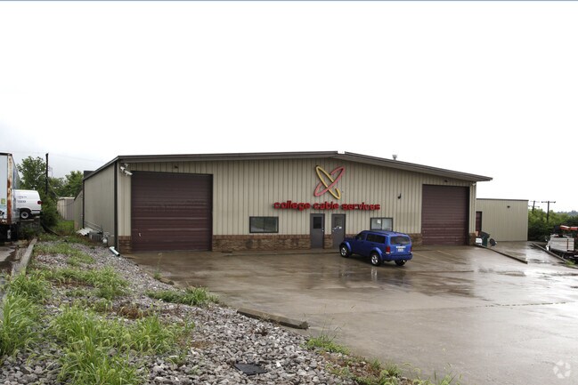
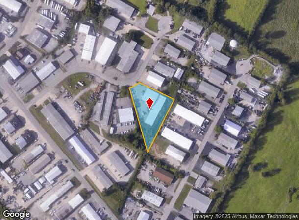
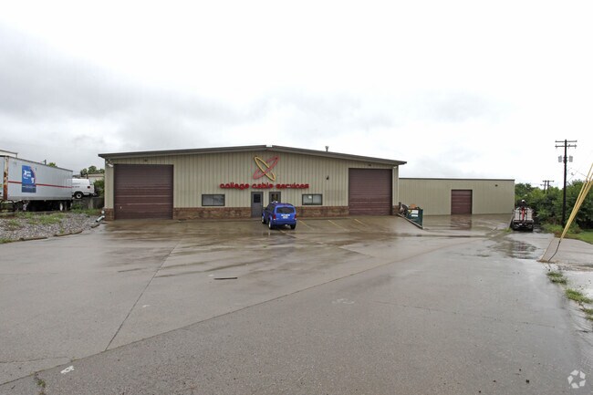
120 Macarthur Ct
Lexington-Fayette, KY
Bluegrass Ind Park
067-00-00-066.00
15H
Multipleuses
Jessamine
X
Kentucky
21113C0070D
15
2025
1.37 AC
2025
Jessamine County
060200
Lexington/Fayette
16,400 SF
DEMOGRAPHICS near 120 Macarthur Ct
1 Mile
3 Mile
5 Mile
2024 Total Population
865
28,432
120,258
2029 Population
923
28,501
121,095
Pop Growth 2024-2029
+ 6.71%
+ 0.24%
+ 0.70%
Average Age
43
39
39
2024 Total Households
319
11,277
50,040
HH Growth 2024-2029
+ 6.90%
+ 0.20%
+ 0.52%
Median Household Inc
$94,078
$85,645
$67,033
Avg Household Size
2.60
2.50
2.40
2024 Avg HH Vehicles
2.00
2.00
2.00
Median Home Value
$363,775
$272,120
$246,073
Median Year Built
1981
1997
1985
Nearby Places
Map Layers
Map Styles
 Street
 Aerial
- Restaurants
- Banks
- Shops
- Fitness
- Groceries
PUBLIC TRANSPORTATION
AIRPORT
Blue Grass
DRIVE
WALK
Distance
Blue Grass
24 min
12.9 mi
SALE & LEASE HISTORY
LISTING DATE
SALE/LEASE

Aug 01, 2018
For Lease
Nearby Properties
Address
Land Use
TOTAL SIZE
Lot Size
Zoning
Address
Land Use
TOTAL SIZE
Lot Size
Zoning
8,001 SF
32.59 AC
MU-3
Address
Land Use
TOTAL SIZE
Lot Size
Zoning
5,650 SF
22.46 AC
R-3
Address
Land Use
TOTAL SIZE
Lot Size
Zoning
22.10 AC
R-3
Address
Land Use
TOTAL SIZE
Lot Size
Zoning
41,040 SF
14.77 AC
R-4
Address
Land Use
TOTAL SIZE
Lot Size
Zoning
184,756 SF
4.43 AC
MU-3
Address
Land Use
TOTAL SIZE
Lot Size
Zoning
41,132 SF
19 AC
Address
Land Use
TOTAL SIZE
Lot Size
Zoning
6.25 AC
A-U
Address
Land Use
TOTAL SIZE
Lot Size
Zoning
4,992 SF
32.12 AC
Address
Land Use
TOTAL SIZE
Lot Size
Zoning
444,063 SF
26.02 AC
Address
Land Use
TOTAL SIZE
Lot Size
Zoning
74,908 SF
15.06 AC
A-U
Address
Land Use
TOTAL SIZE
Lot Size
Zoning
19,536 SF
19.48 AC
R-4
Address
Land Use
TOTAL SIZE
Lot Size
Zoning
Address
Land Use
TOTAL SIZE
Lot Size
Zoning
4,142 SF
19.94 AC
Address
Land Use
TOTAL SIZE
Lot Size
Zoning
44,298 SF
11 AC
Address
Land Use
TOTAL SIZE
Lot Size
Zoning
39,277 SF
15 AC
Address
Land Use
TOTAL SIZE
Lot Size
Zoning
13,686 SF
2 AC
Address
Land Use
TOTAL SIZE
Lot Size
Zoning
196,147 SF
20.02 AC
B-3
Address
Land Use
TOTAL SIZE
Lot Size
Zoning
60,990 SF
4.29 AC
Address
Land Use
TOTAL SIZE
Lot Size
Zoning
82,436 SF
4.24 AC
R-4
Address
Land Use
TOTAL SIZE
Lot Size
Zoning
Address
Land Use
TOTAL SIZE
Lot Size
Zoning
52,283 SF
4.89 AC
A-U
Address
Land Use
TOTAL SIZE
Lot Size
Zoning
1,920 SF
99.41 AC
A-U
Address
Land Use
TOTAL SIZE
Lot Size
Zoning
29,690 SF
255 AC
Address
Land Use
TOTAL SIZE
Lot Size
Zoning
52,480 SF
9 AC
Address
Land Use
TOTAL SIZE
Lot Size
Zoning
44,958 SF
MU-3
Address
Land Use
TOTAL SIZE
Lot Size
Zoning
46,722 SF
MU-3
Address
Land Use
TOTAL SIZE
Lot Size
Zoning
200,857 SF
22.84 AC
Address
Land Use
TOTAL SIZE
Lot Size
Zoning
136 SF
13 AC
Address
Land Use
TOTAL SIZE
Lot Size
Zoning
87,453 SF
9 AC
The World's #1 Commercial Real Estate Marketplace
Connect with us
© 2025 CoStar Group
The information above has been obtained from sources believed reliable. While we do not doubt its accuracy we have not verified it and make no guarantee, warranty or representation about it. It is your responsibility to independently confirm its accuracy and completeness. Any projections, opinions, assumptions, or estimates used are for example only and do not represent the current or future performance of the property. The value of this transaction to you depends on tax and other factors which should be evaluated by your tax, financial, and legal advisors. You and your advisors should conduct a careful, independent investigation of the property to determine to your satisfaction the suitability of the property for your needs.