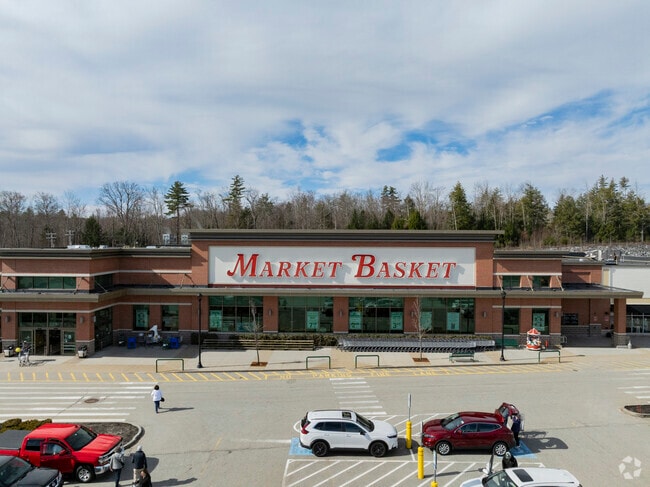
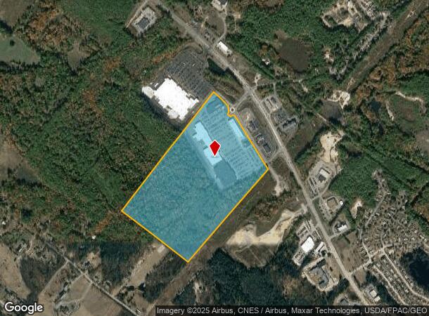
Property Record
120 Marketplace Blvd, Rochester, NH 03867
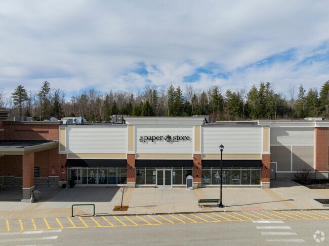

NEARBY LISTINGS FOR SALE OR LEASE
Property Detail
120 Marketplace Blvd
Timberlandforesttreesagricultural
Strafford
X
New Hampshire
33017C0184D
73.08 AC
2024
Strafford County
2024
Boston
084600
Boston-Cambridge-Newton, MA-NH
274,144 SF
RCHE-000216-000011
DEMOGRAPHICS near 120 Marketplace Blvd
1 Mile
3 Mile
5 Mile
2024 Total Population
1,170
17,260
37,230
2029 Population
1,234
18,071
38,988
Pop Growth 2024-2029
+ 5.47%
+ 4.70%
+ 4.72%
Average Age
46
43
43
2024 Total Households
524
7,410
15,532
HH Growth 2024-2029
+ 5.34%
+ 4.76%
+ 4.78%
Median Household Inc
$96,790
$81,964
$85,108
Avg Household Size
2.20
2.30
2.30
2024 Avg HH Vehicles
2.00
2.00
2.00
Median Home Value
$337,333
$242,643
$252,421
Median Year Built
1987
1972
1979
Nearby Places
Map Layers
Map Styles
 Street
 Aerial
- Restaurants
- Banks
- Shops
- Fitness
- Groceries
PUBLIC TRANSPORTATION
AIRPORT
Portsmouth International at Pease
DRIVE
WALK
Distance
Portsmouth International at Pease
33 min
22.0 mi
Freight Ports
Portland, ME
DRIVE
WALK
Distance
Portland, ME
74 min
51.9 mi
SALE & LEASE HISTORY
LISTING DATE
SALE/LEASE

Sep 25, 2016
For Lease
Mar 14, 2024
For Sale
Nearby Properties
Address
Land Use
TOTAL SIZE
Lot Size
Zoning
Address
Land Use
TOTAL SIZE
Lot Size
Zoning
483,789 SF
37 AC
R2
Address
Land Use
TOTAL SIZE
Lot Size
Zoning
277,667 SF
45.36 AC
HC
Address
Land Use
TOTAL SIZE
Lot Size
Zoning
207,125 SF
22 AC
R2
Address
Land Use
TOTAL SIZE
Lot Size
Zoning
224,153 SF
34.36 AC
GRD
Address
Land Use
TOTAL SIZE
Lot Size
Zoning
78,768 SF
10.92 AC
A
Address
Land Use
TOTAL SIZE
Lot Size
Zoning
86,420 SF
3.30 AC
DTC
Address
Land Use
TOTAL SIZE
Lot Size
Zoning
114,867 SF
17.23 AC
HC
Address
Land Use
TOTAL SIZE
Lot Size
Zoning
77,712 SF
10.99 AC
A
Address
Land Use
TOTAL SIZE
Lot Size
Zoning
59,235 SF
22.08 AC
A
Address
Land Use
TOTAL SIZE
Lot Size
Zoning
68,535 SF
7.10 AC
R2
Address
Land Use
TOTAL SIZE
Lot Size
Zoning
236,340 SF
27.68 AC
HC
Address
Land Use
TOTAL SIZE
Lot Size
Zoning
58,500 SF
11.55 AC
R2
Address
Land Use
TOTAL SIZE
Lot Size
Zoning
111,807 SF
31.93 AC
HC
Address
Land Use
TOTAL SIZE
Lot Size
Zoning
221,995 SF
35.47 AC
IND
Address
Land Use
TOTAL SIZE
Lot Size
Zoning
13.34 AC
HC
Address
Land Use
TOTAL SIZE
Lot Size
Zoning
84,700 SF
5.76 AC
GRD
Address
Land Use
TOTAL SIZE
Lot Size
Zoning
51,968 SF
5.40 AC
R2
Address
Land Use
TOTAL SIZE
Lot Size
Zoning
16,444 SF
6.41 AC
GRD
Address
Land Use
TOTAL SIZE
Lot Size
Zoning
66,786 SF
2.41 AC
R2
Address
Land Use
TOTAL SIZE
Lot Size
Zoning
14,552 SF
18 AC
R2
Address
Land Use
TOTAL SIZE
Lot Size
Zoning
2,022 SF
5.01 AC
R2
Address
Land Use
TOTAL SIZE
Lot Size
Zoning
66,899 SF
8.86 AC
HC
Address
Land Use
TOTAL SIZE
Lot Size
Zoning
213,745 SF
19.98 AC
IND
Address
Land Use
TOTAL SIZE
Lot Size
Zoning
114,452 SF
5.81 AC
NMU
Address
Land Use
TOTAL SIZE
Lot Size
Zoning
40,577 SF
5.40 AC
R1
Address
Land Use
TOTAL SIZE
Lot Size
Zoning
150,000 SF
20.10 AC
IND
Address
Land Use
TOTAL SIZE
Lot Size
Zoning
4,000 SF
68 AC
GRD
Address
Land Use
TOTAL SIZE
Lot Size
Zoning
87.64 AC
A
Address
Land Use
TOTAL SIZE
Lot Size
Zoning
65,452 SF
8.87 AC
HC
The World's #1 Commercial Real Estate Marketplace
Connect with us
© 2026 CoStar Group
The information above has been obtained from sources believed reliable. While we do not doubt its accuracy we have not verified it and make no guarantee, warranty or representation about it. It is your responsibility to independently confirm its accuracy and completeness. Any projections, opinions, assumptions, or estimates used are for example only and do not represent the current or future performance of the property. The value of this transaction to you depends on tax and other factors which should be evaluated by your tax, financial, and legal advisors. You and your advisors should conduct a careful, independent investigation of the property to determine to your satisfaction the suitability of the property for your needs.