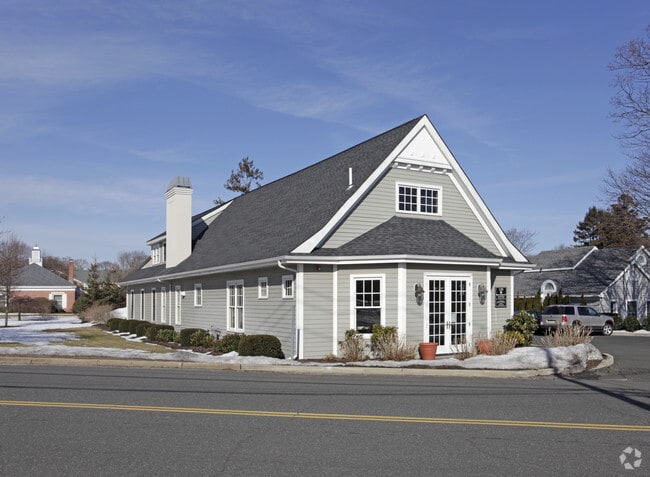
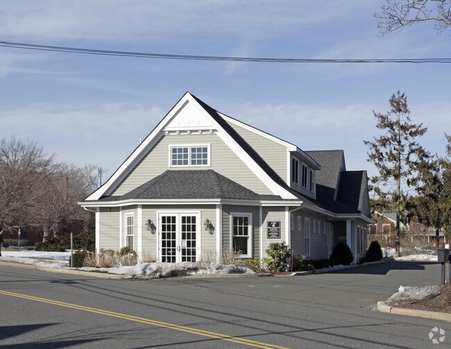
Property Record
120 Mill Rd, Westhampton Beach, NY 11978
NEARBY LISTINGS FOR SALE OR LEASE
Property Detail
120 Mill Rd
0905-012-00-02-00-010-000
LD EQ 87 +1000
Officebuilding
Suffolk
X
New York
36103C0759H
10
2024
0.37 AC
2024
Eastern Suffolk
190502
Long Island (New York)
2,968 SF
Nassau County-Suffolk County, NY
DEMOGRAPHICS near 120 Mill Rd
1 mile
3 mile
5 mile
2024 Total Population
5,081
13,906
23,018
2029 Population
5,463
14,664
23,839
Pop Growth 2024-2029
+ 7.52%
+ 5.45%
+ 3.57%
Average Age
44
45
44
2024 Total Households
1,990
5,333
8,730
HH Growth 2024-2029
+ 7.69%
+ 5.72%
+ 3.67%
Median Household Inc
$122,870
$118,190
$117,864
Avg Household Size
2.50
2.50
2.60
2024 Avg HH Vehicles
2.00
2.00
2.00
Median Home Value
$897,525
$855,545
$819,403
Median Year Built
1976
1980
1979
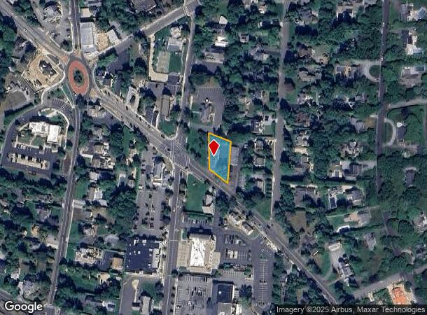
Nearby Places
Map Layers
Map Styles
 Street
 Aerial
Transit
 Traffic
 Biking
Places
Listings with unknown addresses are not visible on the map
- Restaurants
- Banks
- Shops
- Fitness
- Groceries
PUBLIC TRANSPORTATION
COMMUTER RAIL
Westhampton Station (Montauk Branch - Long Island Rail Road)
Drive
Walk
Distance
Westhampton Station (Montauk Branch - Long Island Rail Road)
4 min
1.5 mi
Speonk Station (Montauk Branch - Long Island Rail Road)
Drive
Walk
Distance
Speonk Station (Montauk Branch - Long Island Rail Road)
7 min
3.9 mi
AIRPORT
Long Island MacArthur
Drive
Walk
Distance
Long Island MacArthur
42 min
26.9 mi
Nearby Properties
Address
Land Use
TOTAL SIZE
Lot Size
Zoning
Address
Land Use
TOTAL SIZE
Lot Size
Zoning
1,229.10 AC
LI200
Address
Land Use
TOTAL SIZE
Lot Size
Zoning
53,067 SF
6.20 AC
R2
Address
Land Use
TOTAL SIZE
Lot Size
Zoning
55,202 SF
18.50 AC
R2
Address
Land Use
TOTAL SIZE
Lot Size
Zoning
68,676 SF
9.70 AC
CR200
Address
Land Use
TOTAL SIZE
Lot Size
Zoning
5,656 SF
1.65 AC
R80
Address
Land Use
TOTAL SIZE
Lot Size
Zoning
11.41 AC
LI200
Address
Land Use
TOTAL SIZE
Lot Size
Zoning
18.28 AC
CR200
Address
Land Use
TOTAL SIZE
Lot Size
Zoning
8.26 AC
LI200
Address
Land Use
TOTAL SIZE
Lot Size
Zoning
15,084 SF
10.25 AC
R40
Address
Land Use
TOTAL SIZE
Lot Size
Zoning
12,008 SF
6.86 AC
R1
Address
Land Use
TOTAL SIZE
Lot Size
Zoning
31,393 SF
4.90 AC
R3
Address
Land Use
TOTAL SIZE
Lot Size
Zoning
12,036 SF
1.37 AC
VILLA
Address
Land Use
TOTAL SIZE
Lot Size
Zoning
10,784 SF
2.53 AC
VILLA
Address
Land Use
TOTAL SIZE
Lot Size
Zoning
26,824 SF
146.40 AC
CR200
Address
Land Use
TOTAL SIZE
Lot Size
Zoning
11,344 SF
2.10 AC
VILLA
Address
Land Use
TOTAL SIZE
Lot Size
Zoning
15,309 SF
1.92 AC
R40
Address
Land Use
TOTAL SIZE
Lot Size
Zoning
10,528 SF
3.69 AC
VILLA
Address
Land Use
TOTAL SIZE
Lot Size
Zoning
9,191 SF
14.39 AC
VILLA
Address
Land Use
TOTAL SIZE
Lot Size
Zoning
6,862 SF
1.42 AC
R3
Address
Land Use
TOTAL SIZE
Lot Size
Zoning
4,094 SF
0.94 AC
R80
Address
Land Use
TOTAL SIZE
Lot Size
Zoning
5,895 SF
2.72 AC
R80
Address
Land Use
TOTAL SIZE
Lot Size
Zoning
9,589 SF
3.92 AC
R80
Address
Land Use
TOTAL SIZE
Lot Size
Zoning
28,458 SF
9.60 AC
LI40
Address
Land Use
TOTAL SIZE
Lot Size
Zoning
7,924 SF
2.50 AC
R80
Address
Land Use
TOTAL SIZE
Lot Size
Zoning
10,419 SF
1.20 AC
R40
Address
Land Use
TOTAL SIZE
Lot Size
Zoning
13,482 SF
1.70 AC
R1
Address
Land Use
TOTAL SIZE
Lot Size
Zoning
10,271 SF
1.80 AC
R1
Address
Land Use
TOTAL SIZE
Lot Size
Zoning
51,802 SF
4.40 AC
R3
Address
Land Use
TOTAL SIZE
Lot Size
Zoning
9,418 SF
2.28 AC
VILLA
Address
Land Use
TOTAL SIZE
Lot Size
Zoning
2,947 SF
8.59 AC
VILLA
The World's #1 Commercial Real Estate Marketplace
Connect with us
© 2026 CoStar Group
The information above has been obtained from sources believed reliable. While we do not doubt its accuracy we have not verified it and make no guarantee, warranty or representation about it. It is your responsibility to independently confirm its accuracy and completeness. Any projections, opinions, assumptions, or estimates used are for example only and do not represent the current or future performance of the property. The value of this transaction to you depends on tax and other factors which should be evaluated by your tax, financial, and legal advisors. You and your advisors should conduct a careful, independent investigation of the property to determine to your satisfaction the suitability of the property for your needs.