Property Record
120 N Union St, Grass Lake, MI 49240

NEARBY LISTINGS FOR SALE OR LEASE
Property Detail
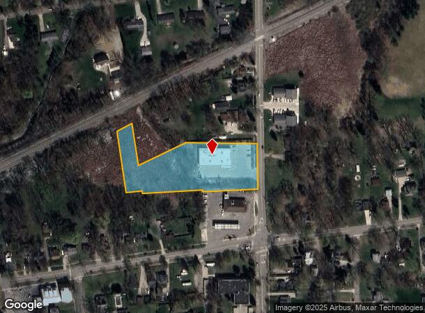
120 N Union St
Jackson, MI
Of Remingtons Add
027-10-33-303-010-02
PART OF THE SOUTHWEST 1/4 OF SECTION 33, TOWN 02 SOUTH, RANGE 2 EAST, VILLAGE OF GRASS LAKE, JACKSON COUNTY, MICHIGAN, ALSO
Wholesaleoutletdiscountstore
Jackson
X
Michigan
26075C0250D
6-10
2024
2.37 AC
2025
Jackson County
006804
West Michigan
9,170 SF
DEMOGRAPHICS near 120 N Union St
1 Mile
3 Mile
5 Mile
2024 Total Population
2,157
4,734
10,189
2029 Population
2,146
4,708
10,129
Pop Growth 2024-2029
(0.51%)
(0.55%)
(0.59%)
Average Age
42
42
43
2024 Total Households
843
1,846
4,035
HH Growth 2024-2029
(0.71%)
(0.65%)
(0.64%)
Median Household Inc
$91,550
$88,333
$84,722
Avg Household Size
2.50
2.50
2.50
2024 Avg HH Vehicles
3.00
2.00
2.00
Median Home Value
$255,098
$250,070
$243,420
Median Year Built
1989
1985
1979
Nearby Places
Map Layers
Map Styles
 Street
 Aerial
- Restaurants
- Banks
- Shops
- Fitness
- Groceries
SALE & LEASE HISTORY
LISTING DATE
SALE/LEASE

May 23, 2017
For Sale
Nearby Properties
Address
Land Use
TOTAL SIZE
Lot Size
Zoning
Address
Land Use
TOTAL SIZE
Lot Size
Zoning
193,748 SF
195.55 AC
LDFA-SMART
Address
Land Use
TOTAL SIZE
Lot Size
Zoning
17,737 SF
3.26 AC
LDFA
Address
Land Use
TOTAL SIZE
Lot Size
Zoning
58,909 SF
LDFA-SMART
Address
Land Use
TOTAL SIZE
Lot Size
Zoning
26,515 SF
LDFA-SMART
Address
Land Use
TOTAL SIZE
Lot Size
Zoning
16,950 SF
179.89 AC
RS SUBU
Address
Land Use
TOTAL SIZE
Lot Size
Zoning
84,428 SF
30.76 AC
LDFA-SMART
Address
Land Use
TOTAL SIZE
Lot Size
Zoning
54.51 AC
LDFA
Address
Land Use
TOTAL SIZE
Lot Size
Zoning
477.80 AC
AG
Address
Land Use
TOTAL SIZE
Lot Size
Zoning
287.51 AC
R2- SIN
Address
Land Use
TOTAL SIZE
Lot Size
Zoning
6,421 SF
16.94 AC
R2- SIN
Address
Land Use
TOTAL SIZE
Lot Size
Zoning
24,480 SF
10 AC
AG AGRI
Address
Land Use
TOTAL SIZE
Lot Size
Zoning
35.66 AC
LDFA
Address
Land Use
TOTAL SIZE
Lot Size
Zoning
323.34 AC
AG
Address
Land Use
TOTAL SIZE
Lot Size
Zoning
21,269 SF
1.88 AC
GC
Address
Land Use
TOTAL SIZE
Lot Size
Zoning
2,840 SF
40.55 AC
R4
Address
Land Use
TOTAL SIZE
Lot Size
Zoning
2,886 SF
148.68 AC
R2- SIN
Address
Land Use
TOTAL SIZE
Lot Size
Zoning
2,716 SF
LDFA-SMART
Address
Land Use
TOTAL SIZE
Lot Size
Zoning
303.87 AC
R1-SIN
Address
Land Use
TOTAL SIZE
Lot Size
Zoning
9,792 SF
2.60 AC
GC
Address
Land Use
TOTAL SIZE
Lot Size
Zoning
7,641 SF
35 AC
R2- SIN
Address
Land Use
TOTAL SIZE
Lot Size
Zoning
1,564 SF
113.71 AC
R2- SIN
Address
Land Use
TOTAL SIZE
Lot Size
Zoning
2,700 SF
175.44 AC
AG
Address
Land Use
TOTAL SIZE
Lot Size
Zoning
21,840 SF
1.67 AC
USG
Address
Land Use
TOTAL SIZE
Lot Size
Zoning
2,783 SF
145.71 AC
R2- SIN
Address
Land Use
TOTAL SIZE
Lot Size
Zoning
193.86 AC
R2- SIN
Address
Land Use
TOTAL SIZE
Lot Size
Zoning
18,008 SF
2.37 AC
RM-1
Address
Land Use
TOTAL SIZE
Lot Size
Zoning
167.50 AC
R2- SIN
Address
Land Use
TOTAL SIZE
Lot Size
Zoning
4,328 SF
3.10 AC
GC
Address
Land Use
TOTAL SIZE
Lot Size
Zoning
2,238 SF
165.90 AC
R1-SIN
Address
Land Use
TOTAL SIZE
Lot Size
Zoning
11,656 SF
9.20 AC
AG AGRI
The World's #1 Commercial Real Estate Marketplace
Connect with us
© 2026 CoStar Group
The information above has been obtained from sources believed reliable. While we do not doubt its accuracy we have not verified it and make no guarantee, warranty or representation about it. It is your responsibility to independently confirm its accuracy and completeness. Any projections, opinions, assumptions, or estimates used are for example only and do not represent the current or future performance of the property. The value of this transaction to you depends on tax and other factors which should be evaluated by your tax, financial, and legal advisors. You and your advisors should conduct a careful, independent investigation of the property to determine to your satisfaction the suitability of the property for your needs.