Property Record
120 Pennsylvania Ave, Oreland, PA 19075


NEARBY LISTINGS FOR SALE OR LEASE
Property Detail
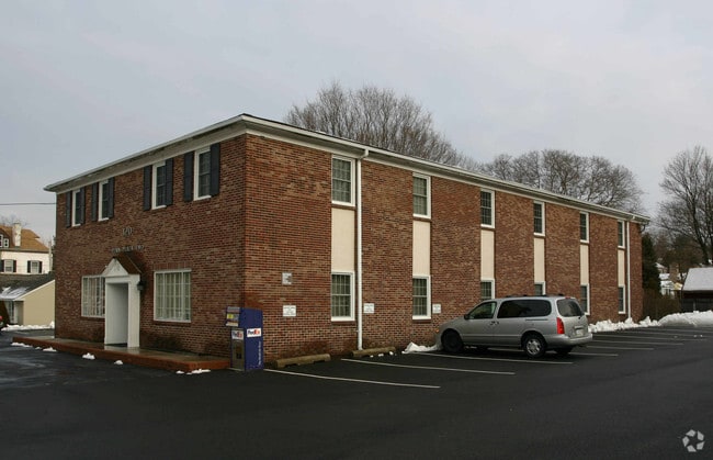
120 Pennsylvania Ave
54-00-13300-002
ASSESSOR BLOCK-UNIT NUMBER 57-42
Officebuilding
Montgomery
X
Pennsylvania
42091C0381G
42
2024
0.52 AC
2025
Ft Wash/Spring House
201407
Philadelphia
8,178 SF
Philadelphia-Camden-Wilmington, PA-NJ-DE-MD
DEMOGRAPHICS near 120 Pennsylvania Ave
1 Mile
3 Mile
5 Mile
2024 Total Population
10,602
93,252
290,304
2029 Population
10,707
94,486
290,190
Pop Growth 2024-2029
+ 0.99%
+ 1.32%
(0.04%)
Average Age
40
42
42
2024 Total Households
3,861
35,126
115,492
HH Growth 2024-2029
+ 0.96%
+ 1.33%
(0.18%)
Median Household Inc
$103,780
$106,054
$87,601
Avg Household Size
2.70
2.50
2.40
2024 Avg HH Vehicles
2.00
2.00
2.00
Median Home Value
$359,273
$359,014
$331,092
Median Year Built
1953
1956
1955
Nearby Places
Map Layers
Map Styles
 Street
 Aerial
- Restaurants
- Banks
- Shops
- Fitness
- Groceries
PUBLIC TRANSPORTATION
TRANSIT/SUBWAY
Oreland (R5 - Southeastern Pennsylvania Transportation Authority Regional Rail (SEPTA Regional Rail))
DRIVE
WALK
Distance
Oreland (R5 - Southeastern Pennsylvania Transportation Authority Regional Rail (SEPTA Regional Rail))
1 min
7 min
0.3 mi
North Hills (R5 - Southeastern Pennsylvania Transportation Authority Regional Rail (SEPTA Regional Rail))
DRIVE
WALK
Distance
North Hills (R5 - Southeastern Pennsylvania Transportation Authority Regional Rail (SEPTA Regional Rail))
2 min
14 min
0.7 mi
COMMUTER RAIL
Oreland (R5 - Southeastern Pennsylvania Transportation Authority Regional Rail (SEPTA Regional Rail))
DRIVE
WALK
Distance
Oreland (R5 - Southeastern Pennsylvania Transportation Authority Regional Rail (SEPTA Regional Rail))
1 min
8 min
0.3 mi
North Hills (R5 - Southeastern Pennsylvania Transportation Authority Regional Rail (SEPTA Regional Rail))
DRIVE
WALK
Distance
North Hills (R5 - Southeastern Pennsylvania Transportation Authority Regional Rail (SEPTA Regional Rail))
2 min
14 min
0.7 mi
AIRPORT
Philadelphia International
DRIVE
WALK
Distance
Philadelphia International
46 min
24.0 mi
Trenton Mercer
DRIVE
WALK
Distance
Trenton Mercer
45 min
31.3 mi
Freight Ports
Port of Philadelphia
DRIVE
WALK
Distance
Port of Philadelphia
26 min
12.8 mi
SALE & LEASE HISTORY
LISTING DATE
SALE/LEASE

Oct 27, 2021
For Lease
Oct 27, 2021
For Sale
Oct 04, 2018
For Lease
Oct 04, 2018
For Sale
Nearby Properties
Address
Land Use
TOTAL SIZE
Lot Size
Zoning
Address
Land Use
TOTAL SIZE
Lot Size
Zoning
733,282 SF
88.07 AC
LIM
Address
Land Use
TOTAL SIZE
Lot Size
Zoning
649,400 SF
55.03 AC
R1
Address
Land Use
TOTAL SIZE
Lot Size
Zoning
678,360 SF
67.10 AC
LIM
Address
Land Use
TOTAL SIZE
Lot Size
Zoning
487,936 SF
58.50 AC
T
Address
Land Use
TOTAL SIZE
Lot Size
Zoning
371,340 SF
53 AC
A
Address
Land Use
TOTAL SIZE
Lot Size
Zoning
467,639 SF
123.58 AC
IAAA
Address
Land Use
TOTAL SIZE
Lot Size
Zoning
705,687 SF
19.89 AC
C1
Address
Land Use
TOTAL SIZE
Lot Size
Zoning
234,934 SF
43.63 AC
AA
Address
Land Use
TOTAL SIZE
Lot Size
Zoning
635,387 SF
10.12 AC
C1
Address
Land Use
TOTAL SIZE
Lot Size
Zoning
316,163 SF
45.32 AC
T
Address
Land Use
TOTAL SIZE
Lot Size
Zoning
456,997 SF
7.91 AC
INST
Address
Land Use
TOTAL SIZE
Lot Size
Zoning
360,524 SF
59.87 AC
INST
Address
Land Use
TOTAL SIZE
Lot Size
Zoning
222,235 SF
29.23 AC
A
Address
Land Use
TOTAL SIZE
Lot Size
Zoning
582,294 SF
9.07 AC
C1
Address
Land Use
TOTAL SIZE
Lot Size
Zoning
615,217 SF
33.52 AC
C2
Address
Land Use
TOTAL SIZE
Lot Size
Zoning
435,888 SF
16.35 AC
MD
Address
Land Use
TOTAL SIZE
Lot Size
Zoning
336,650 SF
61.74 AC
R3
Address
Land Use
TOTAL SIZE
Lot Size
Zoning
232,190 SF
34.16 AC
R4
Address
Land Use
TOTAL SIZE
Lot Size
Zoning
232,000 SF
13.71 AC
RSA3
Address
Land Use
TOTAL SIZE
Lot Size
Zoning
19,059 SF
64.35 AC
RSA3
Address
Land Use
TOTAL SIZE
Lot Size
Zoning
173,160 SF
31.76 AC
INST
Address
Land Use
TOTAL SIZE
Lot Size
Zoning
114,038 SF
13.28 AC
LIM
Address
Land Use
TOTAL SIZE
Lot Size
Zoning
75,051 SF
10.26 AC
H
Address
Land Use
TOTAL SIZE
Lot Size
Zoning
103,260 SF
10.58 AC
A
Address
Land Use
TOTAL SIZE
Lot Size
Zoning
79,965 SF
3.18 AC
RSD1
Address
Land Use
TOTAL SIZE
Lot Size
Zoning
92,965 SF
5.12 AC
R3
Address
Land Use
TOTAL SIZE
Lot Size
Zoning
134,553 SF
3.09 AC
LIM
Address
Land Use
TOTAL SIZE
Lot Size
Zoning
134,553 SF
3.09 AC
LIM
Address
Land Use
TOTAL SIZE
Lot Size
Zoning
66,364 SF
7.08 AC
T
Address
Land Use
TOTAL SIZE
Lot Size
Zoning
62,892 SF
9.60 AC
R4
The World's #1 Commercial Real Estate Marketplace
Connect with us
© 2026 CoStar Group
The information above has been obtained from sources believed reliable. While we do not doubt its accuracy we have not verified it and make no guarantee, warranty or representation about it. It is your responsibility to independently confirm its accuracy and completeness. Any projections, opinions, assumptions, or estimates used are for example only and do not represent the current or future performance of the property. The value of this transaction to you depends on tax and other factors which should be evaluated by your tax, financial, and legal advisors. You and your advisors should conduct a careful, independent investigation of the property to determine to your satisfaction the suitability of the property for your needs.