Property Record
120 Pine Grove Rd, Locust Grove, GA 30248
NEARBY LISTINGS FOR SALE OR LEASE
Property Detail
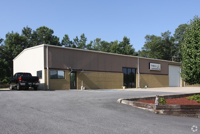
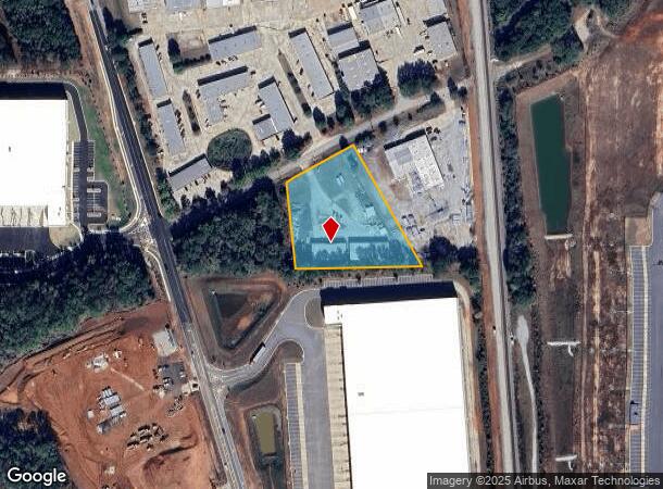
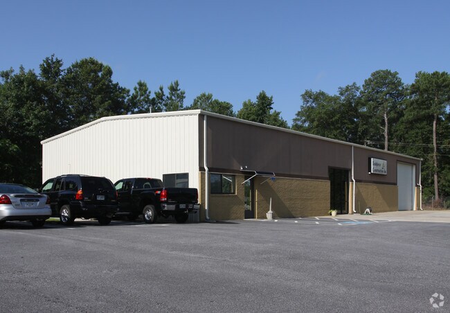
120 Pine Grove Rd
Atlanta-Sandy Springs-Roswell, GA
Plat/Prepared Kenneth L Sailor
0111-01-003-001
LAND LOT: 233 /LAND DISTRICT: 2
Multitenantindustrial
Henry
X
Georgia
13255C0125E
233
2025
1.96 AC
2025
S Clayton/Henry Cnty
070405
Atlanta
10,800 SF
DEMOGRAPHICS near 120 Pine Grove Rd
1 Mile
3 Mile
5 Mile
2024 Total Population
402
15,817
56,332
2029 Population
438
17,439
62,071
Pop Growth 2024-2029
+ 8.96%
+ 10.25%
+ 10.19%
Average Age
37
37
36
2024 Total Households
128
5,415
19,125
HH Growth 2024-2029
+ 8.59%
+ 10.45%
+ 10.31%
Median Household Inc
$82,589
$67,877
$71,974
Avg Household Size
3.20
2.90
2.90
2024 Avg HH Vehicles
2.00
2.00
2.00
Median Home Value
$281,817
$242,998
$222,110
Median Year Built
2005
2005
2004
Nearby Places
Map Layers
Map Styles
 Street
 Aerial
- Restaurants
- Banks
- Shops
- Fitness
- Groceries
PUBLIC TRANSPORTATION
AIRPORT
Hartsfield - Jackson Atlanta International
DRIVE
WALK
Distance
Hartsfield - Jackson Atlanta International
39 min
28.7 mi
Nearby Properties
Address
Land Use
TOTAL SIZE
Lot Size
Zoning
Address
Land Use
TOTAL SIZE
Lot Size
Zoning
1,573,998 SF
84.31 AC
M2
Address
Land Use
TOTAL SIZE
Lot Size
Zoning
1,012,028 SF
98.01 AC
M1
Address
Land Use
TOTAL SIZE
Lot Size
Zoning
1,079,756 SF
92.38 AC
M1
Address
Land Use
TOTAL SIZE
Lot Size
Zoning
1,010,600 SF
78.40 AC
M1
Address
Land Use
TOTAL SIZE
Lot Size
Zoning
1,226,687 SF
100.81 AC
M2
Address
Land Use
TOTAL SIZE
Lot Size
Zoning
247,544 SF
43.30 AC
Address
Land Use
TOTAL SIZE
Lot Size
Zoning
4,307,236 SF
66.85 AC
M1
Address
Land Use
TOTAL SIZE
Lot Size
Zoning
765,316 SF
85.65 AC
M1
Address
Land Use
TOTAL SIZE
Lot Size
Zoning
7,005,327 SF
56.89 AC
M1
Address
Land Use
TOTAL SIZE
Lot Size
Zoning
415,997 SF
41.35 AC
Address
Land Use
TOTAL SIZE
Lot Size
Zoning
18,084 SF
59.72 AC
M1
Address
Land Use
TOTAL SIZE
Lot Size
Zoning
22,633 SF
31 AC
RM
Address
Land Use
TOTAL SIZE
Lot Size
Zoning
4,982 SF
34.62 AC
RM
Address
Land Use
TOTAL SIZE
Lot Size
Zoning
4,237,908 SF
44.42 AC
M
Address
Land Use
TOTAL SIZE
Lot Size
Zoning
660,000 SF
129.11 AC
M1
Address
Land Use
TOTAL SIZE
Lot Size
Zoning
5,681,569 SF
37.80 AC
M1
Address
Land Use
TOTAL SIZE
Lot Size
Zoning
3,877,368 SF
44.93 AC
M2
Address
Land Use
TOTAL SIZE
Lot Size
Zoning
351,848 SF
41.63 AC
C2
Address
Land Use
TOTAL SIZE
Lot Size
Zoning
6,101,324 SF
42.27 AC
M1
Address
Land Use
TOTAL SIZE
Lot Size
Zoning
297,736 SF
57.04 AC
M
Address
Land Use
TOTAL SIZE
Lot Size
Zoning
532,585 SF
67.79 AC
M2
Address
Land Use
TOTAL SIZE
Lot Size
Zoning
1,122,282 SF
39.20 AC
M2
Address
Land Use
TOTAL SIZE
Lot Size
Zoning
2,603,368 SF
49.23 AC
M1
Address
Land Use
TOTAL SIZE
Lot Size
Zoning
3,783,900 SF
43.09 AC
M1
Address
Land Use
TOTAL SIZE
Lot Size
Zoning
678,692 SF
47.81 AC
M1
Address
Land Use
TOTAL SIZE
Lot Size
Zoning
429,447 SF
40.07 AC
M2
Address
Land Use
TOTAL SIZE
Lot Size
Zoning
977,344 SF
32.79 AC
M1
Address
Land Use
TOTAL SIZE
Lot Size
Zoning
297,051 SF
33.41 AC
M1
Address
Land Use
TOTAL SIZE
Lot Size
Zoning
852,348 SF
27.17 AC
M1
Address
Land Use
TOTAL SIZE
Lot Size
Zoning
3,514,660 SF
25.51 AC
M1
The World's #1 Commercial Real Estate Marketplace
Connect with us
© 2025 CoStar Group
The information above has been obtained from sources believed reliable. While we do not doubt its accuracy we have not verified it and make no guarantee, warranty or representation about it. It is your responsibility to independently confirm its accuracy and completeness. Any projections, opinions, assumptions, or estimates used are for example only and do not represent the current or future performance of the property. The value of this transaction to you depends on tax and other factors which should be evaluated by your tax, financial, and legal advisors. You and your advisors should conduct a careful, independent investigation of the property to determine to your satisfaction the suitability of the property for your needs.