Property Record
120 Riverside Dr Sw, Cartersville, GA 30120
NEARBY LISTINGS FOR SALE OR LEASE
Property Detail
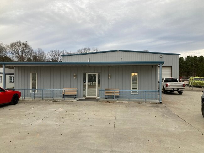
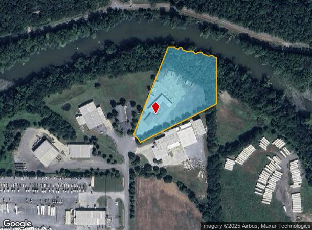
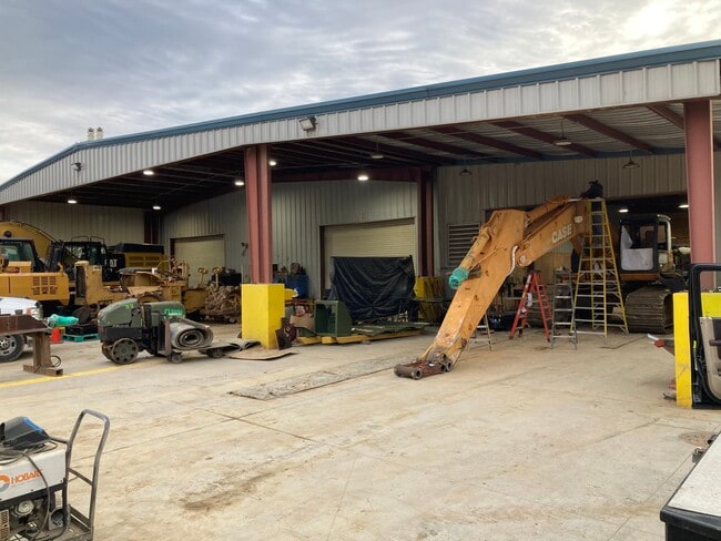
120 Riverside Dr Sw
C047-0001-005
Com - West/Highway 113
Industrialgeneral
LL 637 660 D 4
AE
Bartow
13015C0263H
Georgia
2024
5 AC
2024
Kennesaw/Acworth
960901
Atlanta
13,456 SF
Atlanta-Sandy Springs-Roswell, GA
DEMOGRAPHICS near 120 Riverside Dr Sw
1 Mile
3 Mile
5 Mile
2024 Total Population
719
16,217
40,661
2029 Population
772
17,779
44,498
Pop Growth 2024-2029
+ 7.37%
+ 9.63%
+ 9.44%
Average Age
39
40
39
2024 Total Households
258
6,006
15,082
HH Growth 2024-2029
+ 6.98%
+ 9.39%
+ 9.16%
Median Household Inc
$87,980
$82,699
$74,884
Avg Household Size
2.80
2.60
2.60
2024 Avg HH Vehicles
2.00
2.00
2.00
Median Home Value
$214,423
$260,447
$238,867
Median Year Built
1989
1992
1989
Nearby Places
Map Layers
Map Styles
 Street
 Aerial
- Restaurants
- Banks
- Shops
- Fitness
- Groceries
SALE & LEASE HISTORY
LISTING DATE
SALE/LEASE

Apr 29, 2025
For Lease
Nearby Properties
Address
Land Use
TOTAL SIZE
Lot Size
Zoning
Address
Land Use
TOTAL SIZE
Lot Size
Zoning
196,710 SF
149.63 AC
Address
Land Use
TOTAL SIZE
Lot Size
Zoning
Address
Land Use
TOTAL SIZE
Lot Size
Zoning
Address
Land Use
TOTAL SIZE
Lot Size
Zoning
104,757 SF
45 AC
IN
Address
Land Use
TOTAL SIZE
Lot Size
Zoning
149,158 SF
46.23 AC
IN
Address
Land Use
TOTAL SIZE
Lot Size
Zoning
1,800 SF
102.03 AC
A1
Address
Land Use
TOTAL SIZE
Lot Size
Zoning
88,974 SF
5.42 AC
IN
Address
Land Use
TOTAL SIZE
Lot Size
Zoning
58,757 SF
22.63 AC
A1
Address
Land Use
TOTAL SIZE
Lot Size
Zoning
Address
Land Use
TOTAL SIZE
Lot Size
Zoning
57,164 SF
4.88 AC
Address
Land Use
TOTAL SIZE
Lot Size
Zoning
29,629 SF
21.90 AC
IN
Address
Land Use
TOTAL SIZE
Lot Size
Zoning
9,272 SF
8 AC
IN
Address
Land Use
TOTAL SIZE
Lot Size
Zoning
Address
Land Use
TOTAL SIZE
Lot Size
Zoning
128.74 AC
A1
Address
Land Use
TOTAL SIZE
Lot Size
Zoning
61,132 SF
5.39 AC
Address
Land Use
TOTAL SIZE
Lot Size
Zoning
170,445 SF
6.12 AC
IN
Address
Land Use
TOTAL SIZE
Lot Size
Zoning
6,909 SF
10 AC
IN
Address
Land Use
TOTAL SIZE
Lot Size
Zoning
70,122 SF
6.10 AC
Address
Land Use
TOTAL SIZE
Lot Size
Zoning
211,879 SF
23.57 AC
IN
Address
Land Use
TOTAL SIZE
Lot Size
Zoning
8,816 SF
5.20 AC
IN
Address
Land Use
TOTAL SIZE
Lot Size
Zoning
67,579 SF
18.97 AC
IN
Address
Land Use
TOTAL SIZE
Lot Size
Zoning
34,786 SF
12.23 AC
IN
Address
Land Use
TOTAL SIZE
Lot Size
Zoning
40,000 SF
18.15 AC
Address
Land Use
TOTAL SIZE
Lot Size
Zoning
313,640 SF
24.12 AC
IN
Address
Land Use
TOTAL SIZE
Lot Size
Zoning
53,607 SF
4.84 AC
IN
Address
Land Use
TOTAL SIZE
Lot Size
Zoning
242,214 SF
14.71 AC
IN
Address
Land Use
TOTAL SIZE
Lot Size
Zoning
23,560 SF
11.28 AC
IN
Address
Land Use
TOTAL SIZE
Lot Size
Zoning
2,632 SF
52.90 AC
IN
Address
Land Use
TOTAL SIZE
Lot Size
Zoning
147,500 SF
14.60 AC
IN
Address
Land Use
TOTAL SIZE
Lot Size
Zoning
The World's #1 Commercial Real Estate Marketplace
Connect with us
© 2025 CoStar Group
The information above has been obtained from sources believed reliable. While we do not doubt its accuracy we have not verified it and make no guarantee, warranty or representation about it. It is your responsibility to independently confirm its accuracy and completeness. Any projections, opinions, assumptions, or estimates used are for example only and do not represent the current or future performance of the property. The value of this transaction to you depends on tax and other factors which should be evaluated by your tax, financial, and legal advisors. You and your advisors should conduct a careful, independent investigation of the property to determine to your satisfaction the suitability of the property for your needs.